MyTopo
Rattlesnake Butte North Dakota US Topo Map
Couldn't load pickup availability
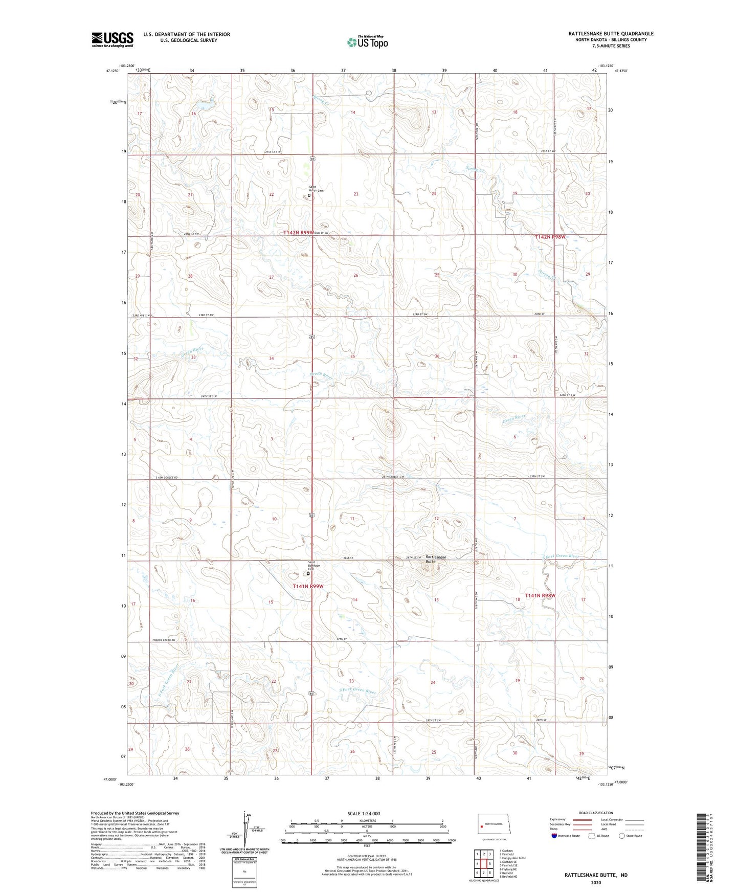
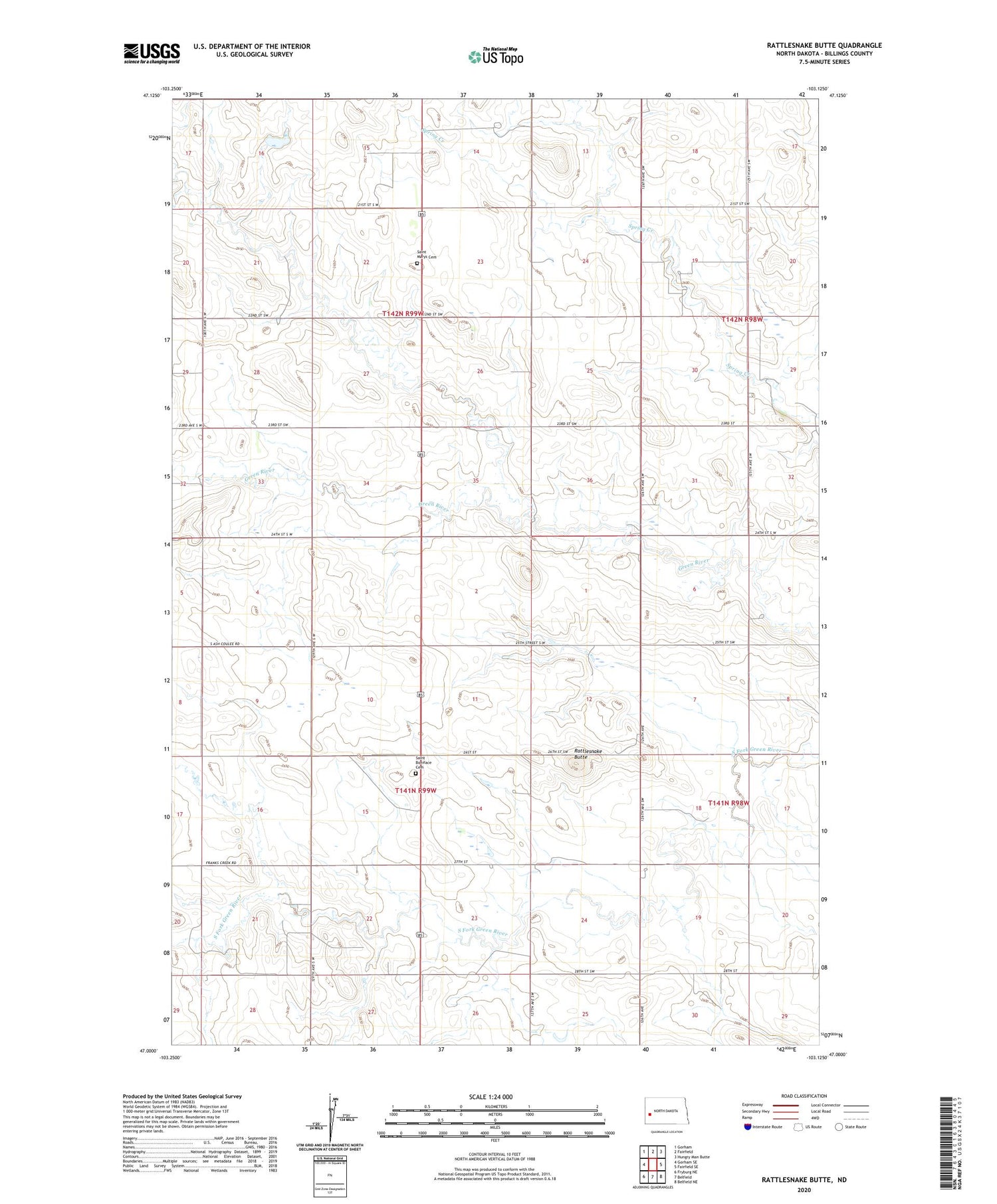
2020 topographic map quadrangle Rattlesnake Butte in the state of North Dakota. Scale: 1:24000. Based on the newly updated USGS 7.5' US Topo map series, this map is in the following counties: Billings. The map contains contour data, water features, and other items you are used to seeing on USGS maps, but also has updated roads and other features. This is the next generation of topographic maps. Printed on high-quality waterproof paper with UV fade-resistant inks.
Quads adjacent to this one:
West: Gorham SE
Northwest: Gorham
North: Fairfield
Northeast: Hungry Man Butte
East: Fairfield SE
Southeast: Belfield NE
South: Belfield
Southwest: Fryburg NE
Contains the following named places: Horse Creek, Klym School, Kordonowy Dam, Rattlesnake Butte, Saint Boniface Cemetery, Saint Demetrius Church, Saint Marys Cemetery, Schaff School, Spring Creek School Number 2, Vokal School