MyTopo
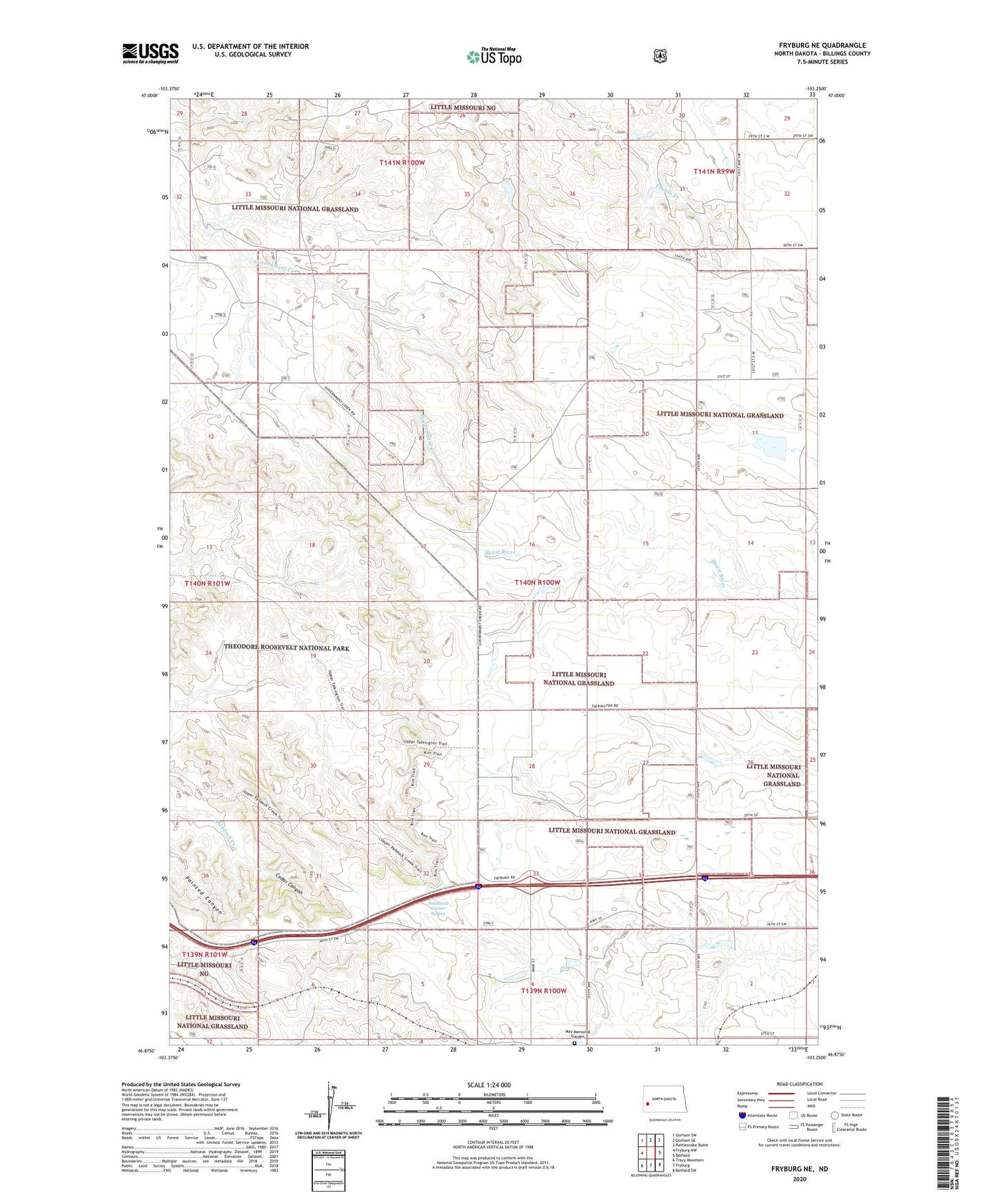
Fryburg NE North Dakota US Topo Map
Couldn't load pickup availability
Also explore the Fryburg NE Forest Service Topo of this same quad for updated USFS data
2024 topographic map quadrangle Fryburg NE in the state of North Dakota. Scale: 1:24000. Based on the newly updated USGS 7.5' US Topo map series, this map is in the following counties: Billings. The map contains contour data, water features, and other items you are used to seeing on USGS maps, but also has updated roads and other features. This is the next generation of topographic maps. Printed on high-quality waterproof paper with UV fade-resistant inks.
Quads adjacent to this one:
West: Fryburg NW
Northwest: Gorham SW
North: Gorham SE
Northeast: Rattlesnake Butte
East: Belfield
Southeast: Belfield SW
South: Fryburg
Southwest: Tracy Mountain
This map covers the same area as the classic USGS quad with code o46103h3.
Contains the following named places: Brien Ranch, Cedar Canyon, Johnson Ranch, Klym Ranch, Lindbo Ranch, Logan Ranch, May Memorial Garden, Painted Canyon, Redmond Farm, Snyder Ranch, Southeast Corner Spring, Talkington Ranch, ZIP Code: 58622