MyTopo
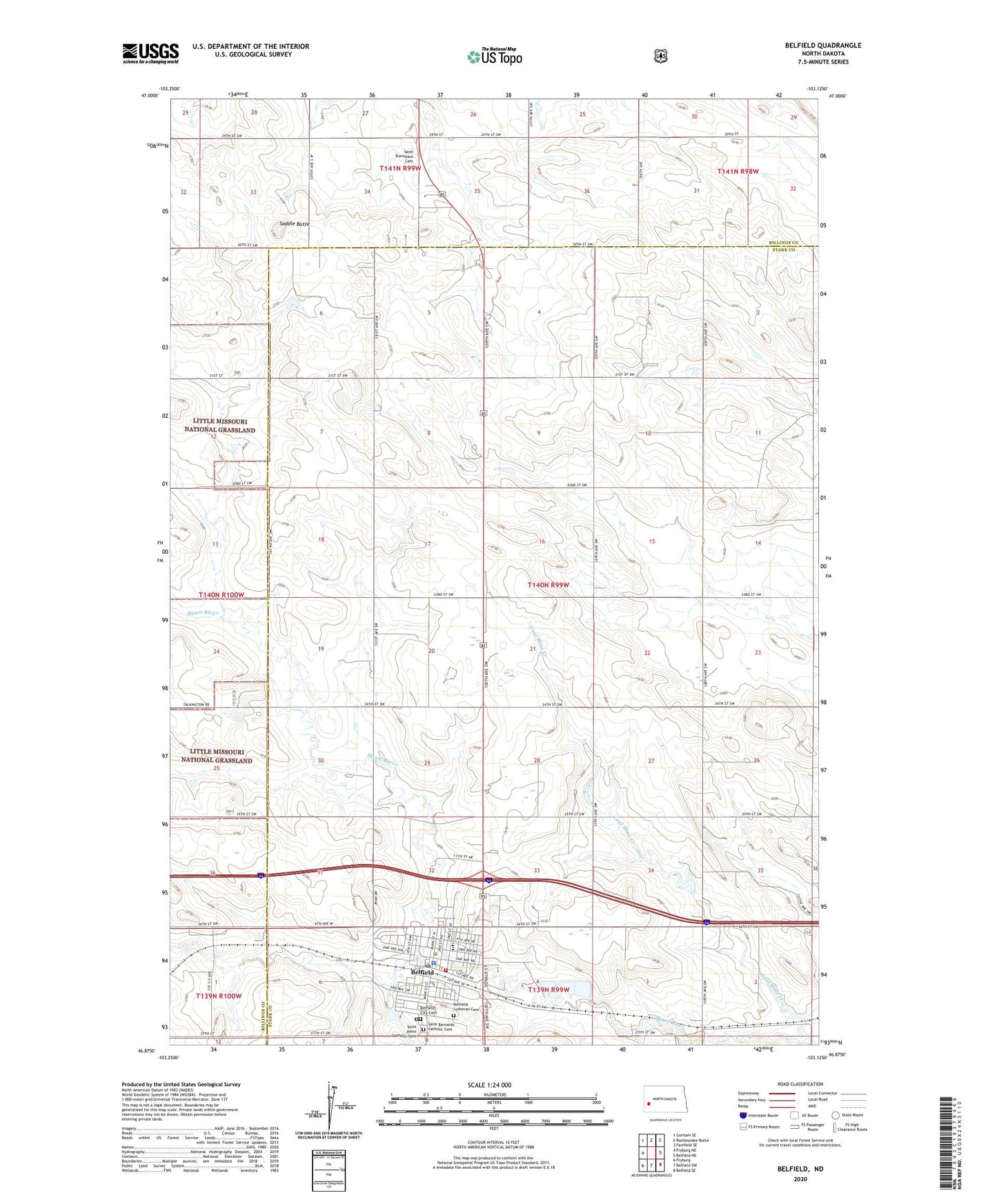
Belfield North Dakota US Topo Map
Couldn't load pickup availability
Also explore the Belfield Forest Service Topo of this same quad for updated USFS data
2024 topographic map quadrangle Belfield in the state of North Dakota. Scale: 1:24000. Based on the newly updated USGS 7.5' US Topo map series, this map is in the following counties: Stark, Billings. The map contains contour data, water features, and other items you are used to seeing on USGS maps, but also has updated roads and other features. This is the next generation of topographic maps. Printed on high-quality waterproof paper with UV fade-resistant inks.
Quads adjacent to this one:
West: Fryburg NE
Northwest: Gorham SE
North: Rattlesnake Butte
Northeast: Fairfield SE
East: Belfield NE
Southeast: Belfield SE
South: Belfield SW
Southwest: Fryburg
This map covers the same area as the classic USGS quad with code o46103h2.
Contains the following named places: Belfield, Belfield Ambulance Service, Belfield City Cemetery, Belfield City Hall, Belfield Fire Department, Belfield Lutheran Cemetery, Belfield Police Department, Belfield Pond, Belfield Post Office, Belfield Public School, City of Belfield, Coal Mine Creek, Saddle Butte, Saint Bernards Catholic Cemetery, Saint Johns Catholic Cemetery, Saint Stanislaus Cemetery, Six Mile Corner, Truelson School