MyTopo
Spiritwood Lake North Dakota US Topo Map
Couldn't load pickup availability
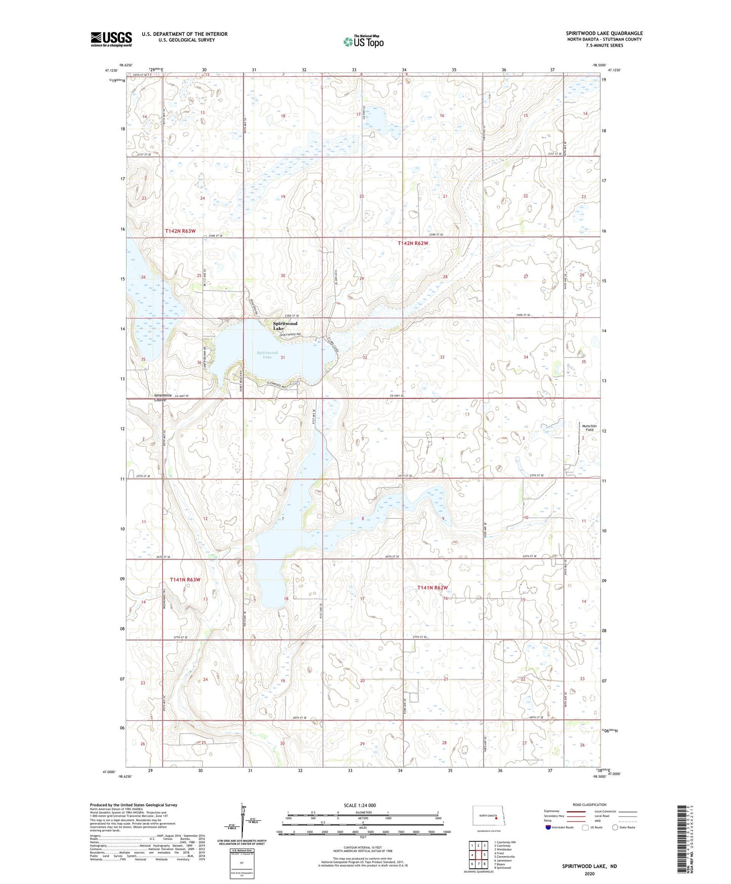
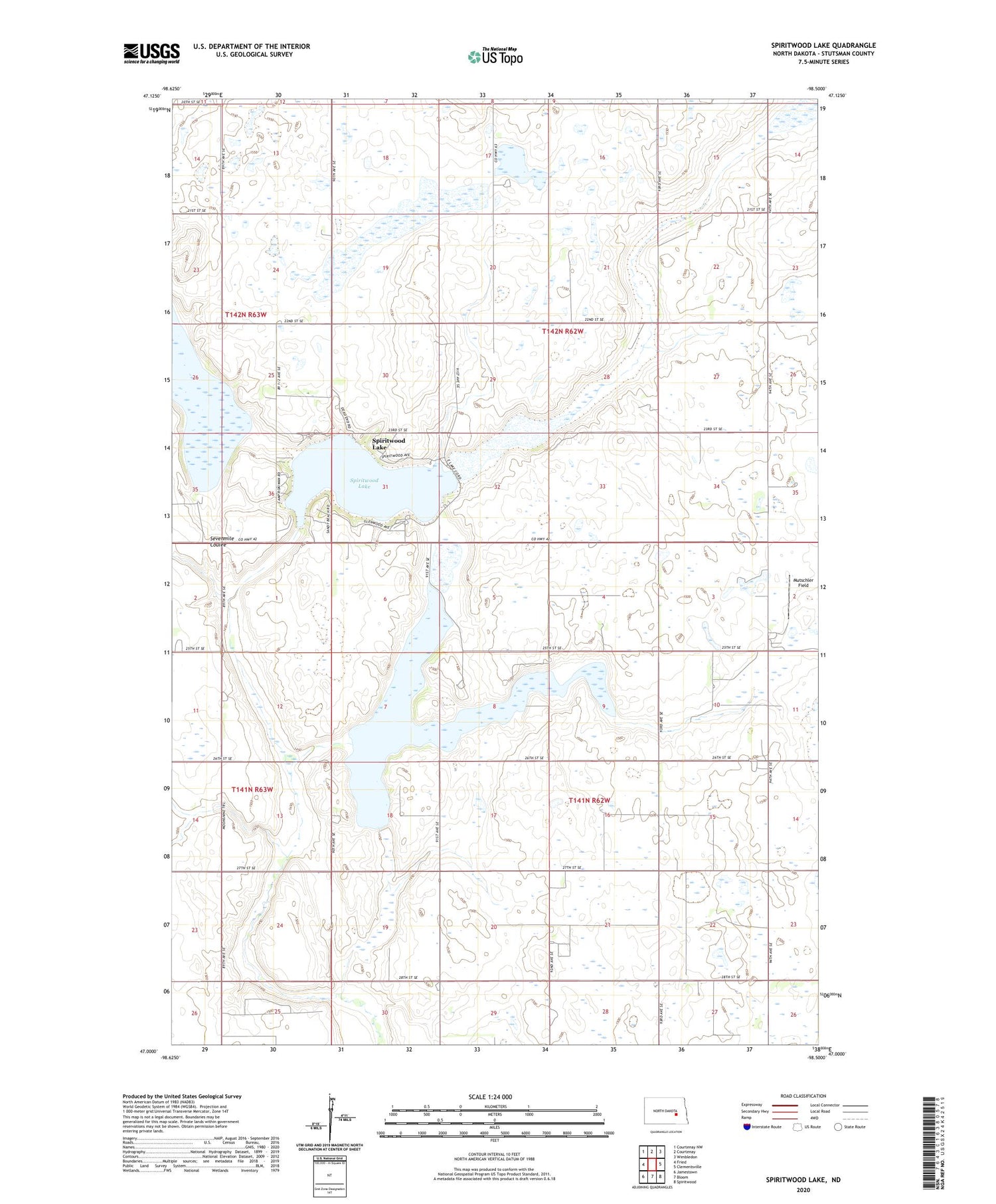
2020 topographic map quadrangle Spiritwood Lake in the state of North Dakota. Scale: 1:24000. Based on the newly updated USGS 7.5' US Topo map series, this map is in the following counties: Stutsman. The map contains contour data, water features, and other items you are used to seeing on USGS maps, but also has updated roads and other features. This is the next generation of topographic maps. Printed on high-quality waterproof paper with UV fade-resistant inks.
Quads adjacent to this one:
West: Fried
Northwest: Courtenay NW
North: Courtenay
Northeast: Wimbledon
East: Clementsville
Southeast: Spiritwood
South: Bloom
Southwest: Jamestown
Contains the following named places: Alkali Lake, City of Spiritwood Lake, Krapp Brothers Dam, Mutschler Field, School Number 1, School Number 2, School Number 3, Spiritwood Lake, Township of Albion, Township of Gray, Township of Rose