MyTopo
Jamestown North Dakota US Topo Map
Couldn't load pickup availability
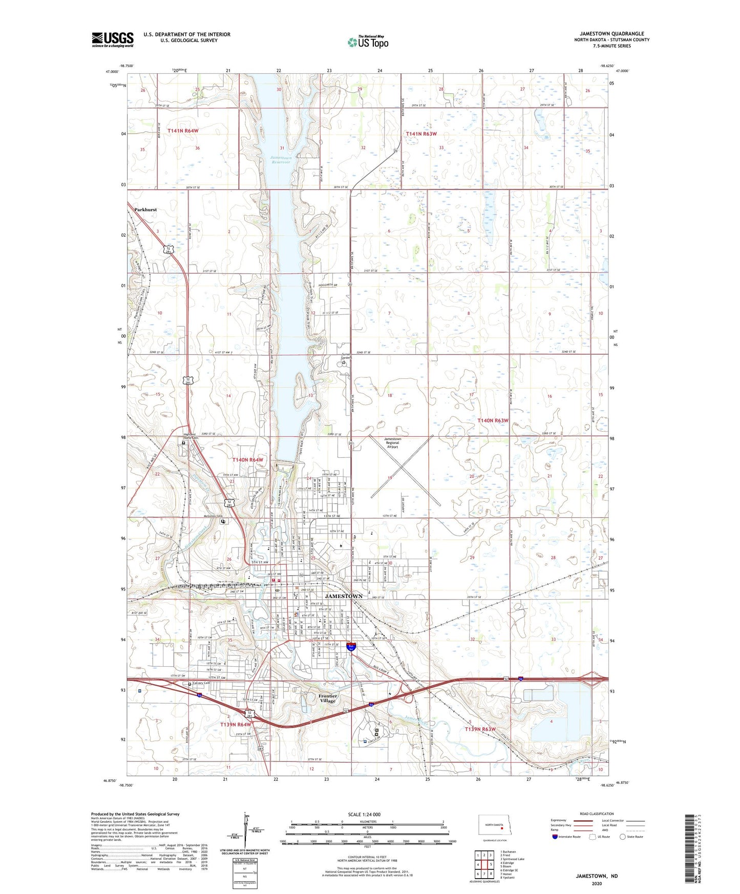
2024 topographic map quadrangle Jamestown in the state of North Dakota. Scale: 1:24000. Based on the newly updated USGS 7.5' US Topo map series, this map is in the following counties: Stutsman. The map contains contour data, water features, and other items you are used to seeing on USGS maps, but also has updated roads and other features. This is the next generation of topographic maps. Printed on high-quality waterproof paper with UV fade-resistant inks.
Quads adjacent to this one:
West: Eldridge
Northwest: Buchanan
North: Fried
Northeast: Spiritwood Lake
East: Bloom
Southeast: Ypsilanti
South: Homer
Southwest: Eldridge SE
This map covers the same area as the classic USGS quad with code o46098h6.
Contains the following named places: Adolescent and Child Treatment Center, Al Cassel Field, Anne Carlsen Center, Ave Maria Village, Buffalo Mall, Calvary Cemetery, City of Jamestown, Elks Park, Eventide at Hi-Acres Manor, Feton Park, Fort Seward Historic Site, Foss Wellness Center, Franklin School, Frontier Village, Gronewald/Middleton Building, Hansen Center, Highland Home Cemetery, Hillcrest Seventh-day Adventist School, Historic Franklin School, James River Community Center, James River Correctional Center, James River Valley Library System, James Valley Area Career and Technology Center, Jamestown, Jamestown Area Ambulance, Jamestown City Hall, Jamestown Civic Center, Jamestown College, Jamestown Dam, Jamestown Fire Department, Jamestown High School, Jamestown Ice House Dam, Jamestown Mall, Jamestown Middle School, Jamestown Police Department, Jamestown Post Office, Jamestown Regional Airport, Jamestown Regional Medical Center, Jamestown Speedway, Klaus Park, KQDJ-AM (Jamestown), Kroeze Hall, LaHaug Building, Larson Sports Center, Learning Resource Center, Liechty Center/Taber Hall, Lincoln Elementary School, Louis L'Amour Elementary School, Lyngstad Center, Masonic Park, McElroy Park, McGinnis Cemetery, Meidinger Square, Nafus Student Center, National Buffalo Museum, Nickeus Park, Nierling Hall, North Dakota Highway Patrol Jamestown, North Dakota Sports Hall of Fame, North Dakota State Hospital, Orlady Hall, Pipestem Creek, Prentice Hall, Raugust Library, Reiland Fine Arts Center, Rollie Greeno Track, Roosevelt Elementary School, Saint Johns Academy, Seibold Hall, Sorkness Center, Stuntsman County Jail, Stutsman County Courthouse, Stutsman County Fairgrounds, Stutsman County Library, Stutsman County Memorial Museum, Stutsman County Recreation Area, Stutsman County Sheriff's Office, Sunset Gardens, Taylor Stadium, Tompkins Rehabilitation and Corrections Center, Township of Bloom, Unruh and Sheldon Center for Business and Computer Science, Victory Christian School, Voorhees Chapel, Washington Elementary School, Watson Hall, Westminster Hall, William S Gussner Elementary School, Wilson Hall, World's Largest Buffalo Statue, ZIP Codes: 58402, 58405