MyTopo
Stony Butte North Dakota US Topo Map
Couldn't load pickup availability
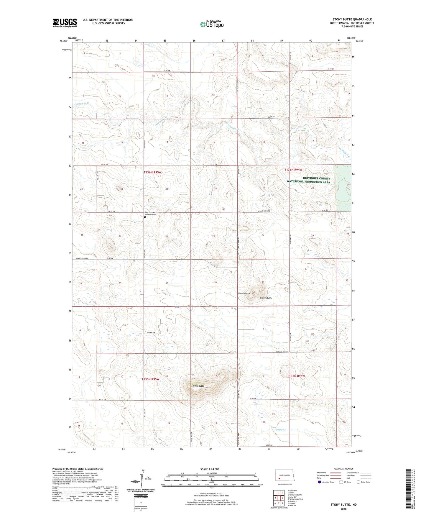
2024 topographic map quadrangle Stony Butte in the state of North Dakota. Scale: 1:24000. Based on the newly updated USGS 7.5' US Topo map series, this map is in the following counties: Hettinger. The map contains contour data, water features, and other items you are used to seeing on USGS maps, but also has updated roads and other features. This is the next generation of topographic maps. Printed on high-quality waterproof paper with UV fade-resistant inks.
Quads adjacent to this one:
West: Lefor SW
Northwest: Lefor NW
North: Lefor
Northeast: White Butte NW
East: White Butte West
Southeast: Mott NW
South: Regent
Southwest: Havelock
This map covers the same area as the classic USGS quad with code o46102e5.
Contains the following named places: Black Butte, Pearl Butte, Stony Butte, Township of Rifle, Zion Church, Zion German Lutheran Cemetery