MyTopo
String Buttes North Dakota US Topo Map
Couldn't load pickup availability
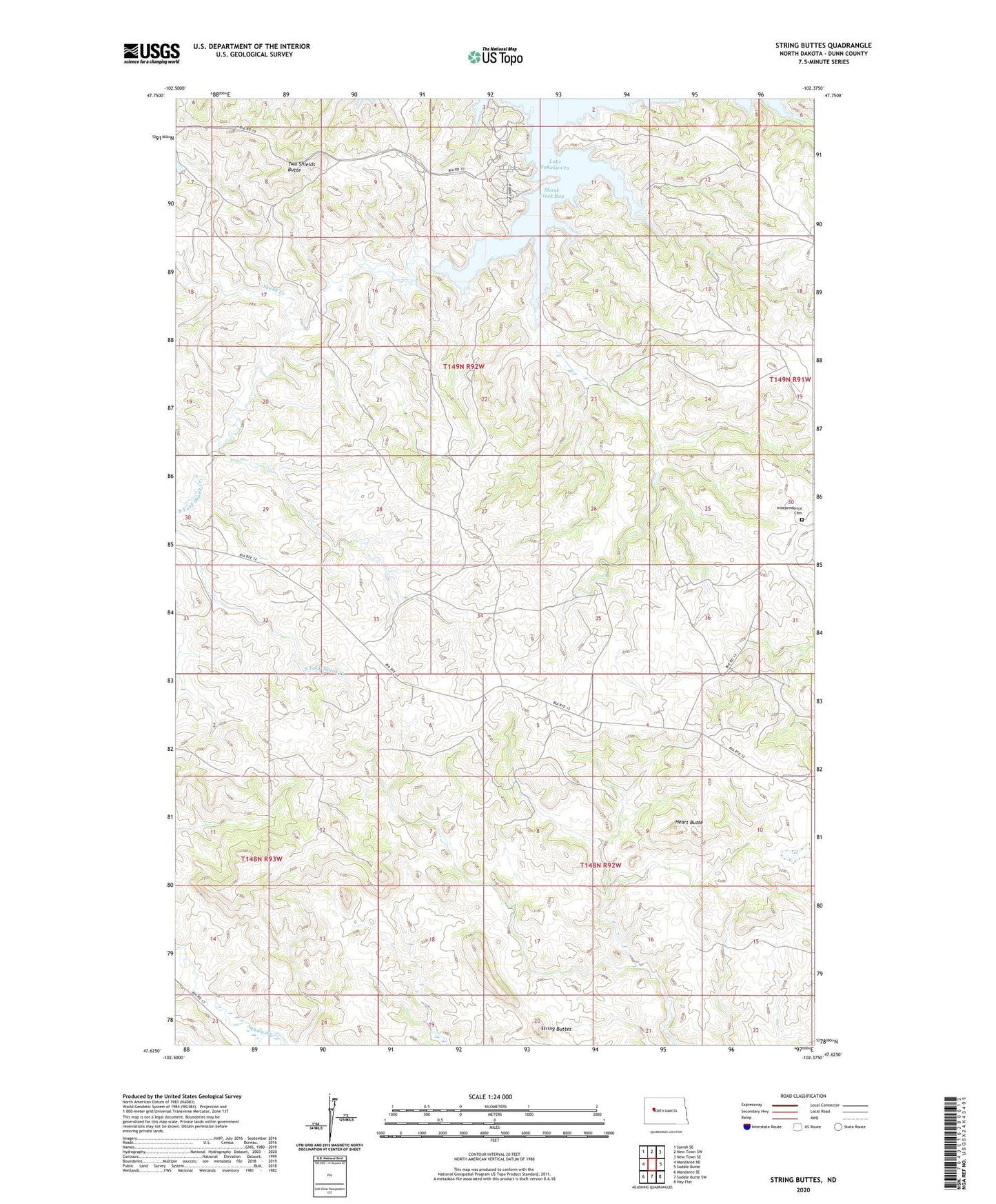
2024 topographic map quadrangle String Buttes in the state of North Dakota. Scale: 1:24000. Based on the newly updated USGS 7.5' US Topo map series, this map is in the following counties: Dunn. The map contains contour data, water features, and other items you are used to seeing on USGS maps, but also has updated roads and other features. This is the next generation of topographic maps. Printed on high-quality waterproof paper with UV fade-resistant inks.
Quads adjacent to this one:
West: Mandaree NE
Northwest: Sanish SE
North: New Town SW
Northeast: New Town SE
East: Saddle Butte
Southeast: Hay Flat
South: Saddle Butte SW
Southwest: Mandaree SE
This map covers the same area as the classic USGS quad with code o47102f4.
Contains the following named places: Heart Butte, Independence Cemetery, Independence Church, Skunk Creek, Skunk Creek Bay, Skunk Creek Public Use Area, String Buttes, Two Shields Butte, Unorganized Territory of Fort Berthold