MyTopo
Taylor Butte North Dakota US Topo Map
Couldn't load pickup availability
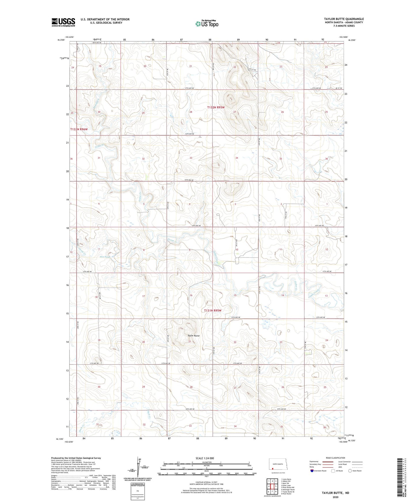
2024 topographic map quadrangle Taylor Butte in the state of North Dakota. Scale: 1:24000. Based on the newly updated USGS 7.5' US Topo map series, this map is in the following counties: Adams. The map contains contour data, water features, and other items you are used to seeing on USGS maps, but also has updated roads and other features. This is the next generation of topographic maps. Printed on high-quality waterproof paper with UV fade-resistant inks.
Quads adjacent to this one:
West: Ehler Lake
Northwest: Liens Dams
North: Abbey Hill
Northeast: Mott SW
East: Pearl Butte NW
Southeast: Pearl Butte
South: Taylor Butte SE
Southwest: Hettinger North
This map covers the same area as the classic USGS quad with code o46102b5.
Contains the following named places: Erickson Field, Fordahl Landing Strip, Goose Creek, Maine Townhall, Nelson Landing Strip, Richland Church, Ross Slough, Spring Creek, Taylor Butte, Taylor Butte School, Taylor Butte Townhall, Township of Maine, Township of Taylor Butte