MyTopo
Turtle Lake North Dakota US Topo Map
Couldn't load pickup availability
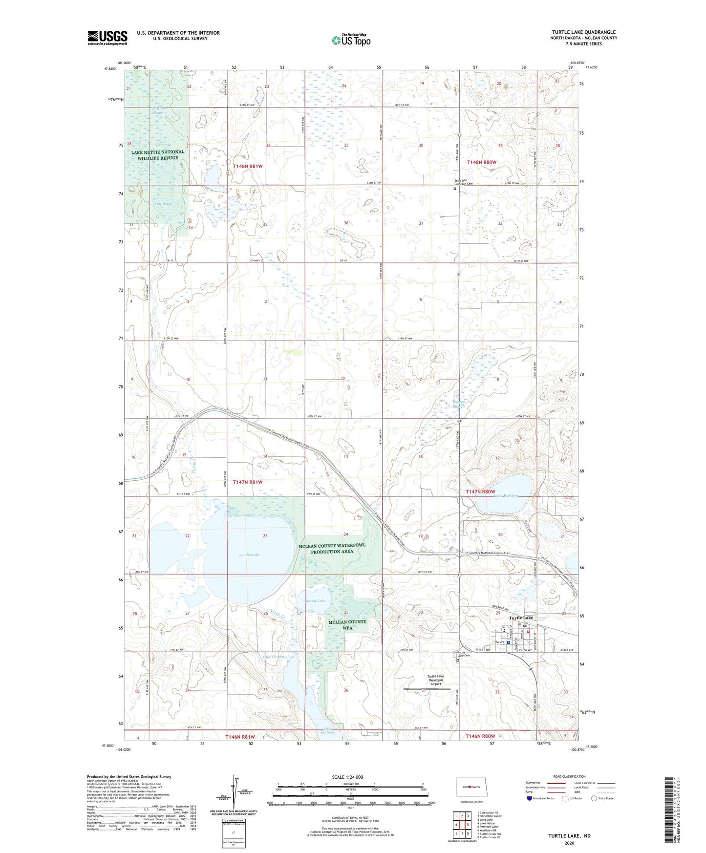
2024 topographic map quadrangle Turtle Lake in the state of North Dakota. Scale: 1:24000. Based on the newly updated USGS 7.5' US Topo map series, this map is in the following counties: McLean. The map contains contour data, water features, and other items you are used to seeing on USGS maps, but also has updated roads and other features. This is the next generation of topographic maps. Printed on high-quality waterproof paper with UV fade-resistant inks.
Quads adjacent to this one:
West: Lake Nettie
Northwest: Coleharbor NE
North: Horseshoe Valley
Northeast: Long Lake
East: Peterson Lake
Southeast: Turtle Creek NE
South: Turtle Creek NW
Southwest: Washburn NE
This map covers the same area as the classic USGS quad with code o47100e8.
Contains the following named places: Brittons Slough, Cherry Lake, City of Turtle Lake, Community Memorial Hospital, Hanson Slough, Kasper Slough, Lake Brekken, Lake Ordway, Mud Lake, Saint Olaf Church, Saint Olaf Lutheran Cemetery, School Number 2, School Number 3, Township of Turtle Lake, Turtle Lake, Turtle Lake Ambulance Service, Turtle Lake Cemetery, Turtle Lake City Hall, Turtle Lake Fire Protection District Station, Turtle Lake Municipal Airport, Turtle Lake Post Office, Turtle Lake Public Library, Turtle Lake-Mercer Public School, ZIP Code: 58575