MyTopo
Verona NE North Dakota US Topo Map
Couldn't load pickup availability
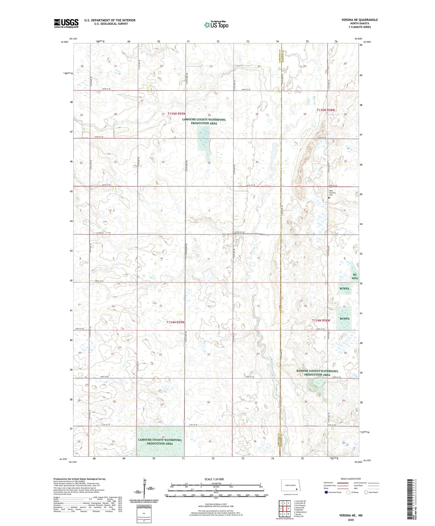
2020 topographic map quadrangle Verona NE in the state of North Dakota. Scale: 1:24000. Based on the newly updated USGS 7.5' US Topo map series, this map is in the following counties: LaMoure, Ransom. The map contains contour data, water features, and other items you are used to seeing on USGS maps, but also has updated roads and other features. This is the next generation of topographic maps. Printed on high-quality waterproof paper with UV fade-resistant inks.
Quads adjacent to this one:
West: Verona NW
Northwest: Litchville SW
North: Litchville SE
Northeast: Fort Ransom
East: Englevale
Southeast: Elliott SW
South: Verona
Southwest: Independence
Contains the following named places: Black Loam Town Hall, Greenville Town Hall, Lamoure County Waterfowl Production Area, Township of Greenville, West Fairview Cemetery, West Fairview Church, ZIP Code: 58490