MyTopo
Independence North Dakota US Topo Map
Couldn't load pickup availability
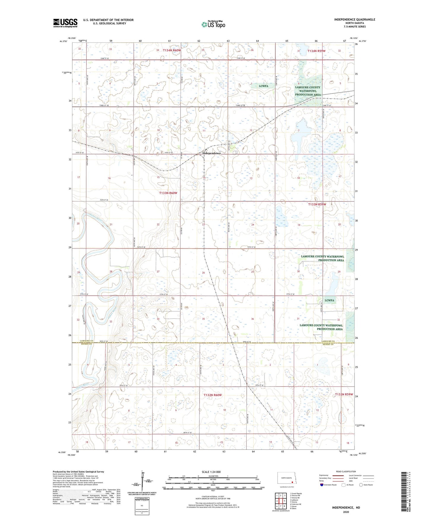
2024 topographic map quadrangle Independence in the state of North Dakota. Scale: 1:24000. Based on the newly updated USGS 7.5' US Topo map series, this map is in the following counties: LaMoure, Dickey. The map contains contour data, water features, and other items you are used to seeing on USGS maps, but also has updated roads and other features. This is the next generation of topographic maps. Printed on high-quality waterproof paper with UV fade-resistant inks.
Quads adjacent to this one:
West: LaMoure
Northwest: Grand Rapids
North: Verona NW
Northeast: Verona NE
East: Verona
Southeast: Oakes
South: Glover
Southwest: Fullerton NE
This map covers the same area as the classic USGS quad with code o46098c2.
Contains the following named places: Independence, Laney Landing Strip, Ryan Town Hall, School Number 2, Township of Ryan, Toy Farmer Museum