MyTopo
Washburn North Dakota US Topo Map
Couldn't load pickup availability
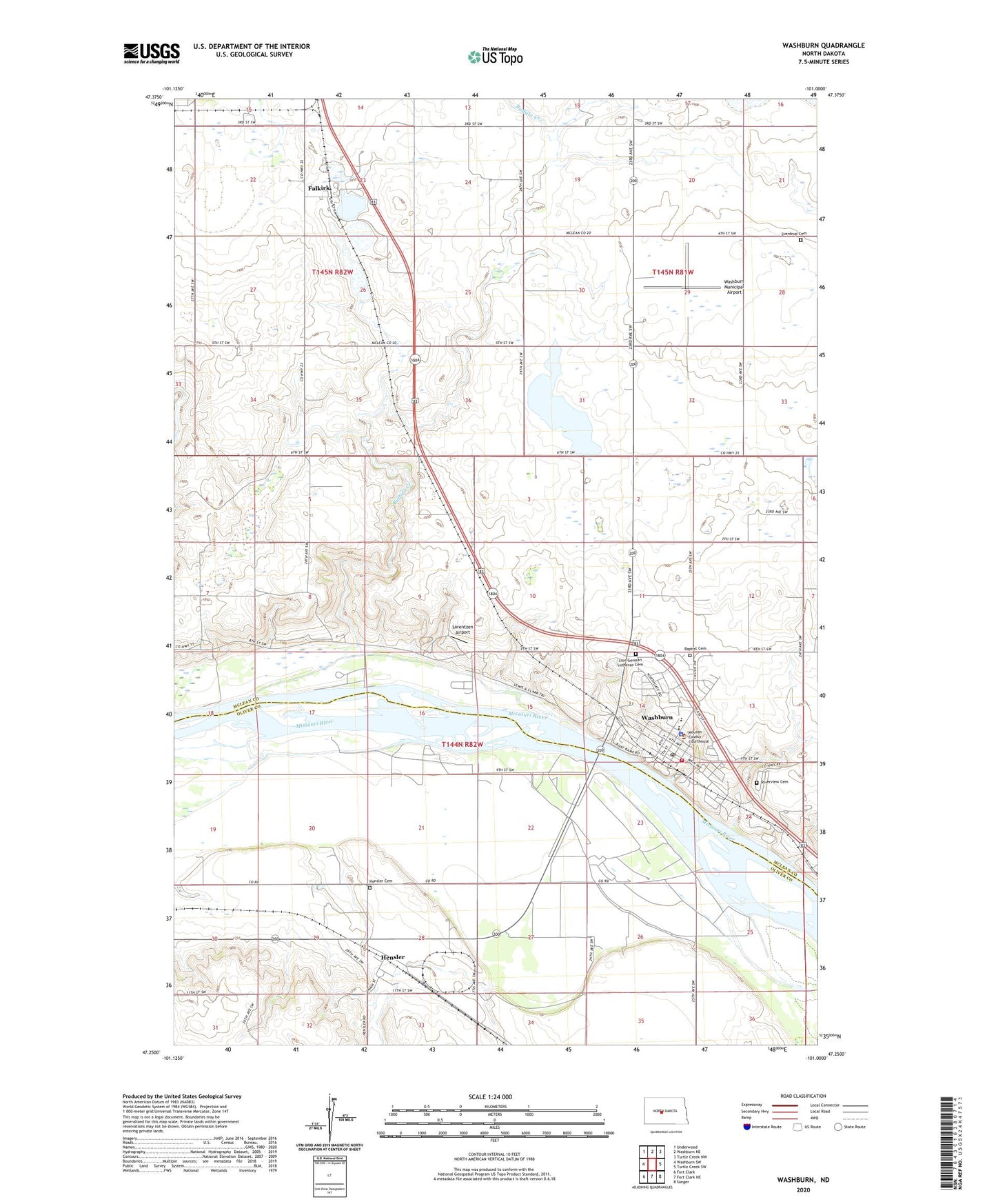
2024 topographic map quadrangle Washburn in the state of North Dakota. Scale: 1:24000. Based on the newly updated USGS 7.5' US Topo map series, this map is in the following counties: McLean, Oliver. The map contains contour data, water features, and other items you are used to seeing on USGS maps, but also has updated roads and other features. This is the next generation of topographic maps. Printed on high-quality waterproof paper with UV fade-resistant inks.
Quads adjacent to this one:
West: Washburn SW
Northwest: Underwood
North: Washburn NE
Northeast: Turtle Creek NW
East: Turtle Creek SW
Southeast: Sanger
South: Fort Clark NE
Southwest: Fort Clark
This map covers the same area as the classic USGS quad with code o47101c1.
Contains the following named places: Baptist Cemetery, Buffalo Creek, Buffalo Lake School Number 2, City of Washburn, Falkirk, Hensler, Hensler Cemetery, Kugler Mine, Lewis and Clark Interpretive Center, Lewis and Clark Rest Area, Lorentzen Airport, McLean County Courthouse, McLean County Historical Society Museum, McLean County Jail, McLean County Sheriff's Office, Oliver County Sheriff Department, Riverview Cemetery, Sverdrup Cemetery, Washburn, Washburn City Hall, Washburn Fire Station, Washburn Municipal Airport, Washburn Post Office, Washburn Public Library, Washburn Public School, Washburn Volunteer Ambulance Service, Zion German Lutheran Cemetery, ZIP Code: 58577