MyTopo
Weisser Dam West North Dakota US Topo Map
Couldn't load pickup availability
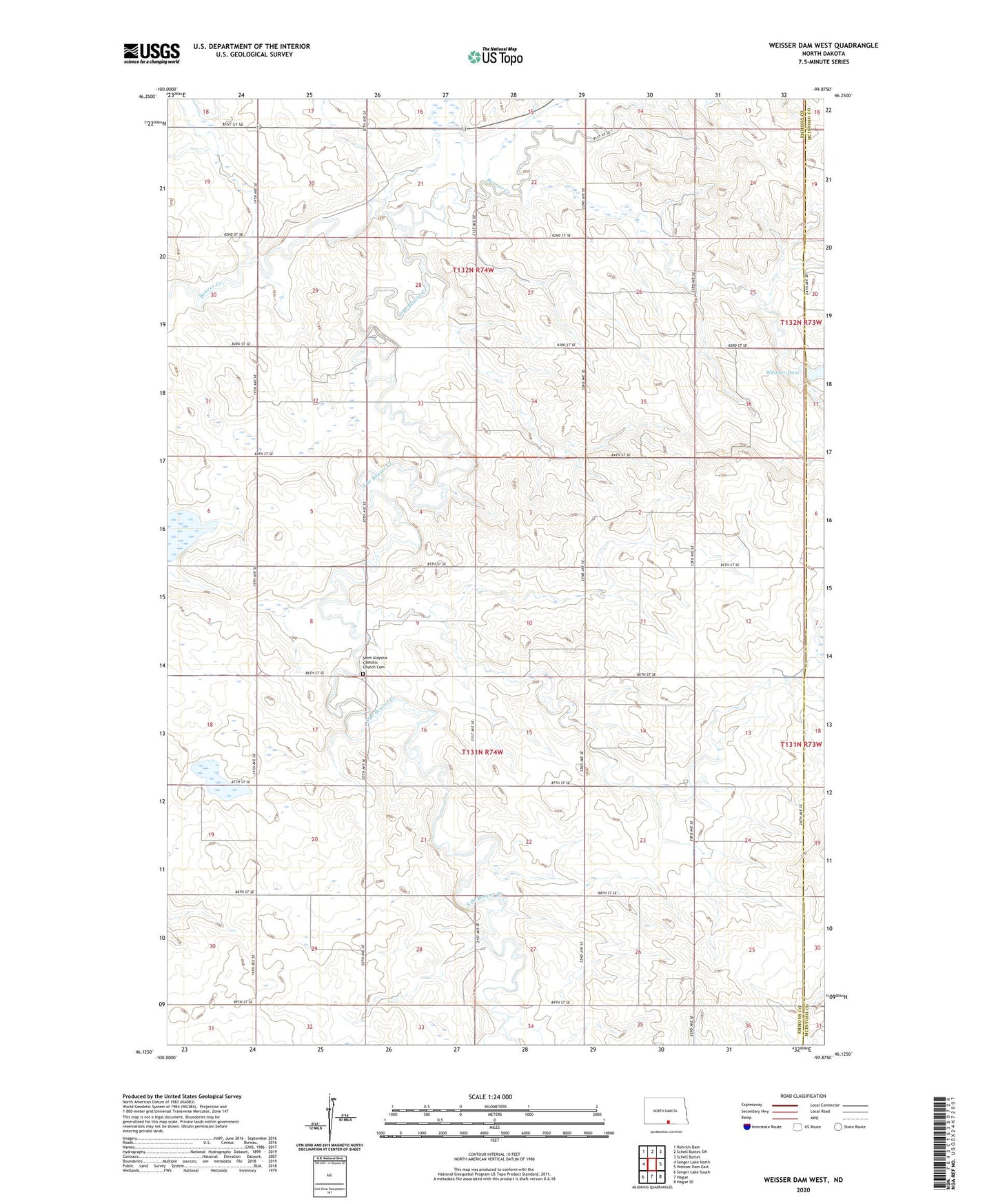
2024 topographic map quadrangle Weisser Dam West in the state of North Dakota. Scale: 1:24000. Based on the newly updated USGS 7.5' US Topo map series, this map is in the following counties: Emmons, McIntosh. The map contains contour data, water features, and other items you are used to seeing on USGS maps, but also has updated roads and other features. This is the next generation of topographic maps. Printed on high-quality waterproof paper with UV fade-resistant inks.
Quads adjacent to this one:
West: Senger Lake North
Northwest: Rohrich Dam
North: Schell Buttes SW
Northeast: Schell Buttes
East: Weisser Dam East
Southeast: Hague SE
South: Hague
Southwest: Senger Lake South
This map covers the same area as the classic USGS quad with code o46099b8.
Contains the following named places: Flickertail Dam, Flickertail Lake, Odessa School, Saint Aloysius Catholic Church Cemetery, Saint Aloysius Church, South Branch Beaver Creek, Weisser Dam