MyTopo
West Fargo South North Dakota US Topo Map
Couldn't load pickup availability
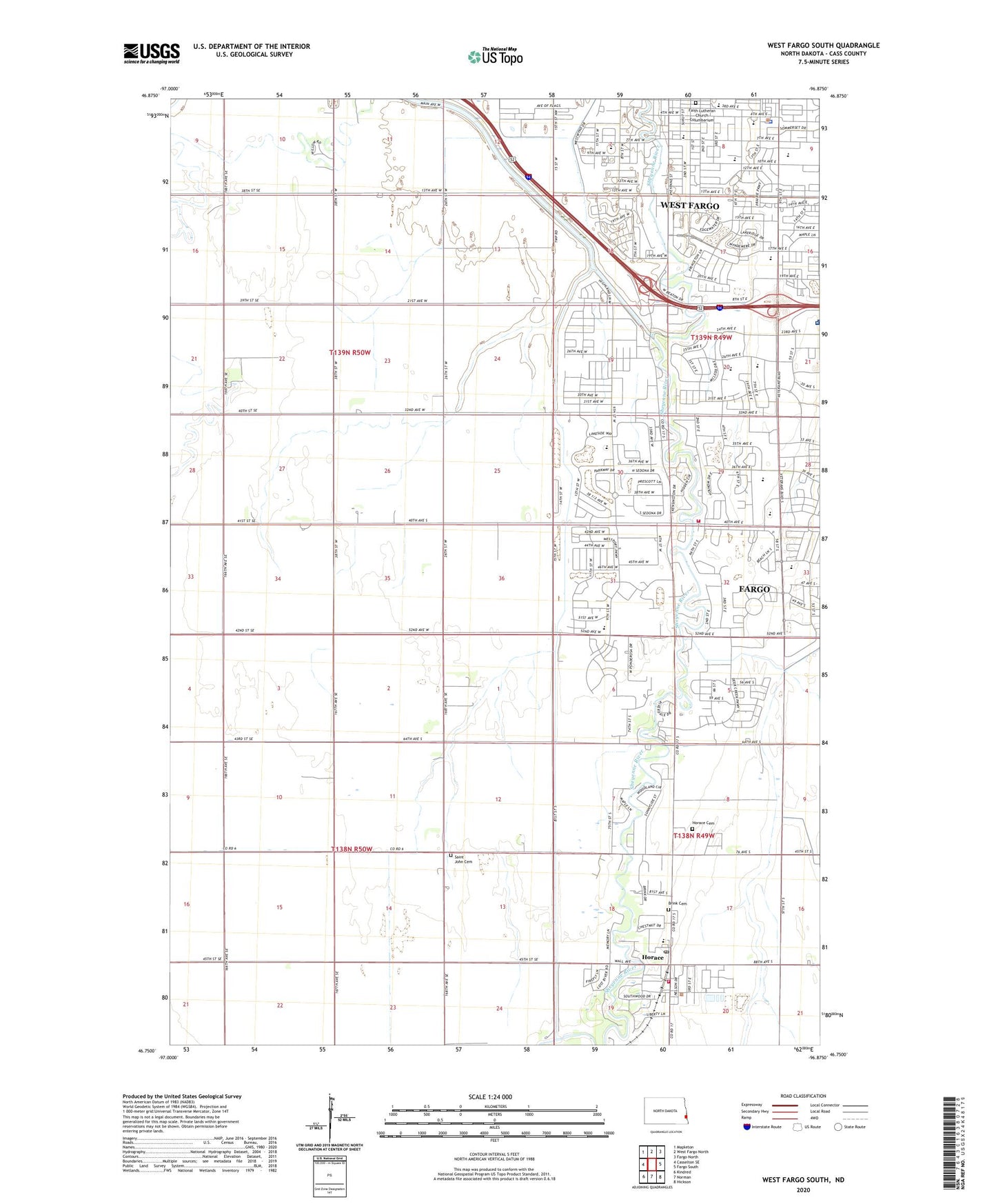
2020 topographic map quadrangle West Fargo South in the state of North Dakota. Scale: 1:24000. Based on the newly updated USGS 7.5' US Topo map series, this map is in the following counties: Cass. The map contains contour data, water features, and other items you are used to seeing on USGS maps, but also has updated roads and other features. This is the next generation of topographic maps. Printed on high-quality waterproof paper with UV fade-resistant inks.
Quads adjacent to this one:
West: Casselton SE
Northwest: Mapleton
North: West Fargo North
Northeast: Fargo North
East: Fargo South
Southeast: Hickson
South: Norman
Southwest: Kindred
Contains the following named places: Aurora Elementary School, Brink Cemetery, Cheney Middle School, City of Horace, City of West Fargo, Clayton A Lodoen Kindergarten Center, Eastwood Elementary School, Faith Lutheran Church Columbarium, Freedom Elementary School, Horace, Horace Cemetery, Horace City Hall, Horace Elementary School, Horace Fire Department, Horace Post Office, KFNW-AM (Fargo), KFNW-AM (West Fargo), KFNW-FM (Fargo), L E Berger Elementary School, Osgood Kindergarten Center, Red River Valley Speedway, Saint John Cemetery, Sheyenne 9th Grade Center, Sheyenne Crossings Care Center, Sheyenne River Diversion Dam, South Elementary School, South West Fargo, Township of Barnes, Township of Mapleton, Township of Warren, West Fargo, West Fargo Airport, West Fargo City Hall, West Fargo High School, West Fargo Police Department, West Fargo Public Library, Westside Elementary School, ZIP Code: 58078