MyTopo
West Fargo North North Dakota US Topo Map
Couldn't load pickup availability
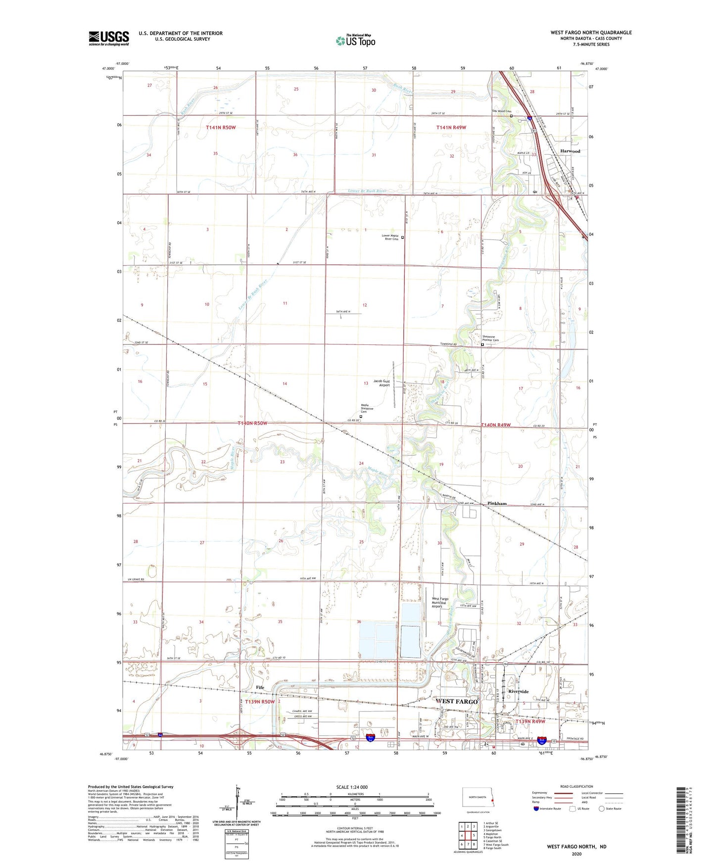
2024 topographic map quadrangle West Fargo North in the state of North Dakota. Scale: 1:24000. Based on the newly updated USGS 7.5' US Topo map series, this map is in the following counties: Cass. The map contains contour data, water features, and other items you are used to seeing on USGS maps, but also has updated roads and other features. This is the next generation of topographic maps. Printed on high-quality waterproof paper with UV fade-resistant inks.
Quads adjacent to this one:
West: Mapleton
Northwest: Arthur SE
North: Argusville
Northeast: Georgetown
East: Fargo North
Southeast: Fargo South
South: West Fargo South
Southwest: Casselton SE
This map covers the same area as the classic USGS quad with code o46096h8.
Contains the following named places: Bonanzaville USA, Canfield, City of Harwood, Fife, Harwood, Harwood City Hall, Harwood Elementary School, Harwood Fire and Rescue Station, Harwood Post Office, Jacob Gust Airport, Jameson Park, Lower Branch Rush River, Lower Maple River Cemetery, Maple River, Maple Sheyenne Cemetery, Maple-Sheyenne Church, Meadow Brook Park, Oak Wood Cemetery, Pinkham, Reed Town Hall, Riverside, Rush River, Sheyenne Pioneer Cemetery, STEM Center, Township of Raymond, Township of Reed, WDAY-AM (Fargo), West Fargo Fire Department, West Fargo Municipal Airport, West Fargo Post Office, ZIP Code: 58042