MyTopo
Casselton SE North Dakota US Topo Map
Couldn't load pickup availability
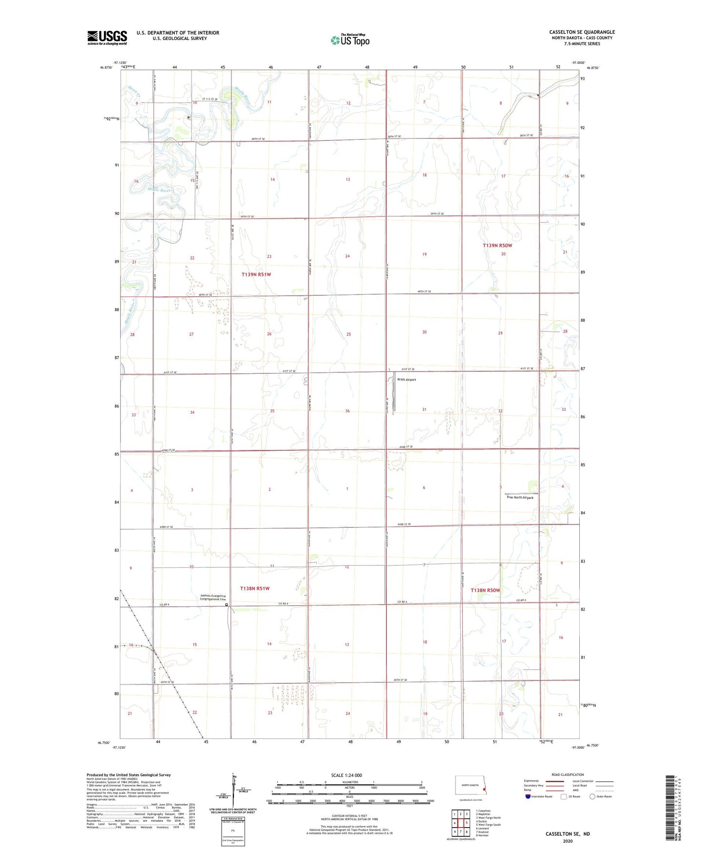
2024 topographic map quadrangle Casselton SE in the state of North Dakota. Scale: 1:24000. Based on the newly updated USGS 7.5' US Topo map series, this map is in the following counties: Cass. The map contains contour data, water features, and other items you are used to seeing on USGS maps, but also has updated roads and other features. This is the next generation of topographic maps. Printed on high-quality waterproof paper with UV fade-resistant inks.
Quads adjacent to this one:
West: Durbin
Northwest: Casselton
North: Mapleton
Northeast: West Fargo North
East: West Fargo South
Southeast: Norman
South: Kindred
Southwest: Leonard
This map covers the same area as the classic USGS quad with code o46097g1.
Contains the following named places: Addison Evangelical Congregational Cemetery, Brownlee Dam, Buffalo Creek, Kraft Airport, Swan Creek, Township of Addison, Township of Durbin, True North Airpark