MyTopo
Wildrose North Dakota US Topo Map
Couldn't load pickup availability
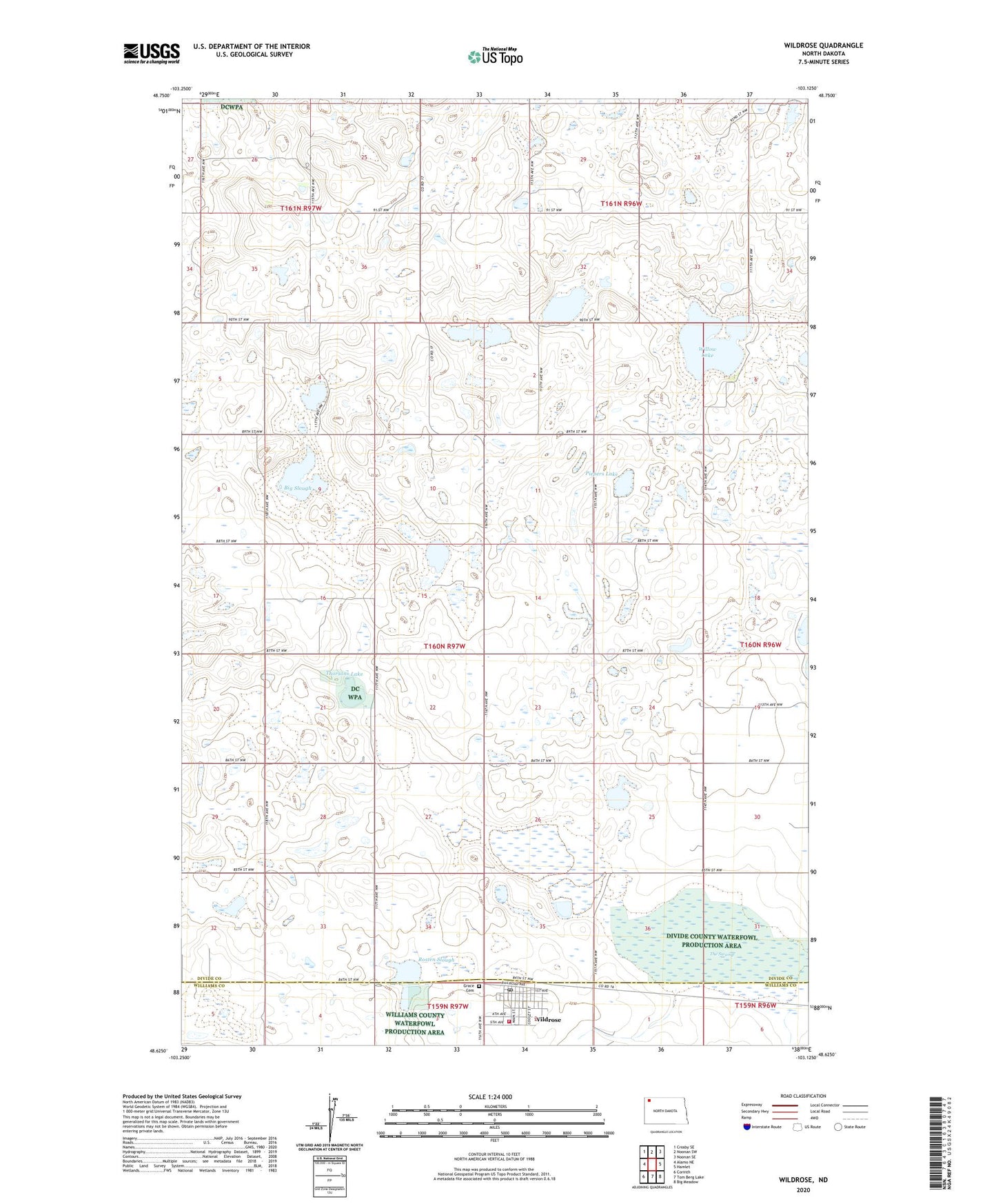
2024 topographic map quadrangle Wildrose in the state of North Dakota. Scale: 1:24000. Based on the newly updated USGS 7.5' US Topo map series, this map is in the following counties: Divide, Williams. The map contains contour data, water features, and other items you are used to seeing on USGS maps, but also has updated roads and other features. This is the next generation of topographic maps. Printed on high-quality waterproof paper with UV fade-resistant inks.
Quads adjacent to this one:
West: Alamo NE
Northwest: Crosby SE
North: Noonan SW
Northeast: Noonan SE
East: Hamlet
Southeast: Big Meadow
South: Tom Berg Lake
Southwest: Corinth
This map covers the same area as the classic USGS quad with code o48103f2.
Contains the following named places: Big Slough, City of Wildrose, Divide County Waterfowl Production Area, Grace Cemetery, Piepers Lake, Rosten Slough, The Swamp, Thorsons Lake, Township of Palmer, Wildrose, Wildrose Fire Protection District, Wildrose Post Office, Willow Lake, ZIP Code: 58795