MyTopo
Alvordton Ohio US Topo Map
Couldn't load pickup availability
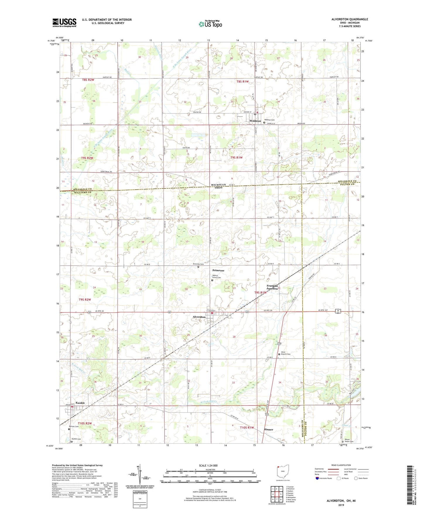
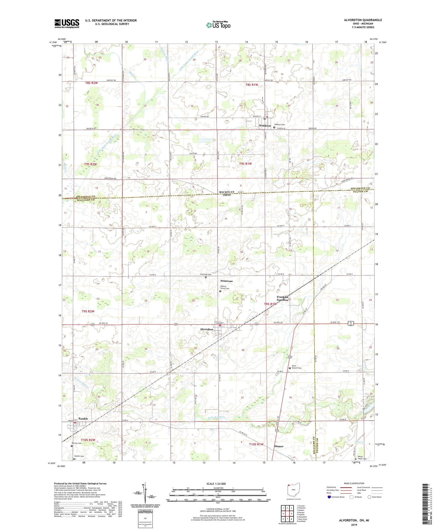
2019 topographic map quadrangle Alvordton in the states of Ohio, Michigan. Scale: 1:24000. Based on the newly updated USGS 7.5' US Topo map series, this map is in the following counties: Williams, Hillsdale, Fulton. The map contains contour data, water features, and other items you are used to seeing on USGS maps, but also has updated roads and other features. This is the next generation of topographic maps. Printed on high-quality waterproof paper with UV fade-resistant inks.
Quads adjacent to this one:
West: Pioneer
Northwest: Frontier
North: Pittsford
Northeast: Hudson
East: Fayette
Southeast: Archbold
South: West Unity
Southwest: Montpelier
Contains the following named places: Alvordton, Alvordton - Millcreek Township Fire Department, Alvordton Census Designated Place, Alvordton Post Office, Barrett Cemetery, Bird Creek, Bradley School, Brehm Farms, Brick School, Church of Christ, Ebenezer Church, Franklin Junction, Gospel Tabernacle, Hamer, Kanayer School, Kunkle, Kunkle Cemetery, Kunkle Census Designated Place, Kunkle Family Farms, Kunkle Fire Department, Kunkle Post Office, Kunkle United Brethren in Christ Church, Laird Creek, Lippy School, Mill Creek Dairy, Mount Salem Cemetery, Newton Drain, North Elementary School, Olive Branch Cemetery, Olive Branch Church, Primrose, Primrose Cemetery, Salvation Camp, School Number 4, School Number 5, Stoner School, Township of Mill Creek, Union Church, Village of Alvordton, Village of Waldron, Waldron, Waldron Cemetery, Waldron District Library, Waldron Post Office, Waldron Schools, Waldron Station, Waldron Wesleyan Church, Walkup School, Walnut Grove Cemetery, West Fork Mill Creek, Wright - Waldron Fire and Ambulance Station 12, ZIP Codes: 43501, 43531, 49288