MyTopo
Frontier Michigan US Topo Map
Couldn't load pickup availability
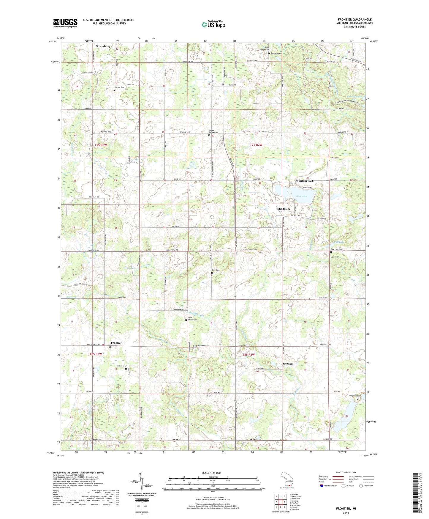
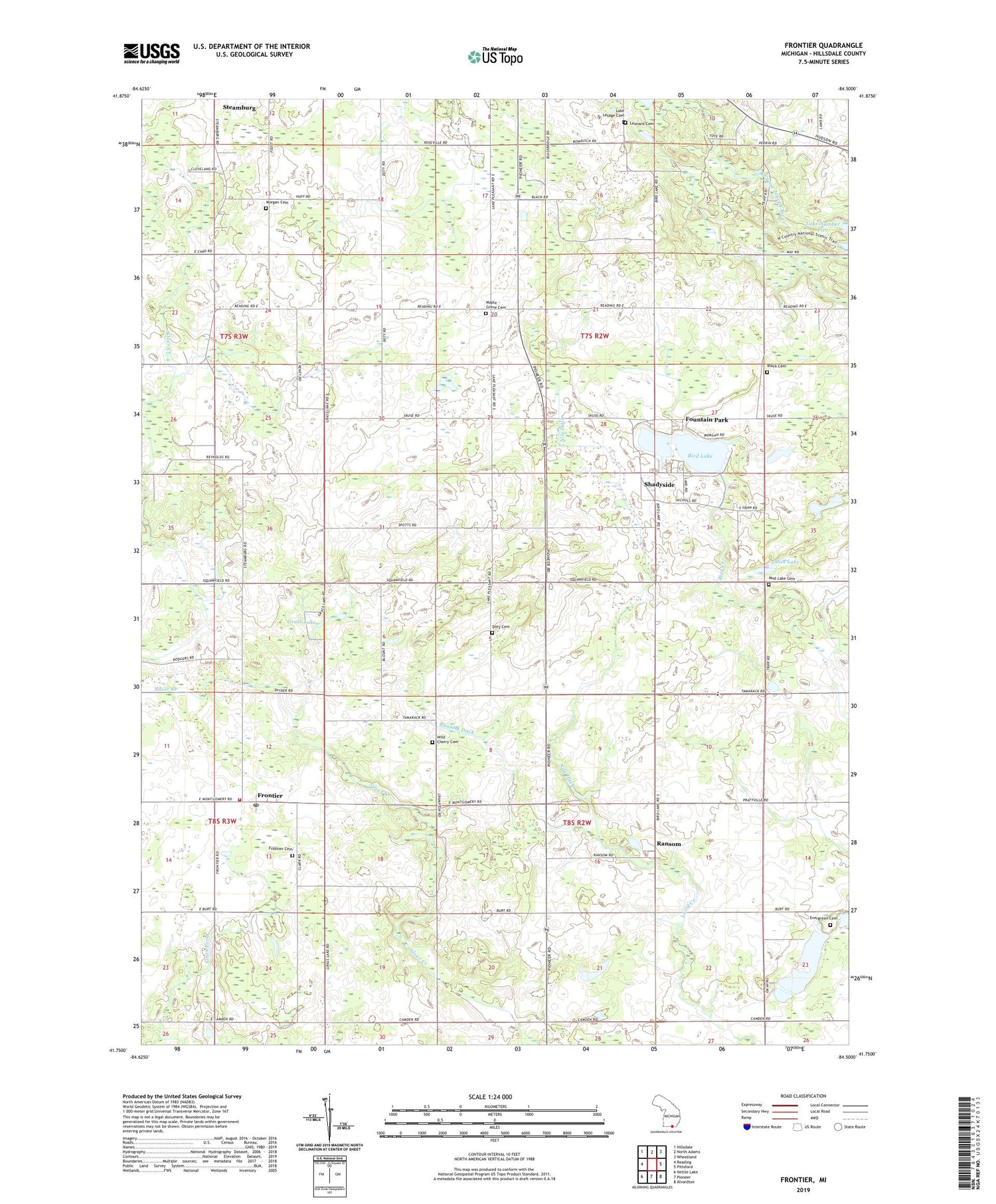
2023 topographic map quadrangle Frontier in the state of Michigan. Scale: 1:24000. Based on the newly updated USGS 7.5' US Topo map series, this map is in the following counties: Hillsdale. The map contains contour data, water features, and other items you are used to seeing on USGS maps, but also has updated roads and other features. This is the next generation of topographic maps. Printed on high-quality waterproof paper with UV fade-resistant inks.
Quads adjacent to this one:
West: Reading
Northwest: Hillsdale
North: North Adams
Northeast: Wheatland
East: Pittsford
Southeast: Alvordton
South: Pioneer
Southwest: Nettle Lake
This map covers the same area as the classic USGS quad with code o41084g5.
Contains the following named places: Bird Lake, Bird Lake Bible School, Bird Lake Wesleyan Missionary Church, Black Cemetery, Doty Cemetery, Evergreen Cemetery, Fountain Park, Frontier, Frontier Cemetery, Frontier Post Office, Frontier United Methodist Church, Gateway Park Church, Grass Lake, Jefferson Post Office, Lake Lesage Cemetery, Leonard Cemetery, Maple Grove Cemetery, Morgan Cemetery, Mud Lake, Mud Lake Cemetery, Nile Ditch, Otto Drain, Ransom, Ransom Ditch, Ransom Post Office, Shadyside, Shadyside Post Office, Township of Jefferson, Township of Ransom, Wild Cherry Cemetery, Woodbridge Township Fire and Rescue, ZIP Code: 49266