MyTopo
Pioneer Ohio US Topo Map
Couldn't load pickup availability
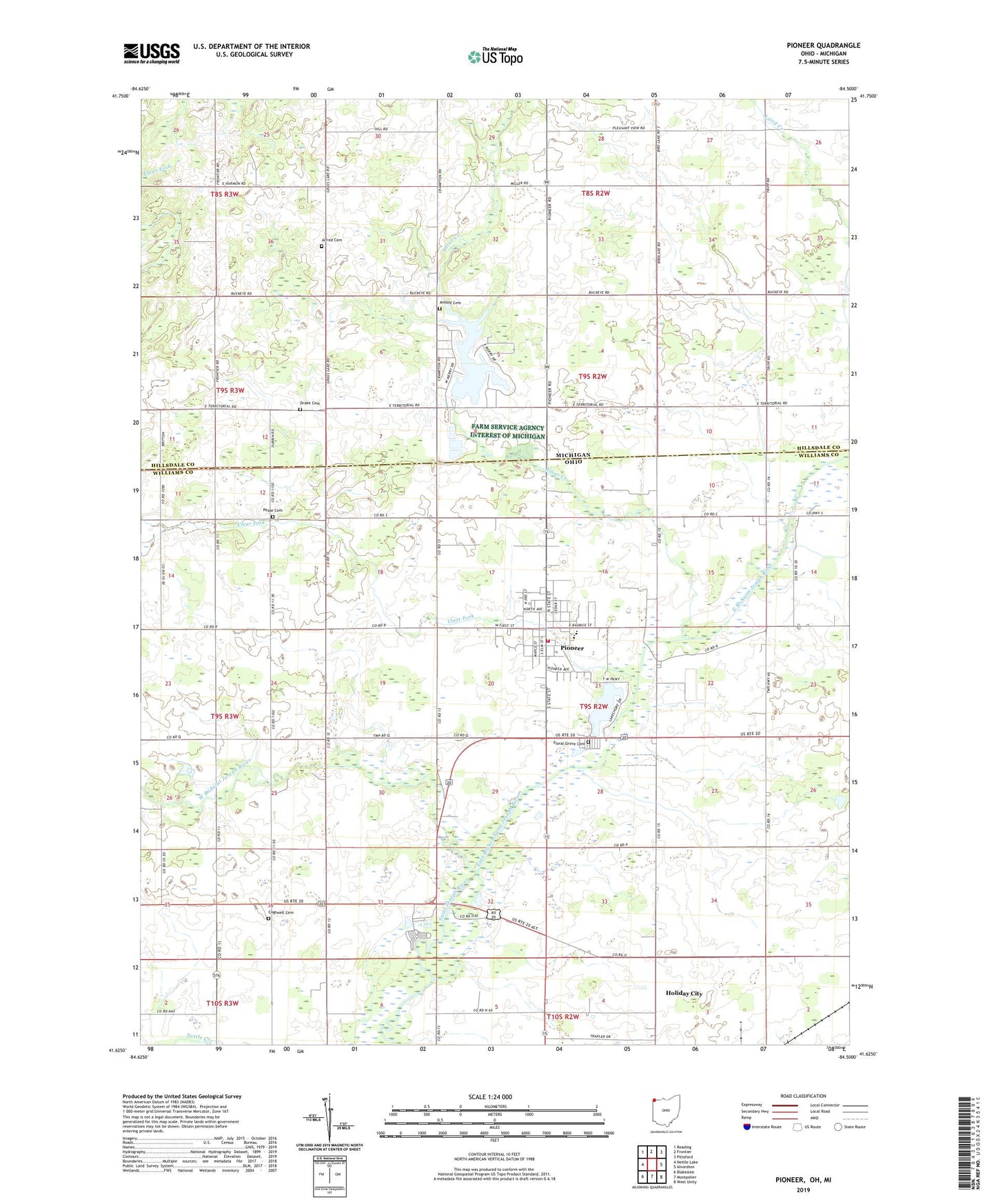
2023 topographic map quadrangle Pioneer in the states of Ohio, Michigan. Scale: 1:24000. Based on the newly updated USGS 7.5' US Topo map series, this map is in the following counties: Williams, Hillsdale. The map contains contour data, water features, and other items you are used to seeing on USGS maps, but also has updated roads and other features. This is the next generation of topographic maps. Printed on high-quality waterproof paper with UV fade-resistant inks.
Quads adjacent to this one:
West: Nettle Lake
Northwest: Reading
North: Frontier
Northeast: Pittsford
East: Alvordton
Southeast: West Unity
South: Montpelier
Southwest: Blakeslee
This map covers the same area as the classic USGS quad with code o41084f5.
Contains the following named places: A C Miller Airport, Alfred Cemetery, Amboy Cemetery, Amboy Church, Amboy Post Office, Buckeye Post Office, Clear Fork, Cogswell Cemetery, Cummins Farms, Deer Lick School, Drake Cemetery, East Branch Saint Joseph River, Floral Grove Cemetery, Greyhound, Hinkle Farms, Jim Town, Joint School, Lake View United Brethren Church, Lazy River Campground, Lighthouse Christian School, Madison Church, North High School, Pease Cemetery, Pioneer, Pioneer Church of the Nazarene, Pioneer Fire Department, Pioneer Mobile Home Park, Pioneer Post Office, Pleasant View Church, Salem Church, School Number 2, School Number 4, School Number 6, Silver Creek, Silver Creek Church of the Brethren, Strobel's Tree Farm, Township of Amboy, Township of Madison, Village of Pioneer, West Branch Saint Joseph River, Williams County Emergency Medical Services Medic 7, ZIP Code: 43554