MyTopo
Ashville Ohio US Topo Map
Couldn't load pickup availability
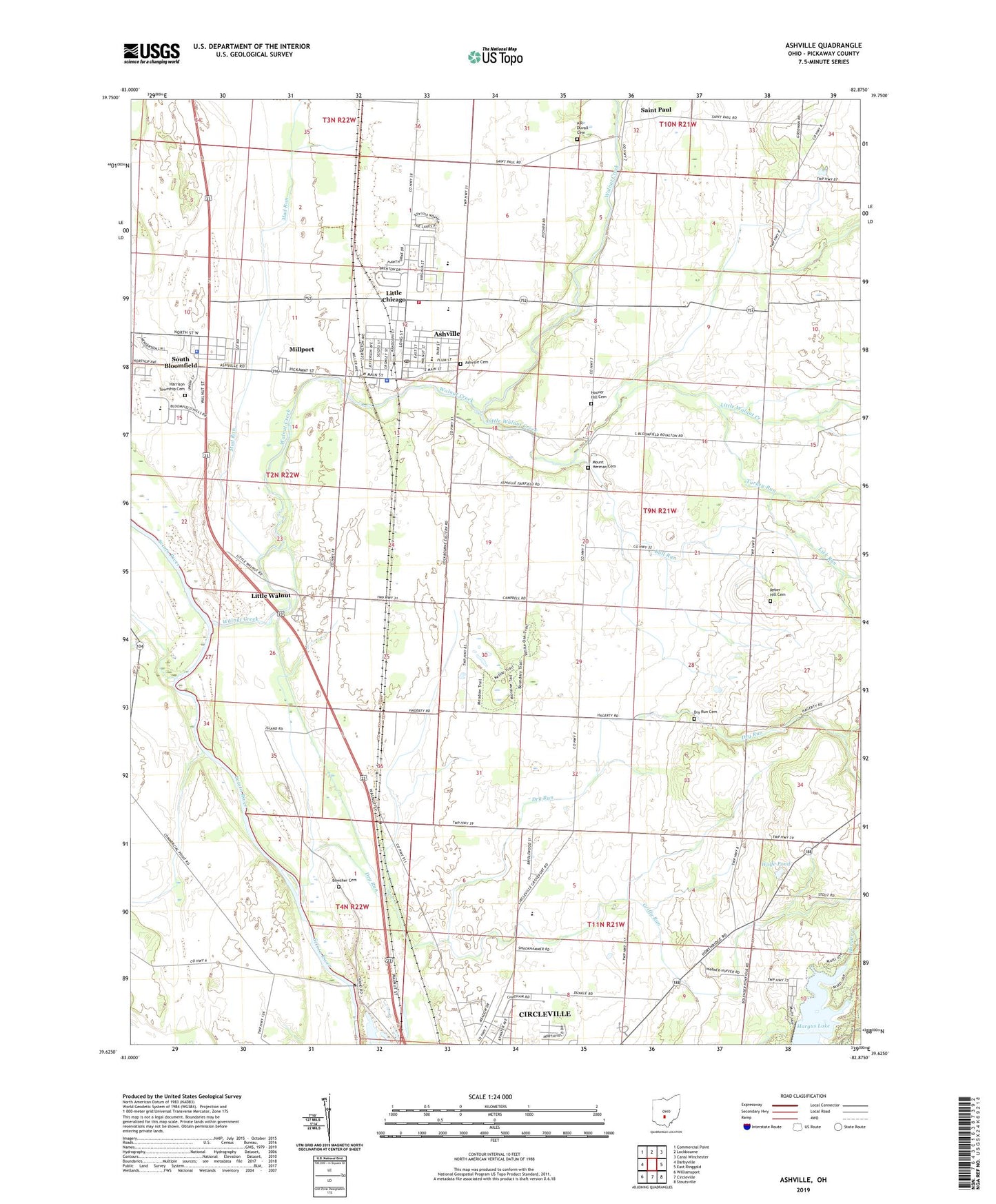
2019 topographic map quadrangle Ashville in the state of Ohio. Scale: 1:24000. Based on the newly updated USGS 7.5' US Topo map series, this map is in the following counties: Pickaway. The map contains contour data, water features, and other items you are used to seeing on USGS maps, but also has updated roads and other features. This is the next generation of topographic maps. Printed on high-quality waterproof paper with UV fade-resistant inks.
Quads adjacent to this one:
West: Darbyville
Northwest: Commercial Point
North: Lockbourne
Northeast: Canal Winchester
East: East Ringgold
Southeast: Stoutsville
South: Circleville
Southwest: Williamsport
Contains the following named places: A R Duvall Cemetery, A W Marion Memorial, A W Marion State Park, Ashton Crossing, Ashton Village, Ashville, Ashville Cemetery, Ashville Church of Christ in Christian Union, Ashville Elementary School, Ashville Police Department, Ashville Post Office, Ashville Primary School, Bells, Bowsher Cemetery, Brandon Court, Bridlewood, Brinker Corners, Bull Run, Bushwhack School, Cromley, Dresbach Farms, Dry Run, Dry Run Cemetery, Dry Run School, Elm Grove School, Fairview, First English Lutheran Church, Gray, Greenfield School, Griffith, Griffy Run, Hagerty, Hargus Lake, Hargus Lake Dam, Hargus Lake Trail, Harrison Township Cemetery, Harrison Township Fire Department, Hedges Chapel, Hoover Hill Cemetery, Island School, Lick Run, Little Chicago, Little Walnut, Little Walnut Creek, Millport, Mount Herman Cemetery, Mud Run, Nebraska, Nebraska Post Office, Nebraska School, Ohio State Highway Patrol - Circleville Patrol Post, Peters School, Pleasantview Farm, Reber Hill Cemetery, Renick School, Rhoads, Robs Trailer Park, Saint Paul, Saint Paul Church, Saint Paul Post Office, School Number 2, School Number 4, Scioto Estates, South Bloomfield, South Bloomfield Police Department, South Bloomfield Post Office, South Bloomfield United Methodist Church, Squawroot Nature Trail, Stages Pond State Nature Preserve, Suburban Village, Sunnyside School, Teays Valley High School, Teays Valley Middle School, Tedrows Mobile Home Park, Township of Harrison, Township of Walnut, Turkey Run, Upper Lansdowne Golf Course, Village of Ashville, Village of South Bloomfield, Voorheis, Walnut Creek, Walnut Elementary School, Ward Corners, WNRE-AM (Circleville), Wolfe Pond, Wolfe Pond Dam, Zimmerman Farms, Zion Church, Zion United Methodist Church, ZIP Code: 43103