MyTopo
Williamsport Ohio US Topo Map
Couldn't load pickup availability
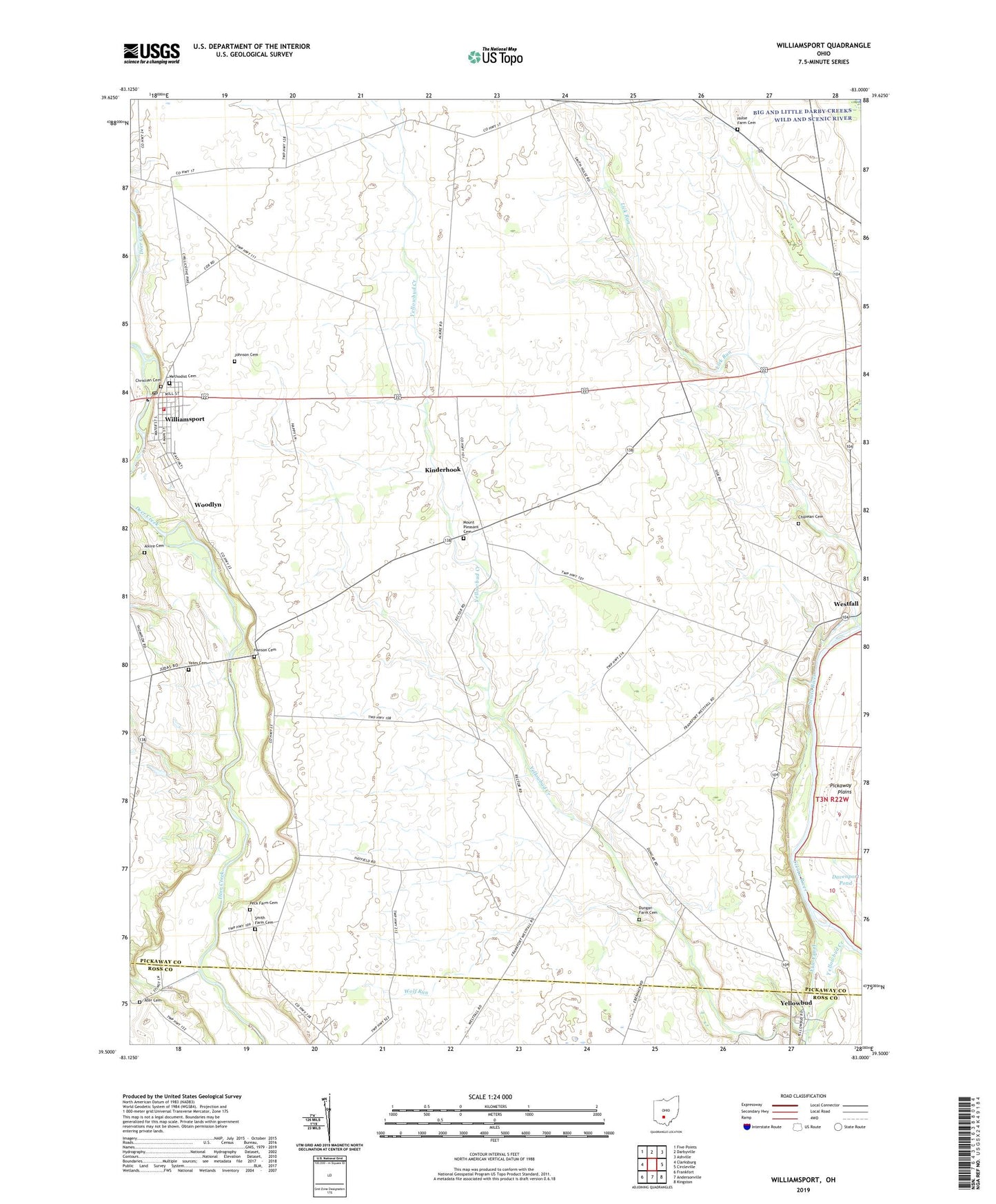
2023 topographic map quadrangle Williamsport in the state of Ohio. Scale: 1:24000. Based on the newly updated USGS 7.5' US Topo map series, this map is in the following counties: Pickaway, Ross. The map contains contour data, water features, and other items you are used to seeing on USGS maps, but also has updated roads and other features. This is the next generation of topographic maps. Printed on high-quality waterproof paper with UV fade-resistant inks.
Quads adjacent to this one:
West: Clarksburg
Northwest: Five Points
North: Darbyville
Northeast: Ashville
East: Circleville
Southeast: Kingston
South: Andersonville
Southwest: Frankfort
This map covers the same area as the classic USGS quad with code o39083e1.
Contains the following named places: Alkire Cemetery, Ater Cemetery, Azbell Farms, Bazore Mill, Bennett School, Chipman Cemetery, Christian Cemetery, Dungan Farm Cemetery, Dungon School, Erie Canal, Fugerson School, Gray Barn Farms, Hanson Cemetery, Hoffman Farms, Hornbeck School, Hulse Farm Cemetery, Hulse School, J Bar Farms, Johnson Cemetery, Johnson Farms, Keys School, Kinderhook, Kinderhook Post Office, Methodist Cemetery, Mount Pleasant Cemetery, Mount Pleasant Church, Peck Farm Cemetery, Pecks Ford, Rolling H Farm, School Number 6, Smith Farm Cemetery, Township of Deercreek, Township of Wayne, Union Grove School, Village of Williamsport, Williamsport, Williamsport and Deercreek Emergency Squad, Williamsport Church of Christ in Christian Union, Williamsport Deercreek Township Volunteer Fire Department, Williamsport Post Office, Williamsport United Methodist Church, WKKJ-FM (Chillicothe), Wolf Run, Woodlyn, Woodlyn Post Office, WWAT-TV (Chillicothe), Yates Cemetery, Yellowbud, Yellowbud Creek, Yellowbud Post Office, ZIP Code: 43164