MyTopo
Clyde Ohio US Topo Map
Couldn't load pickup availability
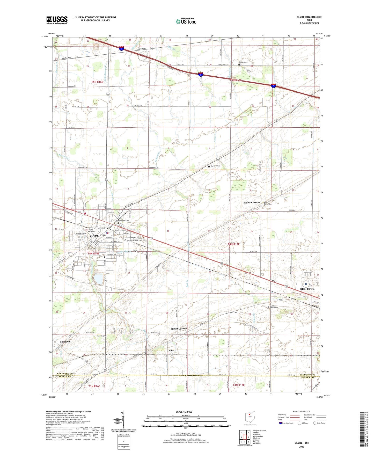
2019 topographic map quadrangle Clyde in the state of Ohio. Scale: 1:24000. Based on the newly updated USGS 7.5' US Topo map series, this map is in the following counties: Sandusky, Seneca. The map contains contour data, water features, and other items you are used to seeing on USGS maps, but also has updated roads and other features. This is the next generation of topographic maps. Printed on high-quality waterproof paper with UV fade-resistant inks.
Quads adjacent to this one:
West: Fremont East
Northwest: Wightmans Grove
North: Vickery
Northeast: Castalia
East: Bellevue
Southeast: Flat Rock
South: Fireside
Southwest: Watson
Contains the following named places: Buck Creek, Butternut Ridge Chapel, Calvary Baptist Church, Cherry Knoll Mobile Park, Cherry Street Park, City of Clyde, City of Clyde Water Treatment Plant, Clyde, Clyde Christian Church, Clyde Church of the Nazarene, Clyde City Hall, Clyde Fire Department Station 1, Clyde Fire Department Station 2, Clyde High School, Clyde Junior High School, Clyde Police Department, Clyde Post Office, Colby, Colby Post Office, Colwell Cemetery, Dauch Hog Farms, Ellsworth Cemetery, Eshleman Fruit Farm, First Baptist Church of Clyde, First United Methodist Church, First United Presbyterian Church, Fuller Cemetery, Galetown, Gilbert Cemetery, Green Hills Golf Course, Harvest Temple, Keegan Farms, Lay Cemetery, Limerick Park, McPherson Cemetery, Mobile Home Estates, Mount Carmel, Mount Carmel Church, Raccoon Creek Reservoir, Raccoon Creek Upground Reservoir Dam, Saint Marys Catholic Church, Saint Marys Cemetery, Saint Marys School, Saint Paul Lutheran Church, Shady Acres, Sleepy Hollow Golf Course, South Main Elementary School, South Meadow Farms, Sucker Run Creek, The Bellevue Hospital, Township of York, Vickery Farms, Vine Street Elementary School, W and W Pork Farm, Wales Corner Cemetery, Wales Corners, Watson Farm, WHVT-FM (Clyde), York, York Elementary School, York Free Chapel, York Free Chapel Cemetery, York Post Office, ZIP Code: 43410