MyTopo
Fireside Ohio US Topo Map
Couldn't load pickup availability
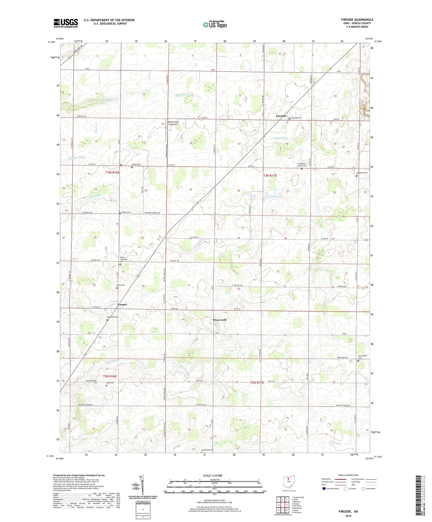
2023 topographic map quadrangle Fireside in the state of Ohio. Scale: 1:24000. Based on the newly updated USGS 7.5' US Topo map series, this map is in the following counties: Seneca. The map contains contour data, water features, and other items you are used to seeing on USGS maps, but also has updated roads and other features. This is the next generation of topographic maps. Printed on high-quality waterproof paper with UV fade-resistant inks.
Quads adjacent to this one:
West: Watson
Northwest: Fremont East
North: Clyde
Northeast: Bellevue
East: Flat Rock
Southeast: Centerton
South: Attica
Southwest: Bloomville
This map covers the same area as the classic USGS quad with code o41082b8.
Contains the following named places: Adams Lutheran Cemetery, Albright Ditch, Armstrong Cemetery, Assumption Catholic Church, Assumption Cemetery, Assumption School, Baldosser Farms, Bandit Field Airdrome, Block Cemetery, Butz School, Center School, Clay Cemetery, Cooper, Cooper Post Office, Decker Pond, Falter Farms, Fireside, Fireside Cemetery, Fireside Post Office, Four County Farm, Good Farms, Goose Pond, Grassy Pond, Green Springs Volunteer Fire Department Station 2, Hamm School, Noel Ditch, Payne Cemetery, Petticord School, Reformed Cemetery, Royer Ditch, School Number 2, School Number 3, School Number 4, School Number 5, School Number 6, School Number 8, Thompson Center Cemetery, Thomsontown, Township of Thompson, Underhill Cemetery, Union Cemetery, Wagner School, West Lodi, West Lodi Post Office, WLCO-FM (Clyde), Zion Lutheran Church, ZIP Code: 44867