MyTopo
Fairhaven Ohio US Topo Map
Couldn't load pickup availability
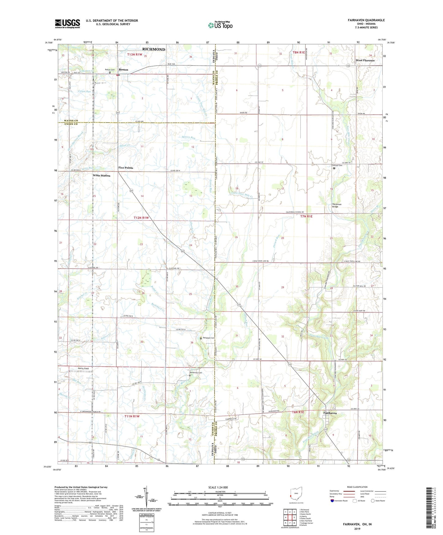
2019 topographic map quadrangle Fairhaven in the states of Ohio, Indiana. Scale: 1:24000. Based on the newly updated USGS 7.5' US Topo map series, this map is in the following counties: Preble, Union, Wayne. The map contains contour data, water features, and other items you are used to seeing on USGS maps, but also has updated roads and other features. This is the next generation of topographic maps. Printed on high-quality waterproof paper with UV fade-resistant inks.
Quads adjacent to this one:
West: Liberty
Northwest: Richmond
North: New Paris
Northeast: Eaton North
East: Eaton South
Southeast: Oxford
South: College Corner
Southwest: New Fairfield
Contains the following named places: Beechy Mire Post Office, Boston, Boston Cemetery, Boston Fire Department, Boston Post Office, Church Creek, Claysburg, Concord Cemetery, Concord Church, Dixon Branch, Dixon-Israel Middle School, Elleman Farms, E-Z Acres Airport, Fairhaven, Fairhaven Post Office, Fairhaven United Presbyterian Church, Five Points, Fleisch Run, Four Mile Farm, Fourmile Church, Goodwins Corner, Goodwins Creek, Harshman Bridge, Kitchel, Kitchel Creek, Kitchel Farm, Norris Field, Nut Run, Orr Farms, Pentecost Cemetery, Radar Creek, Railsback Cemetery, Railsback Creek, Silver Station Brook, Smith Farms, Square Run, Statler Ditch, Sugar Grove Church, Toney Run, Town of Boston, Township of Dixon, Township of Harrison, Twin Acre Farms, West Florence, West Florence Post Office, Witts Run, Witts Station, ZIP Code: 47324