MyTopo
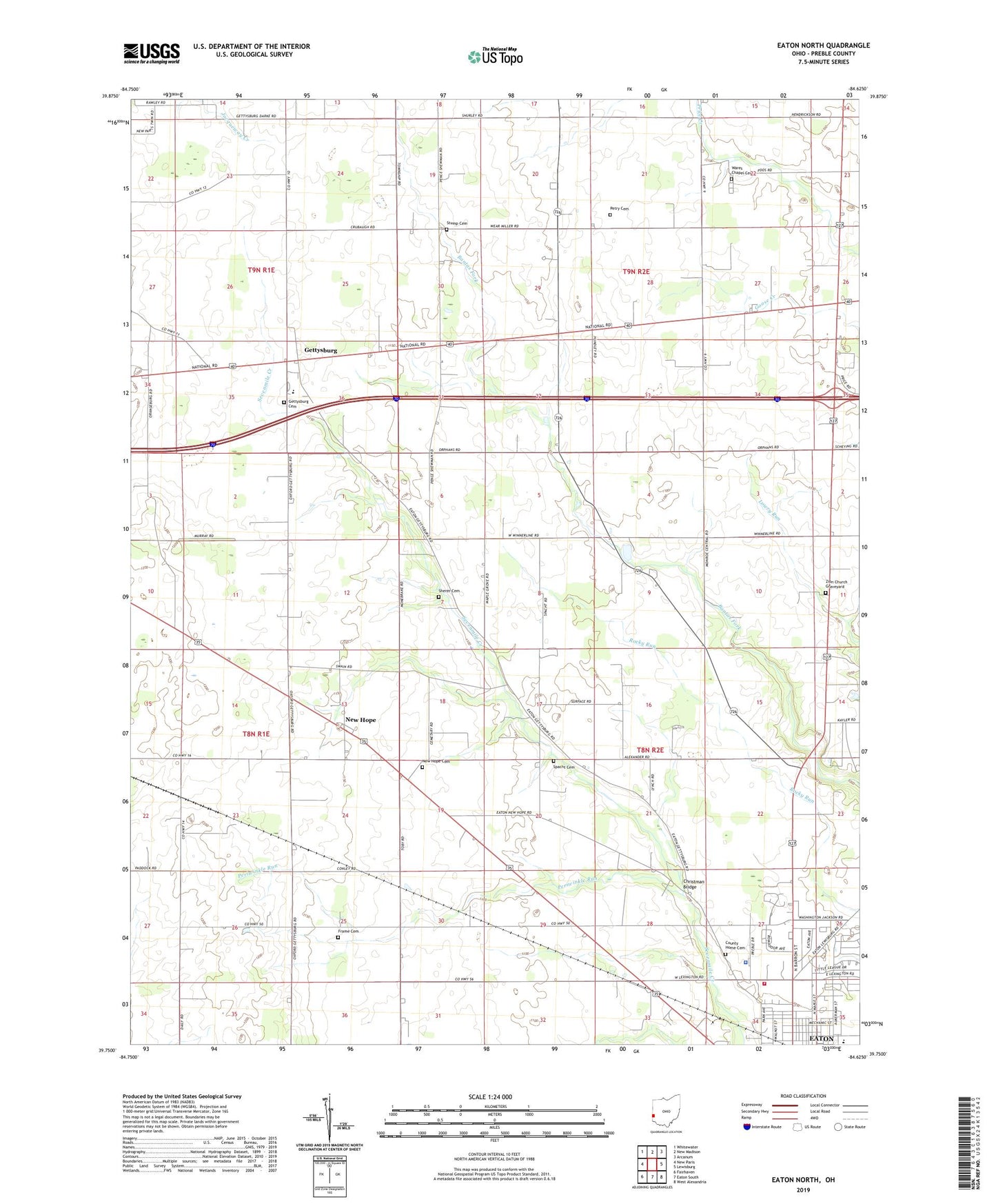
Eaton North Ohio US Topo Map
Couldn't load pickup availability
2023 topographic map quadrangle Eaton North in the state of Ohio. Scale: 1:24000. Based on the newly updated USGS 7.5' US Topo map series, this map is in the following counties: Preble. The map contains contour data, water features, and other items you are used to seeing on USGS maps, but also has updated roads and other features. This is the next generation of topographic maps. Printed on high-quality waterproof paper with UV fade-resistant inks.
Quads adjacent to this one:
West: New Paris
Northwest: Whitewater
North: New Madison
Northeast: Arcanum
East: Lewisburg
Southeast: West Alexandria
South: Eaton South
Southwest: Fairhaven
This map covers the same area as the classic USGS quad with code o39084g6.
Contains the following named places: Barnes Farm, Bowling Trailer Park, Christman Bridge, City of Eaton, County Home Cemetery, Darble Farm, Eaton Fire and EMS Division Station 2, Eaton First Church of the Nazarene, Ebenezer, Ebenezer Church, Ebenezer Post Office, First Baptist Church, First Church of God, Frame Cemetery, Gateway Baptist Church, Gettysburg, Gettysburg Cemetery, Gettysburgh Post Office, Greenbriar Nursing Center, Growing Acres Farm, Lee Farms, Lone Sycamore Farms, Lynch Farms, Lynch's Farms, McFadden School, Miller Farms, Murphy Farms, National Trail Family Farm, National Trail High School, New Hope, New Hope Cemetery, New Hope Station, New Hope Station Post Office, New Hope United Methodist Church, Northedge Shopping Center, Oklahoma, Orangeburg, Periwinkle Run, Petry Cemetery, Preble County Home, Preble County Sheriff's Office, Prices Creek Church of the Brethren, Scottish Crest Farms, Sherer Cemetery, Spacht Cemetery, Stamback School, Studebaker Farms, Stump Cemetery, Township of Monroe, Township of Washington, Wares Chapel Cemetery, Wares Chapel United Methodist Church, Westview Acres Care Center, Zion Church, Zion Church Graveyard, ZIP Code: 45320