MyTopo
Richmond Indiana US Topo Map
Couldn't load pickup availability
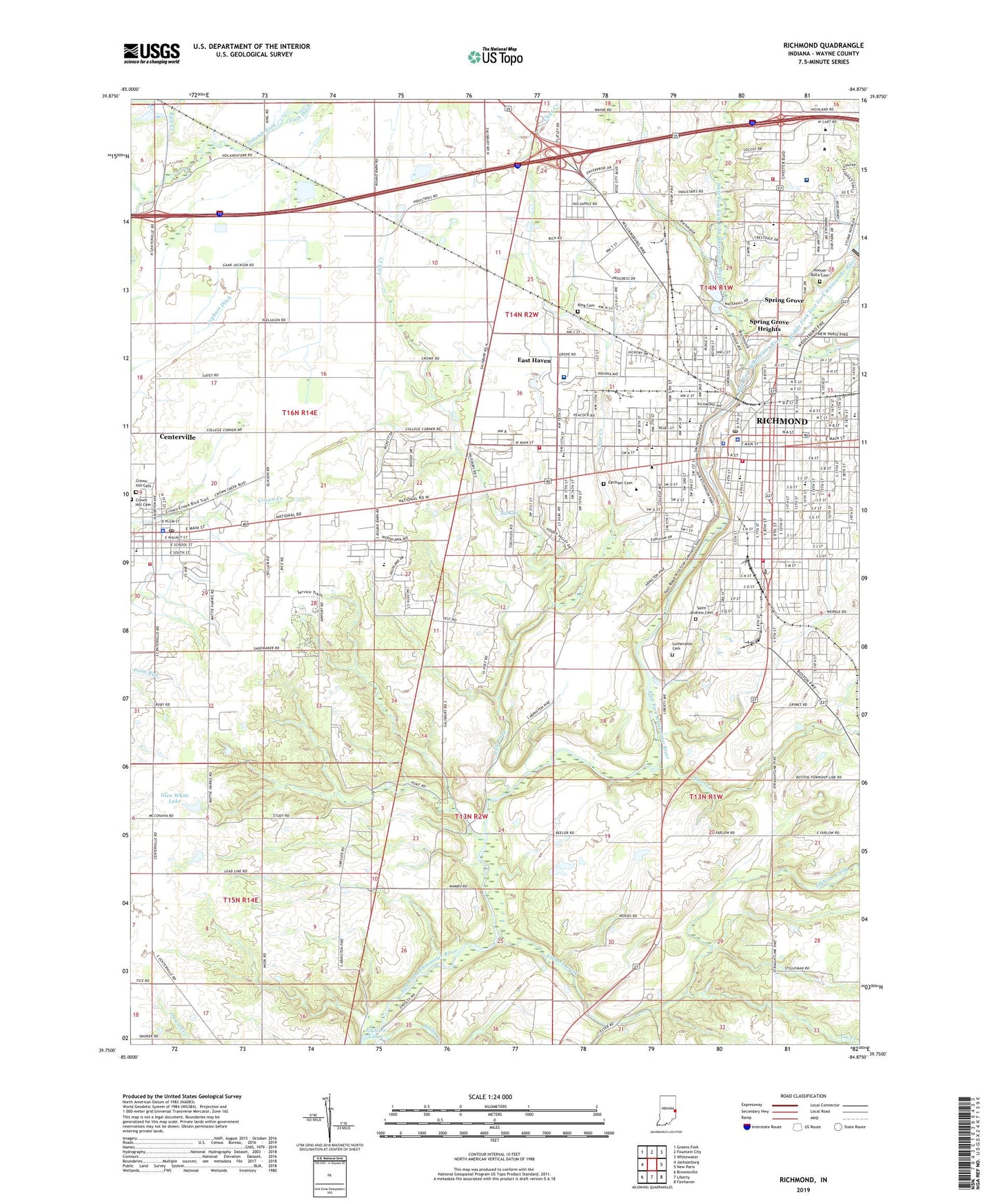
2022 topographic map quadrangle Richmond in the state of Indiana. Scale: 1:24000. Based on the newly updated USGS 7.5' US Topo map series, this map is in the following counties: Wayne. The map contains contour data, water features, and other items you are used to seeing on USGS maps, but also has updated roads and other features. This is the next generation of topographic maps. Printed on high-quality waterproof paper with UV fade-resistant inks.
Quads adjacent to this one:
West: Jacksonburg
Northwest: Greens Fork
North: Fountain City
Northeast: Whitewater
East: New Paris
Southeast: Fairhaven
South: Liberty
Southwest: Brownsville
This map covers the same area as the classic USGS quad with code o39084g8.
Contains the following named places: Boston Creek, Calvary Church, Centerville, Centerville Fire and Rescue Department, Centerville Police Department, Centerville Post Office, City of Richmond, Clear Creek, Clear Creek Park, Crown Hill Cemetery, Dennis David Worth Junior High School, Earlham Cemetery, Earlham College, East Haven, Elkhorn Creek, Elkhorn Lakes, Finley School, Fork Creek, Gephart Ditch, Glen White Dam, Glen White Lake, Greenwood, Hibberd Junior High School, Highland Heights Elementary School, Hoover Bulla Cemetery, King Cemetery, Lick Creek, Lutherania Cemetery, Middle Fork East Fork Whitewater River, Middle Fork Reservoir Dam, Nicholson School, Old Centerville Cemetery, Pentecost Airport, Reid Hospital, Rich Creek, Richmond, Richmond Fire Department Station 1, Richmond Fire Department Station 2, Richmond Fire Department Station 4, Richmond Fire Department Station 5, Richmond Fire Department Station 6, Richmond Police Department, Richmond Post Office, Richmond Senior High School, Richmond State Hospital, Richmond State Hospital Farm, Rural / Metro Ambulance - Richmond, Saint Andrew Cemetery, Saint Andrews School, Saint Johns Church, Saint Pauls Church, Short Creek, Smith Creek, South Richmond, Spring Grove, Spring Grove Heights, Starr Elementary School, Starr Park, Tea Creek, Town of Centerville, Town of Spring Grove, Township of Center, Township of Wayne, Vaile Elementary School, Warner School, Wayne County Sheriff's Office, WECI-FM (Richmond), West Fork East Fork Whitewater River, White Airport, WKBV-AM (Richmond), WRIA-FM (Richmond), ZIP Code: 47374