MyTopo
Fletcher Ohio US Topo Map
Couldn't load pickup availability
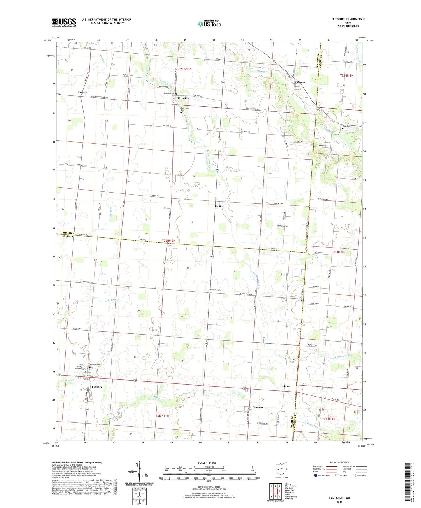
2019 topographic map quadrangle Fletcher in the state of Ohio. Scale: 1:24000. Based on the newly updated USGS 7.5' US Topo map series, this map is in the following counties: Shelby, Miami, Champaign. The map contains contour data, water features, and other items you are used to seeing on USGS maps, but also has updated roads and other features. This is the next generation of topographic maps. Printed on high-quality waterproof paper with UV fade-resistant inks.
Quads adjacent to this one:
West: Piqua East
Northwest: Sidney
North: Port Jefferson
Northeast: De Graff
East: Saint Paris
Southeast: Thackery
South: Christiansburg
Southwest: Troy
Contains the following named places: Alibi School, Anderson Cemetery, Ballou, Ballou Post Office, Charity Chapel, Conover, Conover Post Office, Depew, Depew Post Office, Dorsey Cemetery, Fairlawn School, Fletcher, Fletcher Cemetery, Fletcher Elementary School, Fletcher Post Office, Fletcher Presbyterian Churchyard Cemetery, Fletcher United Methodist Church, Futura Farms, Futureama Farms, Gustin Ditch, Hageman, Hill Farms, Lake School, Leatherwood Cemetery, Leatherwood School, Lena, Lena Baptist Church, Lena Post Office, Miami East Junior High School, Neal Cemetery, New Hope School, Newton Presbyterian Church, Pioneer Cemetery, Plattsville, Plattsville Cemetery, Plattsville Post Office, Progress Farms, R C T Farm, Roberts Cemetery, Spring Creek Church, Sturm Cemetery, Tawawa, Tawawa Post Office, Township of Brown, Township of Green, Valentine, Village of Fletcher, ZIP Code: 45326