MyTopo
Florence Ohio US Topo Map
Couldn't load pickup availability
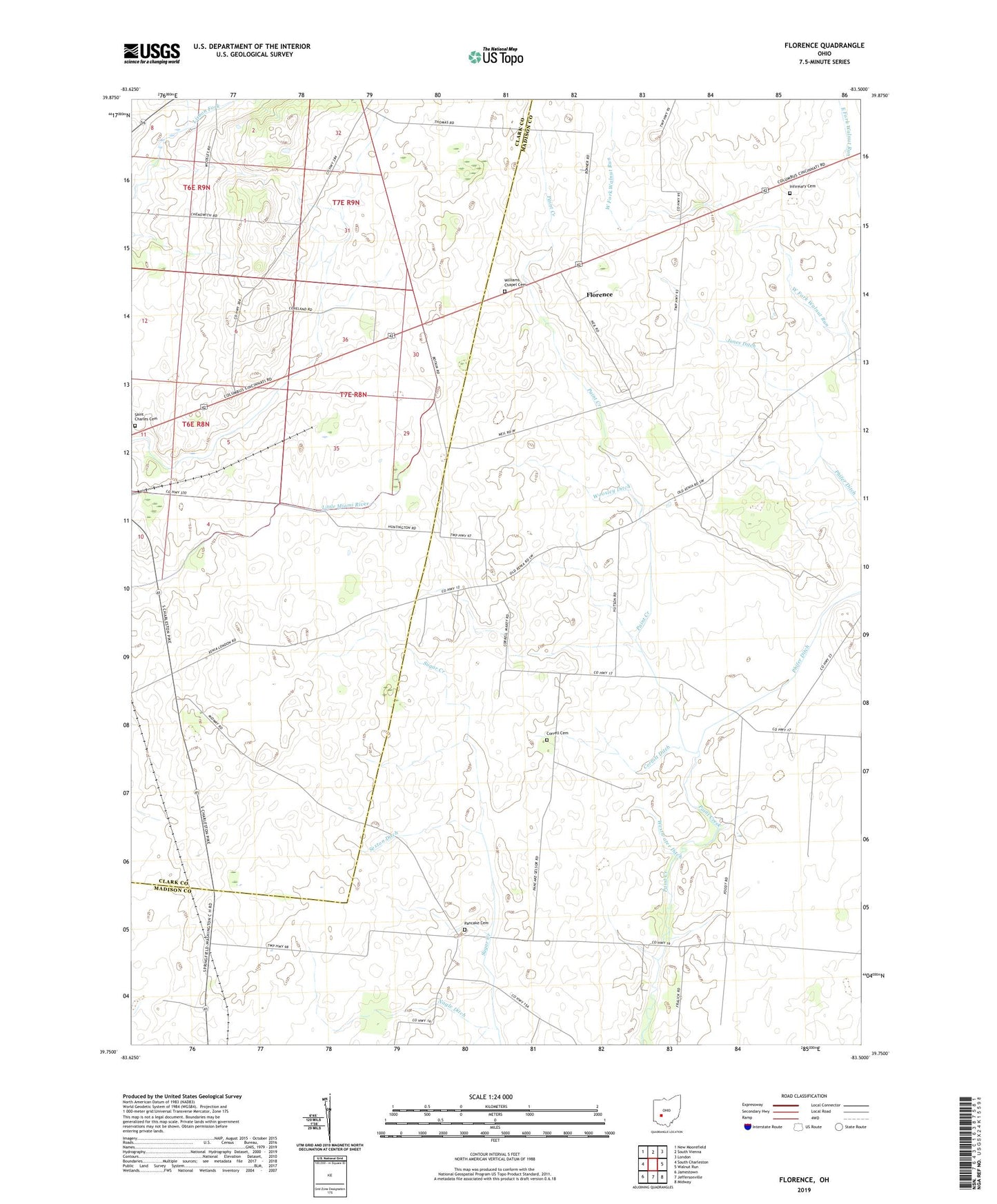
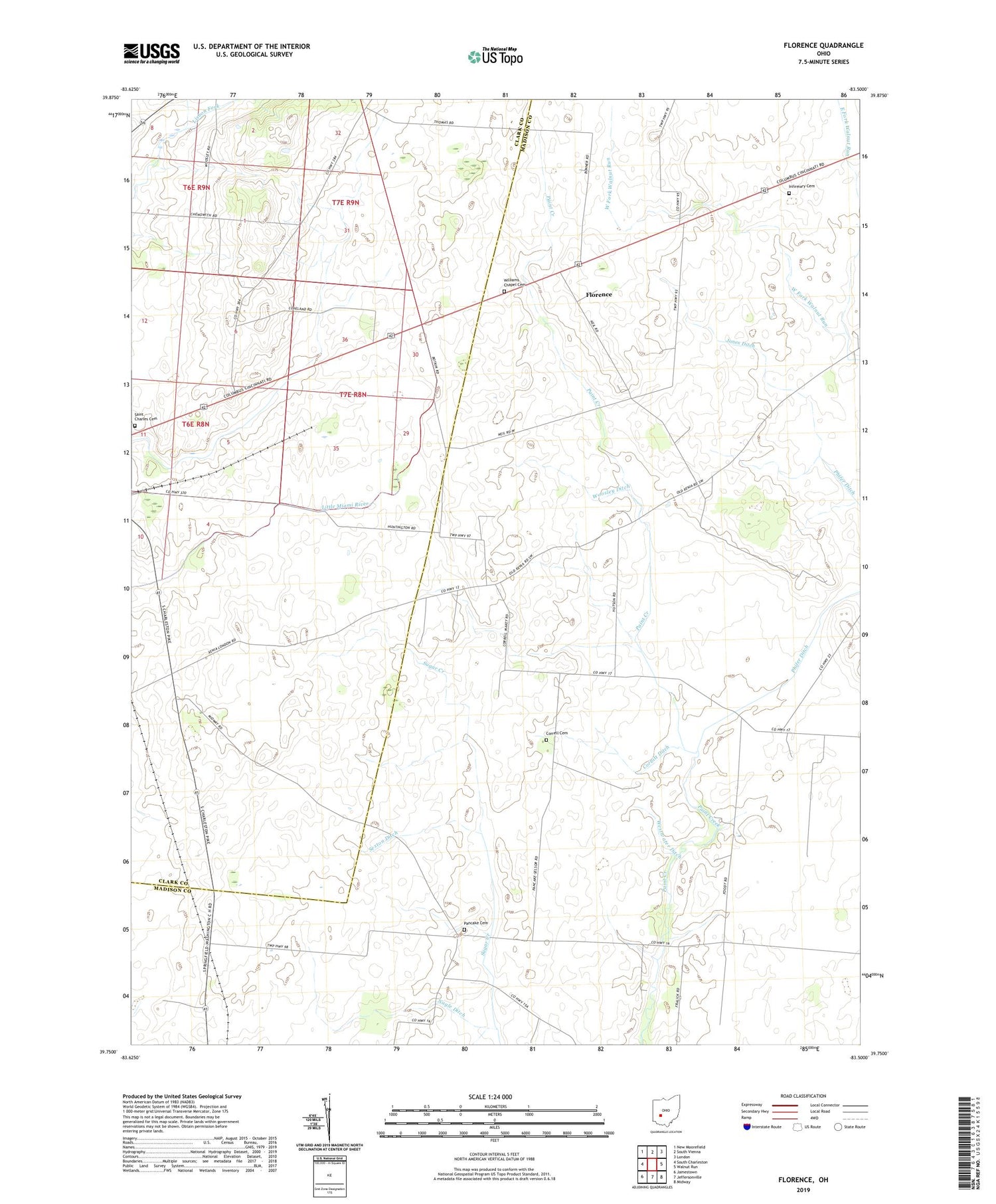
2019 topographic map quadrangle Florence in the state of Ohio. Scale: 1:24000. Based on the newly updated USGS 7.5' US Topo map series, this map is in the following counties: Madison, Clark. The map contains contour data, water features, and other items you are used to seeing on USGS maps, but also has updated roads and other features. This is the next generation of topographic maps. Printed on high-quality waterproof paper with UV fade-resistant inks.
Quads adjacent to this one:
West: South Charleston
Northwest: New Moorefield
North: South Vienna
Northeast: London
East: Walnut Run
Southeast: Midway
South: Jeffersonville
Southwest: Jamestown
Contains the following named places: Aaron Farms, Bonner Ditch, Corbitt Ditch, Cordle Mobile Home Park, Correll Cemetery, Davison Farms, Dunn School, Eachus School, East Fork Walnut Run, Finney Farms, Florence, Gilroy Ditch, Gordin Airport, Hertenstein Ditch, Infirmary Cemetery, Jones Ditch, Madison County Home, Maxie School, Nagle Ditch, Pancake Cemetery, Pancake Chapel, Pancake School, Pleasant View Stock Farm, Roberts Ditch, Saint Charles Cemetery, Sexton Ditch, Township of Paint, Waters Christmas Tree Farm, West Fork Walnut Run, Westwater Ditch, Williams Chapel Cemetery, Wilson Nicholson Ditch, Woosley Ditch