MyTopo
Jeffersonville Ohio US Topo Map
Couldn't load pickup availability
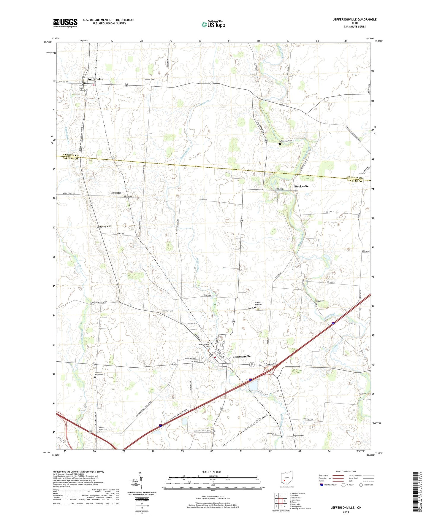
2023 topographic map quadrangle Jeffersonville in the state of Ohio. Scale: 1:24000. Based on the newly updated USGS 7.5' US Topo map series, this map is in the following counties: Fayette, Madison. The map contains contour data, water features, and other items you are used to seeing on USGS maps, but also has updated roads and other features. This is the next generation of topographic maps. Printed on high-quality waterproof paper with UV fade-resistant inks.
Quads adjacent to this one:
West: Jamestown
Northwest: South Charleston
North: Florence
Northeast: Walnut Run
East: Midway
Southeast: Washington Court House
South: Milledgeville
Southwest: Bowersville
This map covers the same area as the classic USGS quad with code o39083f5.
Contains the following named places: Blessing, Blessings School, Booco - Ryan Cemetery, Bookwalter, Bookwalter Church of Christ in Christian Union, Bookwalter Post Office, Bookwalter School, Cozy Corners, Dumpling Hill, Fairview Cemetery, Grassy Plain School, Harold School, Hidy Cemetery, Hidy School, Highbee Cemetery, Hillside School, Hogue - Allen Cemetery, Jefferson Township Fire Department Station 500, Jeffersonville, Jeffersonville Church, Jeffersonville Elementary School, Jeffersonville Post Office, Jeffersonville United Methodist Church, Kirk Cemetery, Maple Grove School, McKillip - Kirk Cemetery, Old Jeffersonville Cemetery, Slaughter School, South Solon, South Solon Cemetery, South Solon Post Office, South Solon School, Stokes Township Fire Department, Sunnyside School, Thomas Cemetery, Thomas School, Township of Jefferson, Township of Stokes, Twin Oak Dairy, Village of Jeffersonville, Village of South Solon, Walnut Hill School, Walnut Ridge School, Wesley Chapel Church, Whiteman Cemetery, ZIP Codes: 43128, 43153