MyTopo
Jamestown Ohio US Topo Map
Couldn't load pickup availability
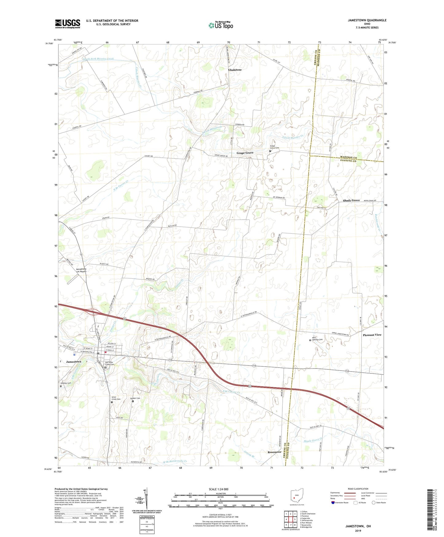
2023 topographic map quadrangle Jamestown in the state of Ohio. Scale: 1:24000. Based on the newly updated USGS 7.5' US Topo map series, this map is in the following counties: Greene, Fayette, Madison. The map contains contour data, water features, and other items you are used to seeing on USGS maps, but also has updated roads and other features. This is the next generation of topographic maps. Printed on high-quality waterproof paper with UV fade-resistant inks.
Quads adjacent to this one:
West: Cedarville
Northwest: Clifton
North: South Charleston
Northeast: Florence
East: Jeffersonville
Southeast: Milledgeville
South: Bowersville
Southwest: Port William
This map covers the same area as the classic USGS quad with code o39083f6.
Contains the following named places: Aerodrome Les Noyers, Bell Center, Bethel School, Bloom Airport, Camstra Airport, Church of Christ in Christian Union, College Hill School, Gladstone, Gladstone Post Office, Grape Grove, Grape Grove Cemetery, Grape Grove Church, Grapegrove Post Office, Greenview High School, Griffin School, Hickory Grove School, International Pentecostal Church, Jamestown, Jamestown Friends Meeting House, Jamestown Police Department, Jamestown Post Office, Locust Grove School, Maple Grove School, Mechanicsville, Mills - McKillip Cemetery, Oak Grove School, Old Silver Creek Cemetery, Pleasant View, Pleasant View Church of Christ, Pleasant View School, Quaker Cemetery, Rosemoor, Saint Augustine Catholic Church, Shady Grove, Shady Grove School, Sheeley Cemetery, Shiloh School, Silver Creek Cemetery, Silver Ridge School, Silvercreek Township Fire Department, Sugar Grove School, Township of Ross, Township of Silvercreek, Velesky Airport, Village of Jamestown, ZIP Code: 45335