MyTopo
Forest Ohio US Topo Map
Couldn't load pickup availability
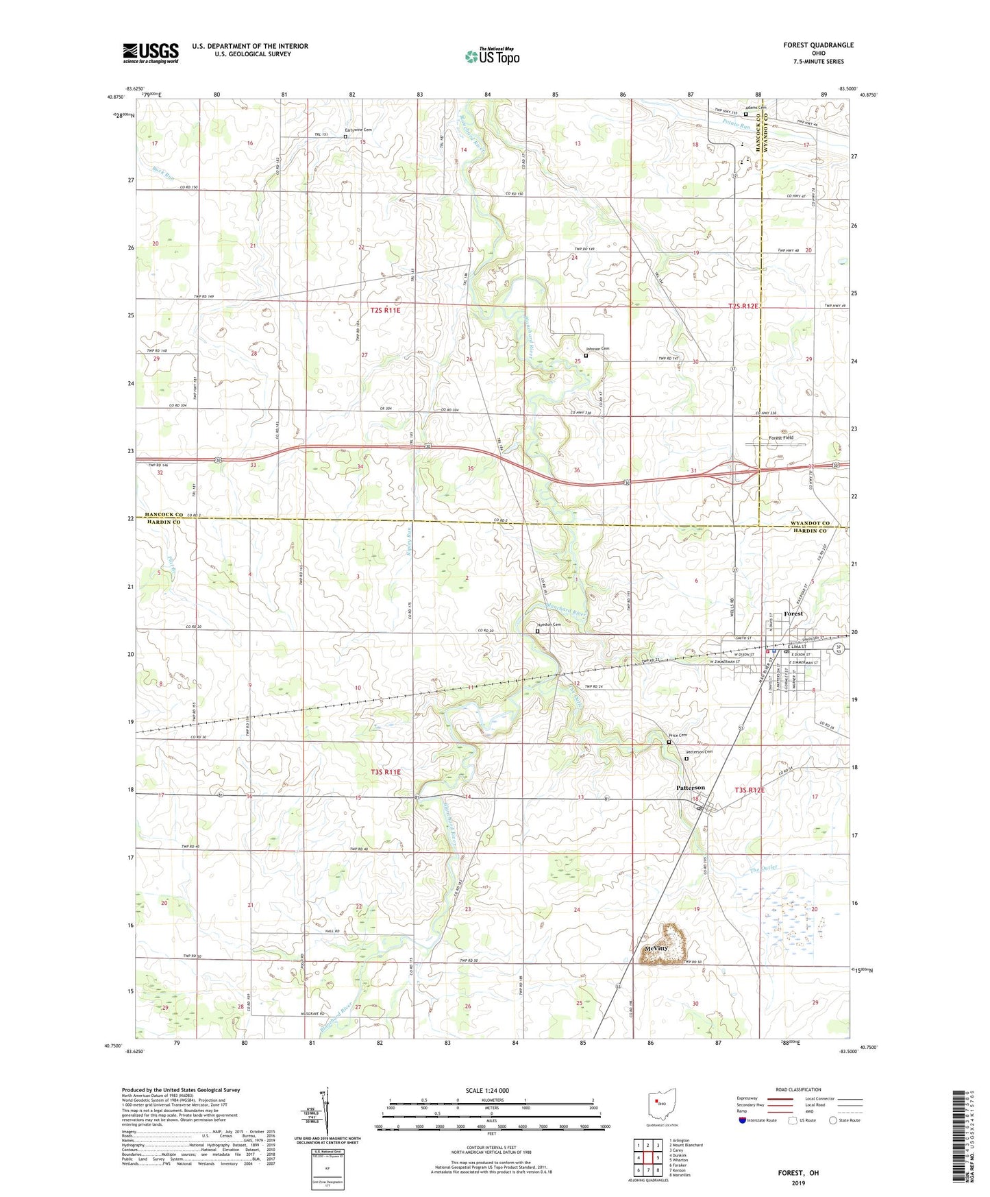
2019 topographic map quadrangle Forest in the state of Ohio. Scale: 1:24000. Based on the newly updated USGS 7.5' US Topo map series, this map is in the following counties: Hardin, Hancock, Wyandot. The map contains contour data, water features, and other items you are used to seeing on USGS maps, but also has updated roads and other features. This is the next generation of topographic maps. Printed on high-quality waterproof paper with UV fade-resistant inks.
Quads adjacent to this one:
West: Dunkirk
Northwest: Arlington
North: Mount Blanchard
Northeast: Carey
East: Wharton
Southeast: Marseilles
South: Kenton
Southwest: Foraker
Contains the following named places: Adams Cemetery, Blanchard River Church, Earlywine Cemetery, First Baptist Church, First Presbyterian Church, Forest, Forest Christian Pre-School, Forest Elementary School, Forest Field, Forest Fire Department, Forest Police Department, Forest Post Office, Forest United Methodist Church, Herzog Quarry, Hope Church, Hueston Cemetery, Jackson - Forest Joint Ambulance District, Johnson Cemetery, Maplegrove Church, McVitty, Mount Zion Church, Oak Harbor Church, Oak Harbor School, Patterson, Patterson Cemetery, Patterson Post Office, Price Cemetery, Ripley Run, Rushville School, The Outlet, Township of Blanchard, Township of Delaware, Township of Jackson, Union Chapel, Village of Forest, Village of Patterson, ZIP Code: 45843