MyTopo
Foraker Ohio US Topo Map
Couldn't load pickup availability
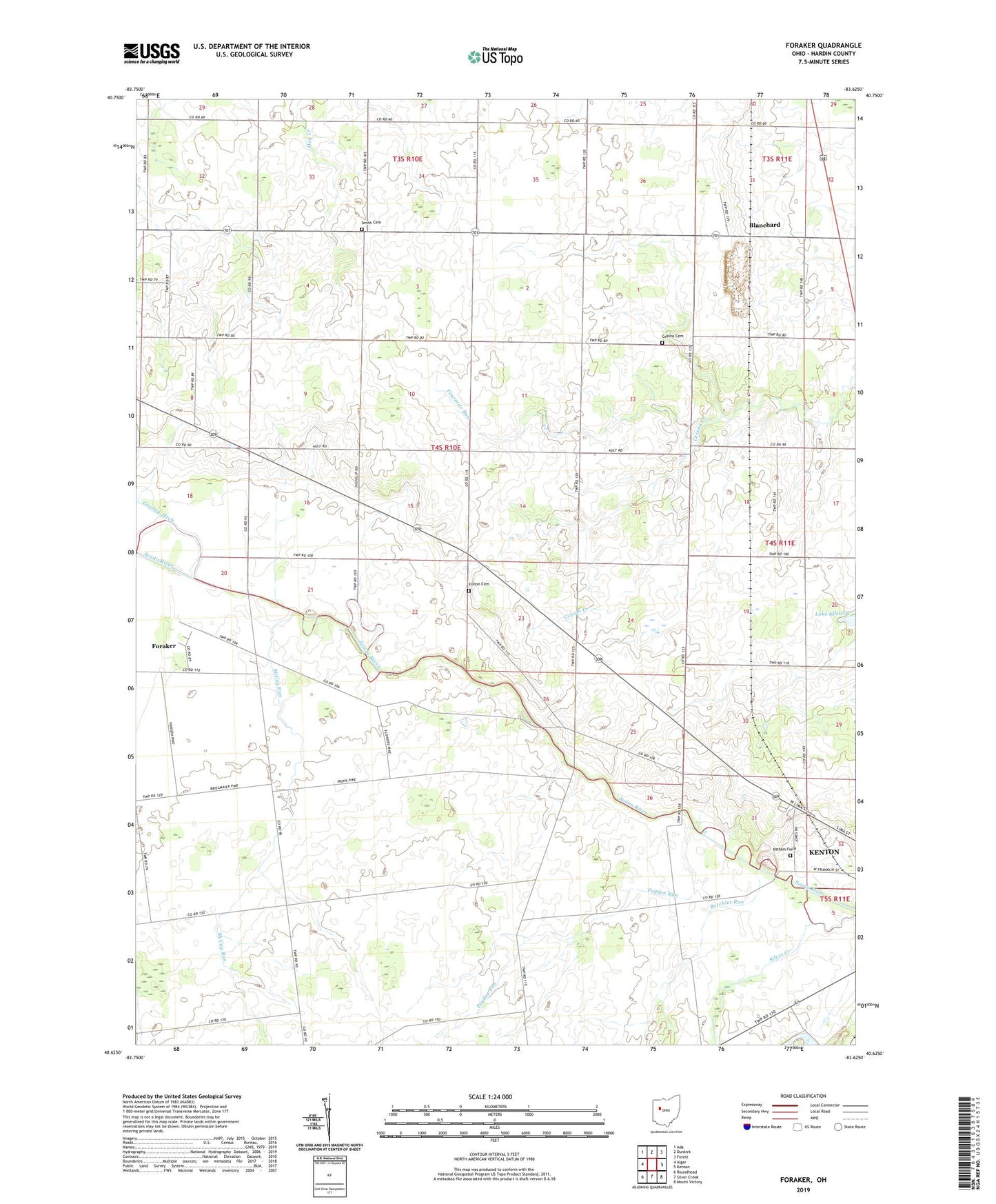
2023 topographic map quadrangle Foraker in the state of Ohio. Scale: 1:24000. Based on the newly updated USGS 7.5' US Topo map series, this map is in the following counties: Hardin. The map contains contour data, water features, and other items you are used to seeing on USGS maps, but also has updated roads and other features. This is the next generation of topographic maps. Printed on high-quality waterproof paper with UV fade-resistant inks.
Quads adjacent to this one:
West: Alger
Northwest: Ada
North: Dunkirk
Northeast: Forest
East: Kenton
Southeast: Mount Victory
South: Silver Creek
Southwest: Roundhead
This map covers the same area as the classic USGS quad with code o40083f6.
Contains the following named places: Batchlet Run, Bateson School, Beech Grove School, Blanchard, Blanchard Post Office, Blocktown, Brush College, Buckeye School, Cessna Cemetery, Eagle School, Eibling Circle E Airport, Elmwood School, Fairview Church, Fariview School, Flynn School, Foraker, Foraker Church, Foraker Post Office, Fort McArthur, Fourmile Run, Friendship Grange Hall, Fulton Cemetery, Hardin Airport, Hardin County, Hardin County Home, Hardin Quarry, Lake Idlewild, Liberty School, Lynn Valley School, McCoy Run, Opossum School, Payden Run, Potters Field Cemetery, Saint Johns Church, Salem School, Schingle School, Scioto School, Smith Cemetery, Township of Cessna, Township of Lynn