MyTopo
Glenford Ohio US Topo Map
Couldn't load pickup availability
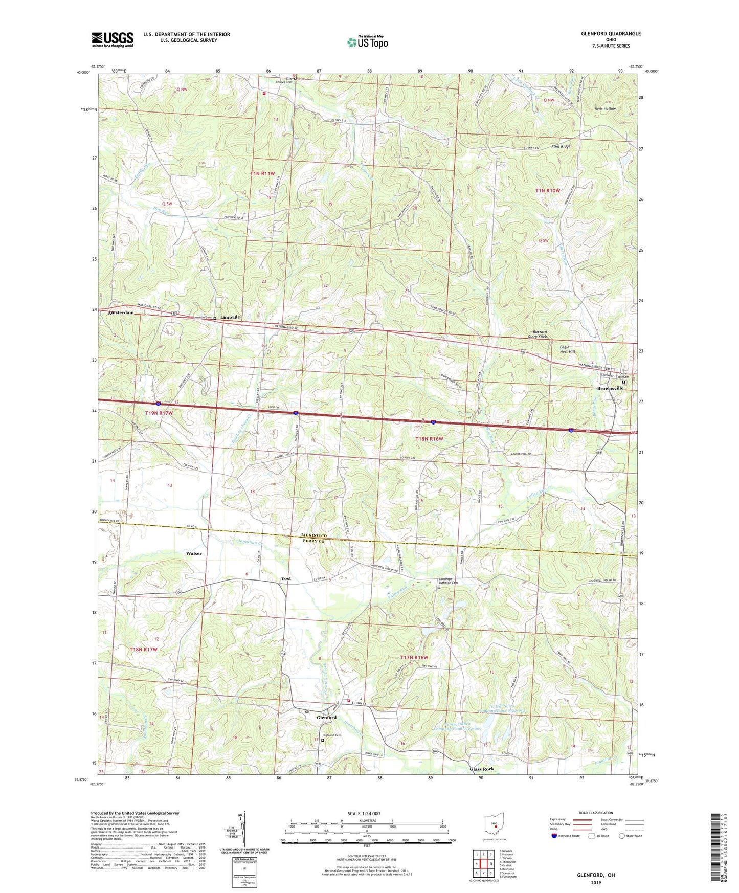
2019 topographic map quadrangle Glenford in the state of Ohio. Scale: 1:24000. Based on the newly updated USGS 7.5' US Topo map series, this map is in the following counties: Licking, Perry. The map contains contour data, water features, and other items you are used to seeing on USGS maps, but also has updated roads and other features. This is the next generation of topographic maps. Printed on high-quality waterproof paper with UV fade-resistant inks.
Quads adjacent to this one:
West: Thornville
Northwest: Newark
North: Hanover
Northeast: Toboso
East: Gratiot
Southeast: Fultonham
South: Somerset
Southwest: Rushville
Contains the following named places: Baraca Church, Bowling Green Creek, Brook Hall Farm, Brownsville, Brownsville Census Designated Place, Brownsville Post Office, Buzzard Glory Knob, Cedar Hill Cemetery, Central Silica Company Pond 9722-009, Central Silica Company Pond 9722-012, Central Silica Company Pond 9722-012 Dam, Chestnut Ridge Farm, Cold Spring Farm, Eagle Nest Hill, Ellis Chapel, Ellis Chapel Cemetery, Elmwood Farm, Fairview School, Flint Ridge, Flint Ridge Park, Franklin Elementary School, Glass Rock, Glenford, Glenford Elementary School, Glenford Post Office, Good Hope Lutheran Cemetery, Goodhope Lutheran Church, Greenwood Church, Hearst School, Heartland Orchard, Highland Cemetery, Hopewell Township Fire Department, Licking Township Fire Company Station 2, Linnville, Linnville Cemetery, Linnville Post Office, Little Bowling Green Prairie, Locust Grove Farm, Maple Grove Farm, Paddy Run, Pike Farm, Pleasant Ridge Farm, Pleasant Valley Farm, Porter School, Prairie Valley Farm, Roberts School, Stockberger School, Sugar Spring Farm, Township of Bowling Green, Township of Franklin, Valley Run, Village of Glenford, Walser, Wise Run, Yost, Yost Post Office, ZIP Codes: 43721, 43739