MyTopo
Fultonham Ohio US Topo Map
Couldn't load pickup availability
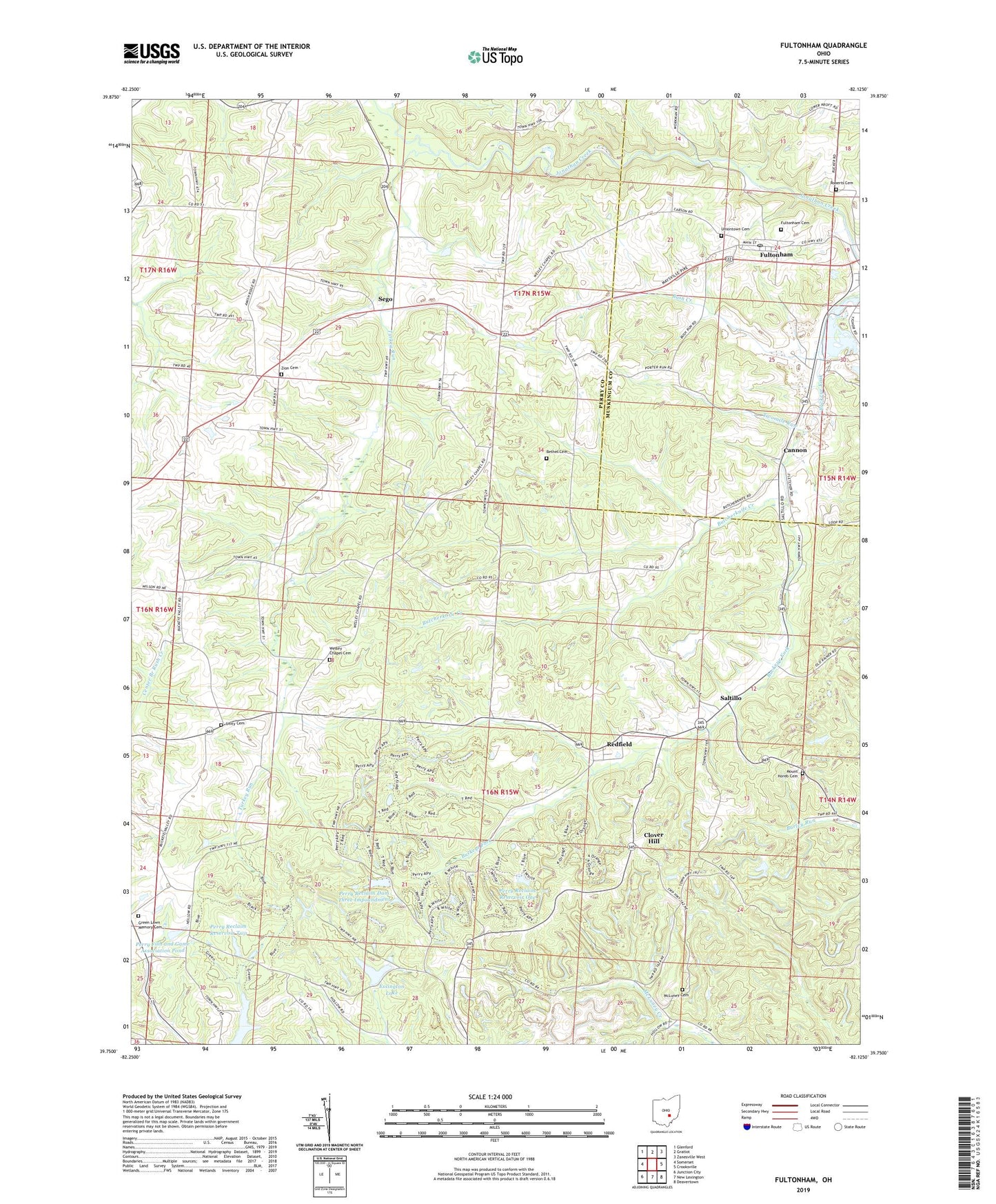
2023 topographic map quadrangle Fultonham in the state of Ohio. Scale: 1:24000. Based on the newly updated USGS 7.5' US Topo map series, this map is in the following counties: Perry, Muskingum. The map contains contour data, water features, and other items you are used to seeing on USGS maps, but also has updated roads and other features. This is the next generation of topographic maps. Printed on high-quality waterproof paper with UV fade-resistant inks.
Quads adjacent to this one:
West: Somerset
Northwest: Glenford
North: Gratiot
Northeast: Zanesville West
East: Crooksville
Southeast: Deavertown
South: New Lexington
Southwest: Junction City
This map covers the same area as the classic USGS quad with code o39082g2.
Contains the following named places: Avondale State Wildlife Area, Bethel Cemetery, Bush Creek, Butcherknife Creek, Cannon, Clayton School, Clover Hill, Curren School, Essington Lake, Essington Lake Dam, Fultonham, Fultonham Cemetery, Fultonham Post Office, Green Lawn Memory Cemetery, Lick School, Locust Grove School, Madison School, McLuney Cemetery, Mount Horeb Cemetery, New Lexington Water Supply Reservoir, Olive School, Perry Fish and Game Association Pond, Perry Fish and Game Association Pond Dam, Perry Reclaim Dam One, Perry Reclaim Dam Three, Perry Reclaim Dam Three Impoundment, Perry Reclaim Dam Two, Perry Reclaim Reservoir One, Perry Reclaim Reservoir Two, Perry State Forest, Perrydale School, Pike School, Porter School, Redfield, Redfield Post Office, Roberts Cemetery, Saltillo, Saltillo Post Office, Sego, Sego Post Office, Township of Clayton, Township of Madison, Turkey Run, Twomile Run, Uniontown Cemetery, Unity Church, Unity Presbyterian Cemetery, Village of Fultonham, Wesley, Wesley Chapel, Wesley Chapel Cemetery, Wesley Post Office, Wesley School, WWJM-FM (New Lexington), Zion Cemetery, Zion Methodist Church, ZIP Code: 43738