MyTopo
Greer Ohio US Topo Map
Couldn't load pickup availability
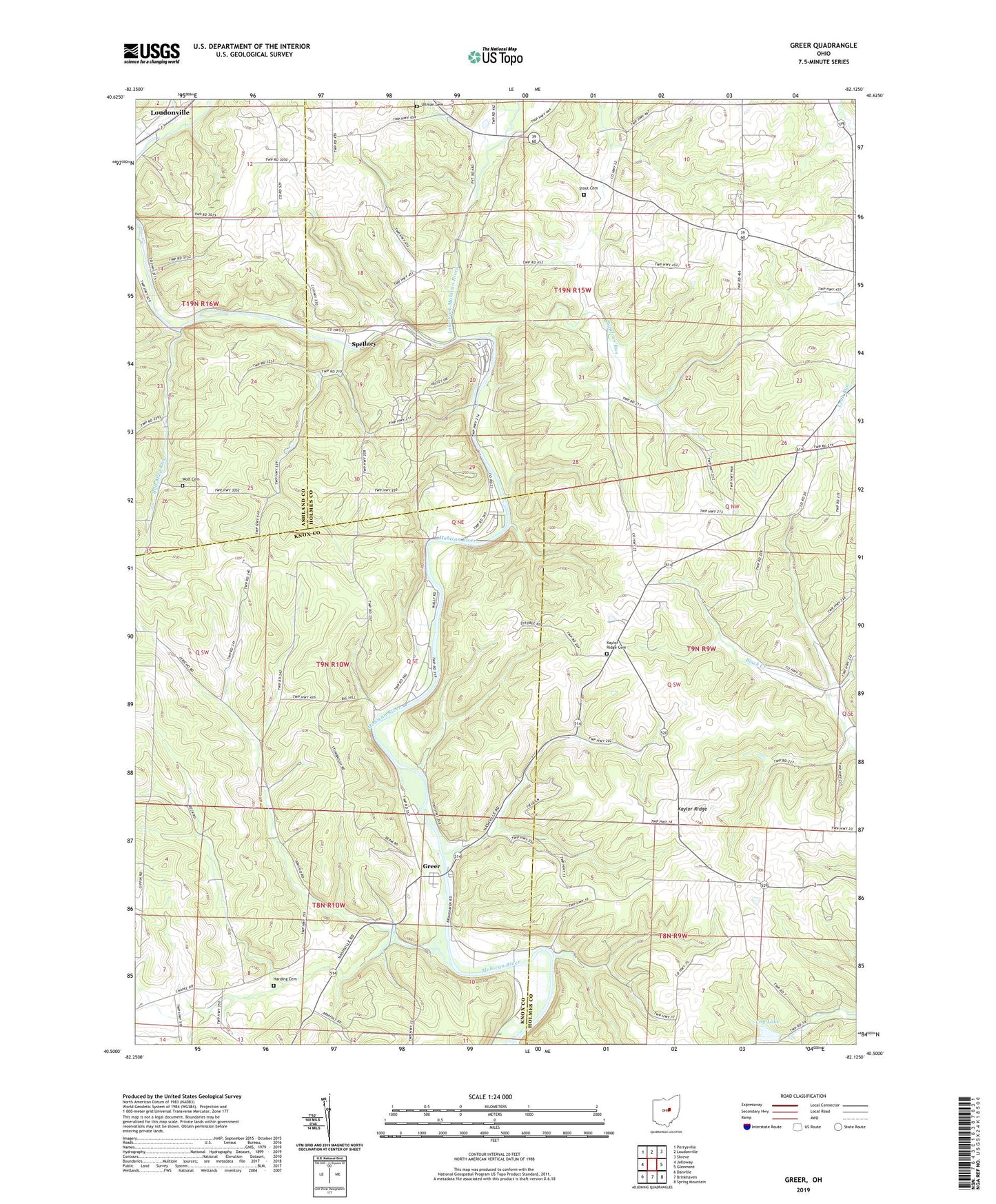
2019 topographic map quadrangle Greer in the state of Ohio. Scale: 1:24000. Based on the newly updated USGS 7.5' US Topo map series, this map is in the following counties: Holmes, Knox, Ashland. The map contains contour data, water features, and other items you are used to seeing on USGS maps, but also has updated roads and other features. This is the next generation of topographic maps. Printed on high-quality waterproof paper with UV fade-resistant inks.
Quads adjacent to this one:
West: Jelloway
Northwest: Perrysville
North: Loudonville
Northeast: Shreve
East: Glenmont
Southeast: Spring Mountain
South: Brinkhaven
Southwest: Danville
Contains the following named places: Ball Alley Run, Ball Alley School, Camp Bethany, Coy Lake, Coy Lake Dam, Cross School, Dino School, Germany School, Greer, Greer Post Office, Griggs Valley School, Harding Cemetery, Jance School, Jericho School, Kaylor Farm, Kaylor Ridge, Kaylor Ridge Cemetery, Knox School, Lake Fork Mohican River, Mosher School, New Wheeling, Peaceful Valley Camp, Pine Grove Farm, Pleasant Valley Campground, Pleasant View School, School Number 5, School Number 6, School Number 8, Sigafoos Run, Spellacy, Stout Cemetery, Township of Jefferson, Township of Knox, Turkey Ridge School, Ullman Cemetery, Walnut Farm, Walnut Grove School, Wolf Cemetery, ZIP Code: 44628