MyTopo
Spring Mountain Ohio US Topo Map
Couldn't load pickup availability
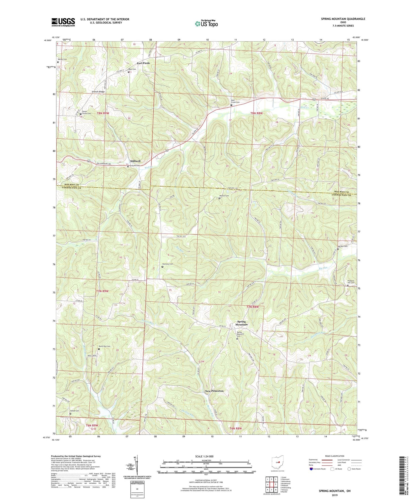
2023 topographic map quadrangle Spring Mountain in the state of Ohio. Scale: 1:24000. Based on the newly updated USGS 7.5' US Topo map series, this map is in the following counties: Coshocton, Holmes. The map contains contour data, water features, and other items you are used to seeing on USGS maps, but also has updated roads and other features. This is the next generation of topographic maps. Printed on high-quality waterproof paper with UV fade-resistant inks.
Quads adjacent to this one:
West: Brinkhaven
Northwest: Greer
North: Glenmont
Northeast: Millersburg
East: Killbuck
Southeast: Randle
South: Warsaw
Southwest: Walhonding
This map covers the same area as the classic USGS quad with code o40082d1.
Contains the following named places: Barnes Cemetery, Big Run Cemetery, Big Run School, Bucy Cemetery, Dutch Run Cemetery, Dutch Run Church, Dutch Run School, Election School, Fort Fizzle, French Ridge, Harmony Cemetery, Harmony Church, Hazel Glen School, Lookout School, McKee Cemetery, McKelvey School, Monroe Cemetery, Monroe Church, New Princeton, New Princeton Post Office, Pleasant Hill Cemetery, Pleasant Hill Church, Pleasant Valley School, Rock Ridge School, Spring Mountain, Spring Mountain Cemetery, Spring Mountain Post Office, Stillwell, Stillwell Cemetery, Stilwell Post Office, Stuber School, Township of Monroe, Township of Richland, Union Grove Cemetery, Union Grove Church, Wolf Creek Cemetery, ZIP Code: 44637