MyTopo
Homer Ohio US Topo Map
Couldn't load pickup availability
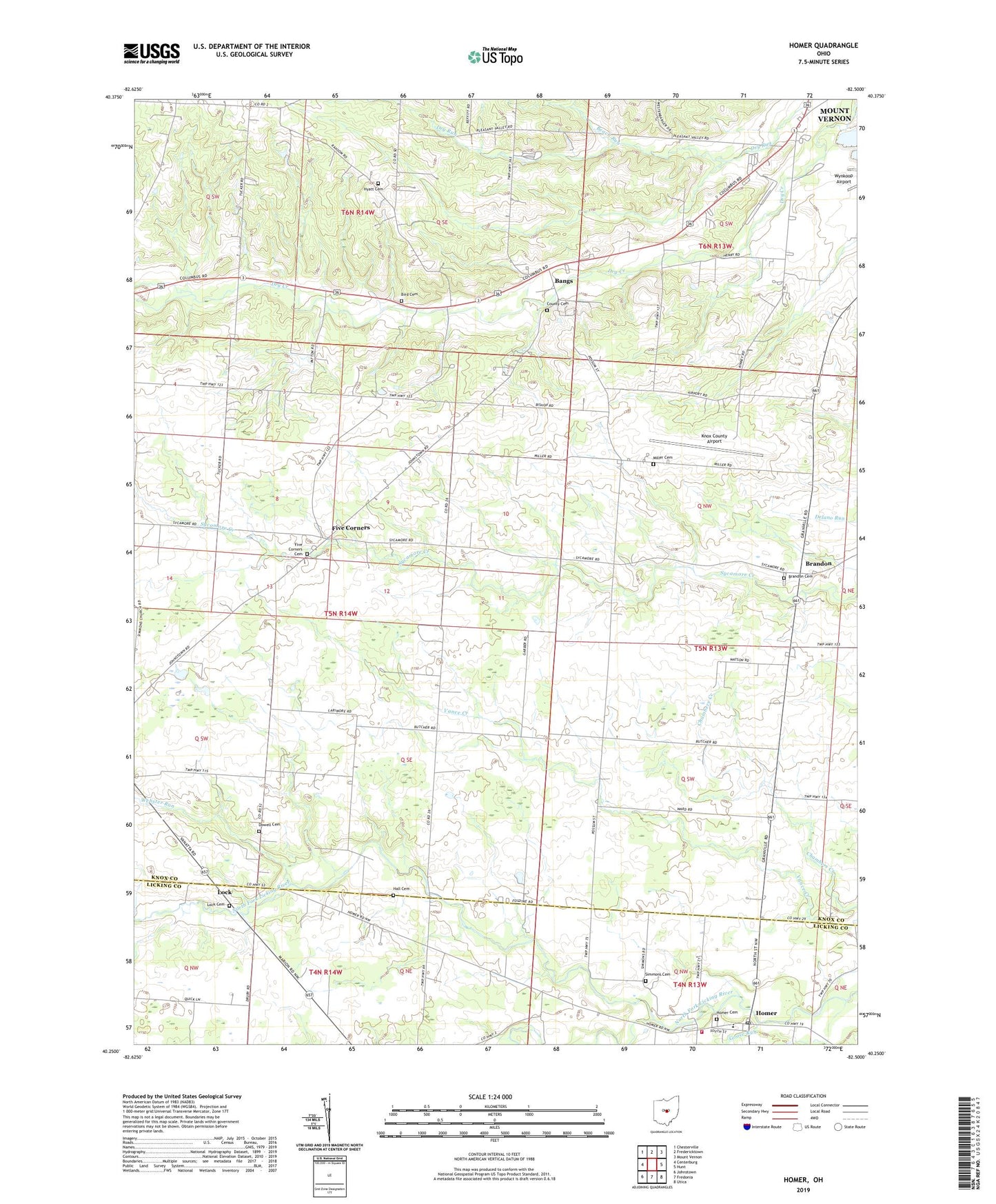
2019 topographic map quadrangle Homer in the state of Ohio. Scale: 1:24000. Based on the newly updated USGS 7.5' US Topo map series, this map is in the following counties: Knox, Licking. The map contains contour data, water features, and other items you are used to seeing on USGS maps, but also has updated roads and other features. This is the next generation of topographic maps. Printed on high-quality waterproof paper with UV fade-resistant inks.
Quads adjacent to this one:
West: Centerburg
Northwest: Chesterville
North: Fredericktown
Northeast: Mount Vernon
East: Hunt
Southeast: Utica
South: Fredonia
Southwest: Johnstown
Contains the following named places: Bangs, Bangs Post Office, Beach Run, Beech Grove School, Beech Knob School, Bird Cemetery, Bishop School, Brandon, Brandon Cemetery, Brandon Post Office, Camp Anderson, Camp School, County Cemetery, Cross Farm, Dowell Cemetery, Dwight Field Airport, Fairview School, Five Corners, Five Corners Cemetery, Goose Run, Granville Road School, Hall Cemetery, Hardin and Prestons Mill, Homer, Homer Cemetery, Homer Post Office, Homer Volunteer Fire Department, Hyatt Cemetery, Knox County Airport, Knox County Infirmary, Licking School, Lock, Lock Cemetery, Lock Post Office, Milford Township House, Milfordton, Milfordton Post Office, Miller Cemetery, Mink Street School, Mud Hill School, Northridge Homer Elementary School, Opossum Street School, Otter Fork Licking River, Prospect School, Simmons Cemetery, Splinterville School, Township of Clinton, Township of Milford, Township of Miller, Weaver School, Webster Run