MyTopo
Jackson Center Ohio US Topo Map
Couldn't load pickup availability
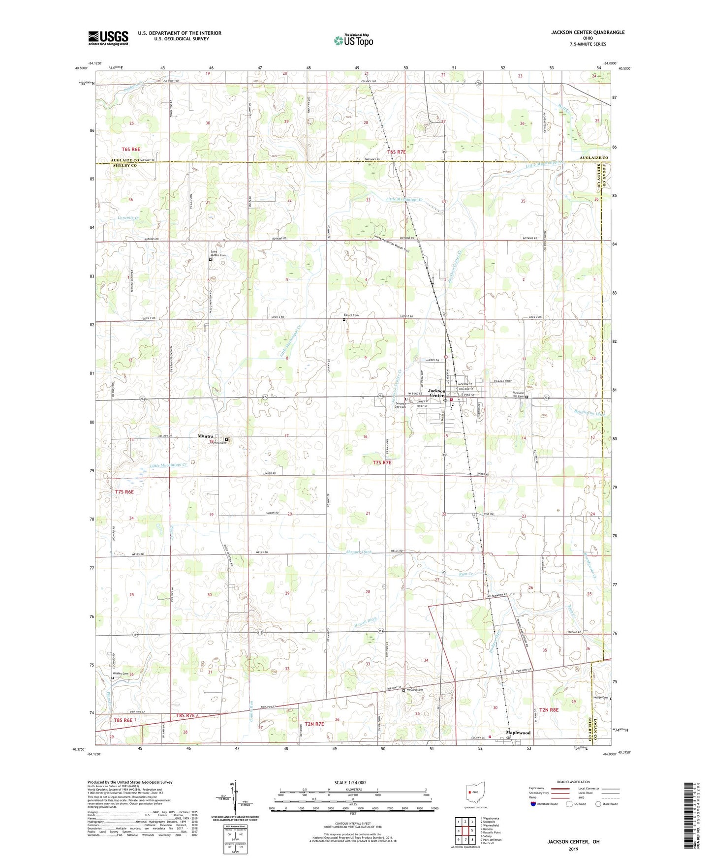
2019 topographic map quadrangle Jackson Center in the state of Ohio. Scale: 1:24000. Based on the newly updated USGS 7.5' US Topo map series, this map is in the following counties: Shelby, Auglaize, Logan. The map contains contour data, water features, and other items you are used to seeing on USGS maps, but also has updated roads and other features. This is the next generation of topographic maps. Printed on high-quality waterproof paper with UV fade-resistant inks.
Quads adjacent to this one:
West: Botkins
Northwest: Wapakoneta
North: Uniopolis
Northeast: Waynesfield
East: Russells Point
Southeast: De Graff
South: Port Jefferson
Southwest: Sidney
Contains the following named places: Bennett School, Castle School, Elliott Cemetery, Emmanuel Lutheran Church, Grace Lutheran Church, Gross Woods Nature Preserve, Hodges Ditch, Hopkins School, Howell Cemetery, Howell Ditch, Jackson Center, Jackson Center Church of the Nazarene, Jackson Center Creek, Jackson Center Elementary School, Jackson Center High School, Jackson Center Police Department, Jackson Center Post Office, Jackson Center Rescue Squad, Jackson Center United Methodist Church, Jackson Center Volunteer Fire Department, Korn Landing Field, Maplewood, Maplewood Post Office, Maplewood United Methodist Church, Maplewood Volunteer Fire Department, McCord Cemetery, Metz School, Montra, Montra Post Office, Pleasant Hill Cemetery, Poplar Knob School, Rhine School, Saint Jacobs Cemetery, Saint Jacobs Lutheran Church, Saint Lawrence Catholic Church, School Number 10, School Number 3, School Number 4, School Number 5, School Number 7, School Number 9, Seventh Day Cemetery, Shroyer Ditch, Township of Jackson, Village of Jackson Center, Wesley Chapel Cemetery, Wolf Creek, ZIP Code: 45334