MyTopo
Uniopolis Ohio US Topo Map
Couldn't load pickup availability
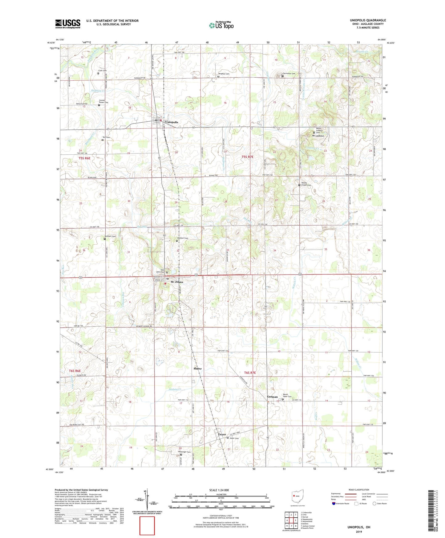
2023 topographic map quadrangle Uniopolis in the state of Ohio. Scale: 1:24000. Based on the newly updated USGS 7.5' US Topo map series, this map is in the following counties: Auglaize. The map contains contour data, water features, and other items you are used to seeing on USGS maps, but also has updated roads and other features. This is the next generation of topographic maps. Printed on high-quality waterproof paper with UV fade-resistant inks.
Quads adjacent to this one:
West: Wapakoneta
Northwest: Cridersville
North: Lima
Northeast: Harrod
East: Waynesfield
Southeast: Russells Point
South: Jackson Center
Southwest: Botkins
This map covers the same area as the classic USGS quad with code o40084e1.
Contains the following named places: Blackhoof Creek, Coleman Run, Conner-Kaiser Cemetery, Craft Cemetery, Dry Run, Fairmount Cemetery, Geyer, Geyer Cemetery, Geyer Post Office, Gutman, Gutman Post Office, Helminger Cemetery, Huffman Creek, Lockhart Cemetery, Maple Lane Farms, Mount Lookout, Mount Lookout Cemetery, Mount Tabor Cemetery, Mount Tabor Methodist Church, Reinhart Cemetery, Rinehart Post Office, Rineharts, Saint Johns, Saint Johns Cemetery, Saint Johns Census Designated Place, Saint Johns Post Office, Saint Johns United Methodist Church, Saint Johns Volunteer Fire and Rescue Department, Saint Mark Church, School Number 1, School Number 2, School Number 3, School Number 4, School Number 8, Slater, Tam Cemetery, Township of Clay, Township of Union, Uniopolis, Uniopolis Census Designated Place, Uniopolis Post Office, Uniopolis Volunteer Fire Department, United School, Vaughan Cemetery, Village of Uniopolis, Virginia Creek, Wesley Chapel Cemetery, Wesley Chapel Methodist Episcopal Church, ZIP Codes: 45884, 45888