MyTopo
Killbuck Ohio US Topo Map
Couldn't load pickup availability
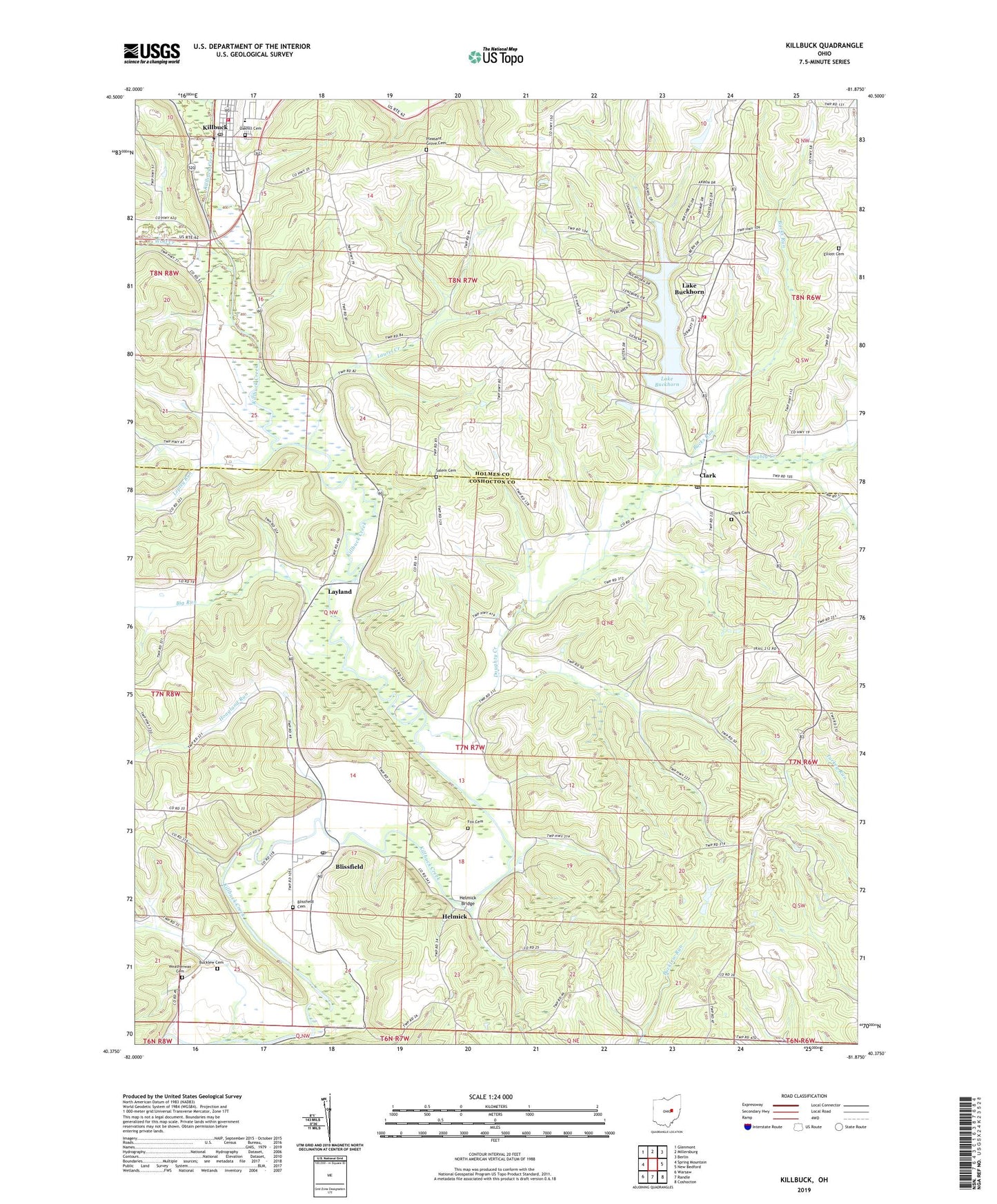
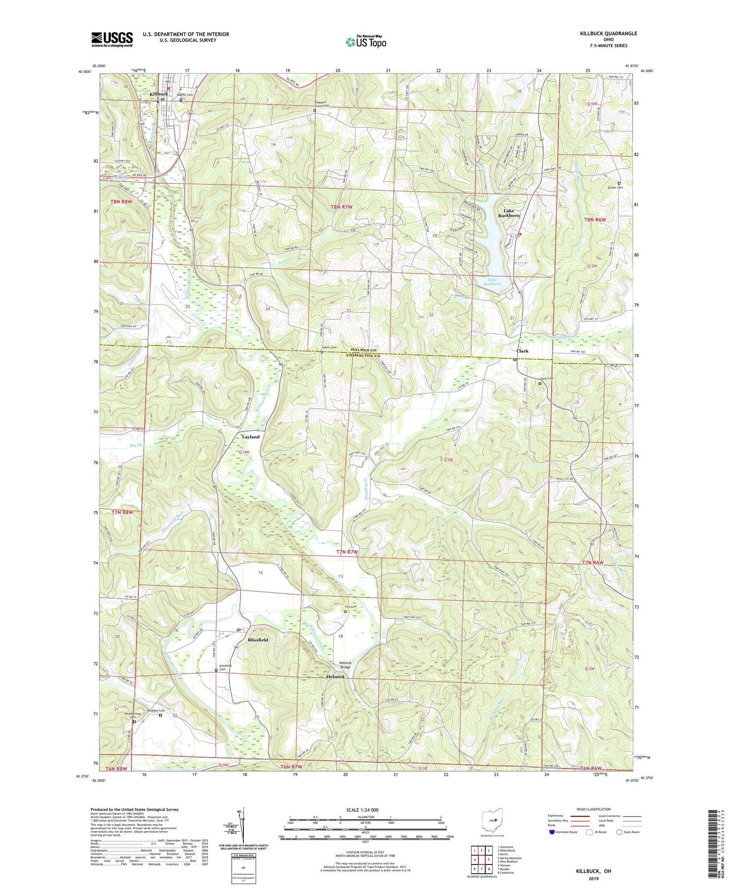
2019 topographic map quadrangle Killbuck in the state of Ohio. Scale: 1:24000. Based on the newly updated USGS 7.5' US Topo map series, this map is in the following counties: Coshocton, Holmes. The map contains contour data, water features, and other items you are used to seeing on USGS maps, but also has updated roads and other features. This is the next generation of topographic maps. Printed on high-quality waterproof paper with UV fade-resistant inks.
Quads adjacent to this one:
West: Spring Mountain
Northwest: Glenmont
North: Millersburg
Northeast: Berlin
East: New Bedford
Southeast: Coshocton
South: Randle
Southwest: Warsaw
Contains the following named places: Big Run, Black Creek, Blissfield, Blissfield Cemetery, Blissfield Post Office, Bucklew Cemetery, Bucks Run, Clark, Clark Cemetery, Clark Post Office, Doughty Creek, Elliott Cemetery, Fox Cemetery, Green Valley School, Greenhorn School, Helmick, Helmick Bridge, Helmick Post Office, Helmick Station, Hickory Lake, Hickory Lake Dam, Hoagland Run, Holmes Fire District 1 Buckhorn Station, Killbuck, Killbuck Cemetery, Killbuck Elementary School, Killbuck Post Office, Killbuck Township Fire Department, Lake Buckhorn, Lake Buckhorn Census Designated Place, Lake Buckhorn Dam, Laurel Creek, Laurel Run School, Layland, Layland Post Office, Layland School, Lepley Run, Mill Creek Landfill, Mount Dispute School, Mount Union, Pleasant Grove Cemetery, Pleasant Grove School, Salem Cemetery, Stony Point School, Township of Clark, Township of Killbuck, Village of Killbuck, Weatherwax Cemetery, Wolf Creek, ZIP Code: 43805