MyTopo
Laurelville Ohio US Topo Map
Couldn't load pickup availability
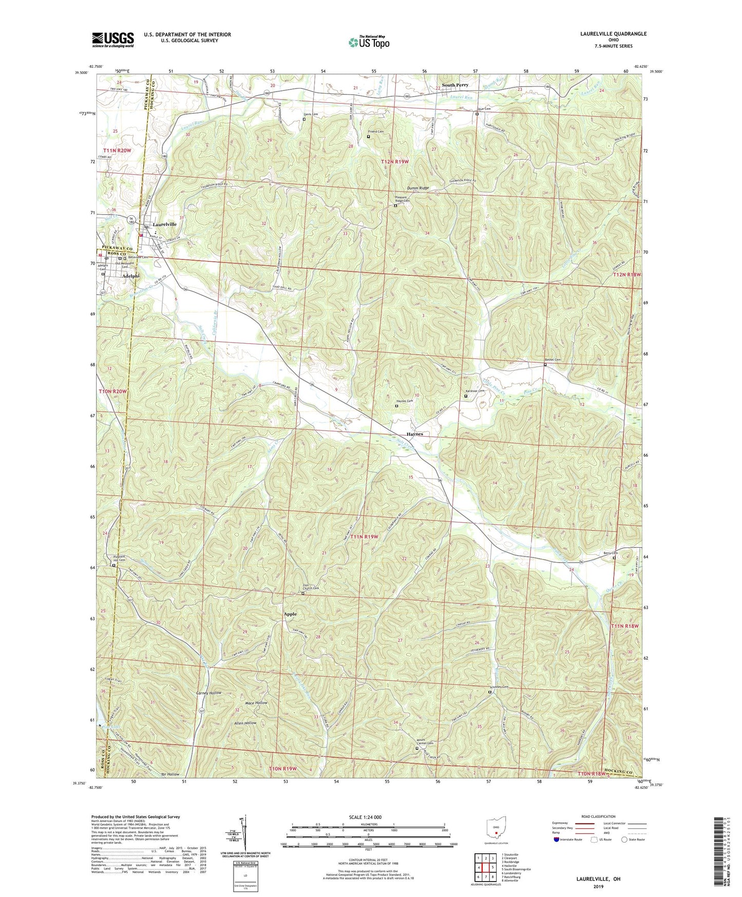
2019 topographic map quadrangle Laurelville in the state of Ohio. Scale: 1:24000. Based on the newly updated USGS 7.5' US Topo map series, this map is in the following counties: Hocking, Ross, Pickaway, Vinton. The map contains contour data, water features, and other items you are used to seeing on USGS maps, but also has updated roads and other features. This is the next generation of topographic maps. Printed on high-quality waterproof paper with UV fade-resistant inks.
Quads adjacent to this one:
West: Hallsville
Northwest: Stoutsville
North: Clearport
Northeast: Rockbridge
East: South Bloomingville
Southeast: Allensville
South: Ratcliffburg
Southwest: Londonderry
Contains the following named places: Adelphi, Adelphi Cemetery, Adelphi Volunteer Fire and Rescue Department, Adelphia Post Office, Apple, Apple Post Office, Belleview Cemetery, Berry Cemetery, Bethel Cemetery, Bethel Church, Blue Creek, Brimstone Creek, Brimstone School, California Branch, Carney Hollow, Davis Cemetery, Dry Run, Dumm Ridge, Feightner, Feightner Post Office, Friend Cemetery, Haynes, Haynes Cemetery, Haynes Post Office, Hocking County Emergency Medical Services Station 2, Karshner Cemetery, Karshner School, Laurel Run, Laurelville, Laurelville Elementary School, Laurelville Police Department, Laurelville Post Office, Laurelville Volunteer Fire Department, Little Pine Creek, Long Run, Middle Fork Laurel Run, Moccasin Creek, Mount Carmel Cemetery, Mount Carmel Church, Mount Olive Church, Nancy, Nancy Post Office, Old Methodist Cemetery, Olive Cemetery, Pine Cottage School, Pine Creek, Pine Lake, Pine Lake Dam, Pine School, Pleasant Hill Cemetery, Pleasant Hill Church, Pleasant Ridge Cemetery, Pleasant Ridge Church of Christ, Pleasant Ridge School, Poling School, Queer Creek, Reeds, Salt Creek Valley Church, Sams Creek, Schooley Cemetery, Smith School, South Perry, South Perry Post Office, Stump Run, Township of Salt Creek, Union School, Village of Adelphi, Village of Laurelville, Zion Church, Zion Church Cemetery, ZIP Codes: 43101, 43135