MyTopo
Rockbridge Ohio US Topo Map
Couldn't load pickup availability
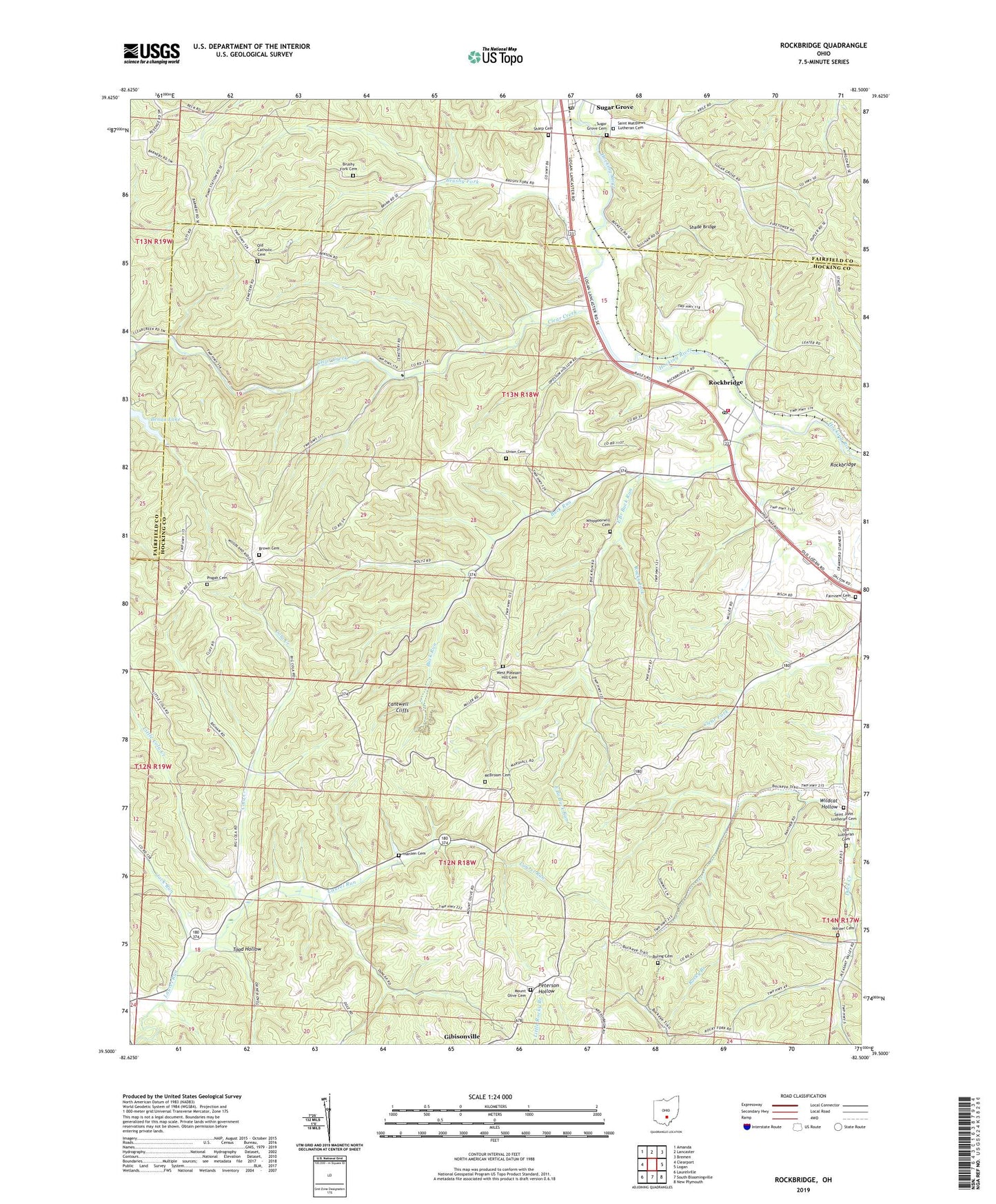
2023 topographic map quadrangle Rockbridge in the state of Ohio. Scale: 1:24000. Based on the newly updated USGS 7.5' US Topo map series, this map is in the following counties: Hocking, Fairfield. The map contains contour data, water features, and other items you are used to seeing on USGS maps, but also has updated roads and other features. This is the next generation of topographic maps. Printed on high-quality waterproof paper with UV fade-resistant inks.
Quads adjacent to this one:
West: Clearport
Northwest: Amanda
North: Lancaster
Northeast: Bremen
East: Logan
Southeast: New Plymouth
South: South Bloomingville
Southwest: Laurelville
This map covers the same area as the classic USGS quad with code o39082e5.
Contains the following named places: Benua Lake, Benua Lake Dam, Boling Cemetery, Brown Cemetery, Browns Corners, Brushy Fork, Brushy Fork Cemetery, Buck Run, Camp Wyandot, Cantwell Cliffs, Clear Creek, Clear Creek Nature Preserve, Cola Creek, Drinkle Post Office, East Branch Buck Run, Fairview Cemetery, Fairview Church, Good Hope Township Volunteer Fire Department, Hansen Cemetery, Jack Run, Little Cola Creek, McBroom Cemetery, Mound Crossing, Mount Olive Cemetery, Nihizer Cemetery, Old Catholic Cemetery, Old Lutheran Cemetery, Pine Grove, Pisgah Cemetery, Rockbridge, Rockbridge Census Designated Place, Rockbridge Post Office, Rocky Fork, Rush Creek, Saint John Lutheran Cemetery, Saint Johns Church, Saint Matthews Lutheran Cemetery, Shade Bridge, Sharp Cemetery, Sugar Grove Cemetery, Sugar Grove Post Office, Toad Hollow, Township of Good Hope, Township of Laurel, Union Cemetery, West Pleasant Hill Cemetery, West Pleasant Hill Church, Whippoorwill Cemetery, Wildcat Hollow, ZIP Code: 43149