MyTopo
Leon Ohio US Topo Map
Couldn't load pickup availability
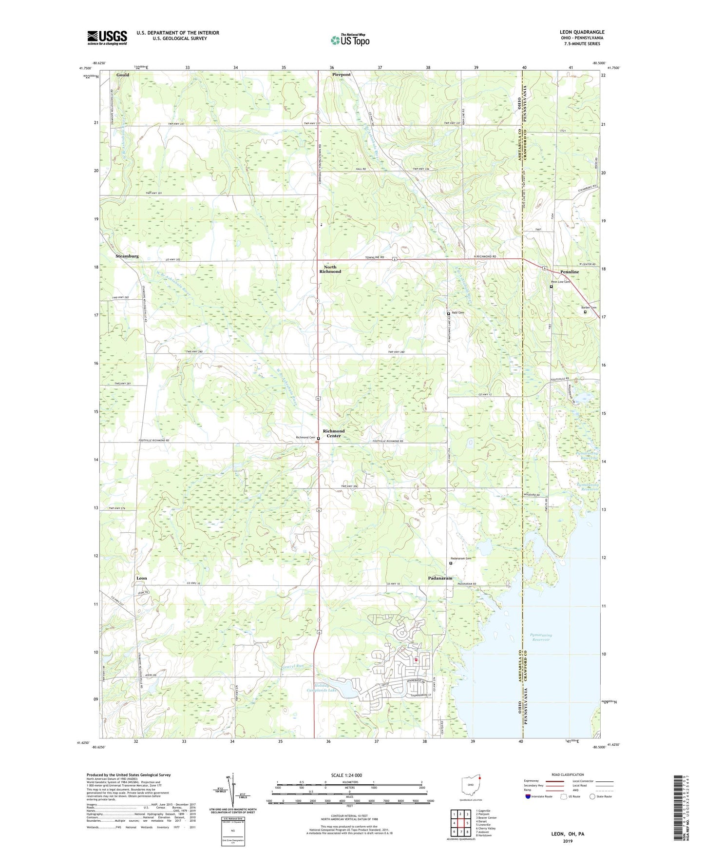
2019 topographic map quadrangle Leon in the states of Ohio, Pennsylvania. Scale: 1:24000. Based on the newly updated USGS 7.5' US Topo map series, this map is in the following counties: Ashtabula, Crawford. The map contains contour data, water features, and other items you are used to seeing on USGS maps, but also has updated roads and other features. This is the next generation of topographic maps. Printed on high-quality waterproof paper with UV fade-resistant inks.
Quads adjacent to this one:
West: Dorset
Northwest: Gageville
North: Pierpont
Northeast: Beaver Center
East: Linesville
Southeast: Hartstown
South: Andover
Southwest: Cherry Valley
Contains the following named places: Anderson, Barber Cemetery, Beckwith Dairy, Boggs Dairy Farm, Boleratzs Farm, Dart Cemetery, Gould, Harvey Farms, Holiday Camplands Lake, Holiday Camplands Lake Dam, Holiday Camplands Volunteer Fire Department, Kettunen Farm, Leon, Leon Post Office, Lonesome Pine Farm, North Richmond, Oak Swampy Farm, Padanaram, Padanaram Cemetery, Padanarum Post Office, Penn Line Cemetery, Pennline, Pennline Church, Pierpont, Pierpont Centre Post Office, Pyma-Love Airport, Pymatuning State Park, Pymatuning Swamp, Richmond Center, Richmond Center Cemetery, Richmond Center Post Office, Richmond School, Sharpe Farm, Skyview Farm, Steamburg, Steamburg Church, Steamburg Post Office, Township of Richmond, Windblown Acres, Woodard Farms