MyTopo
Beaver Center Pennsylvania US Topo Map
Couldn't load pickup availability
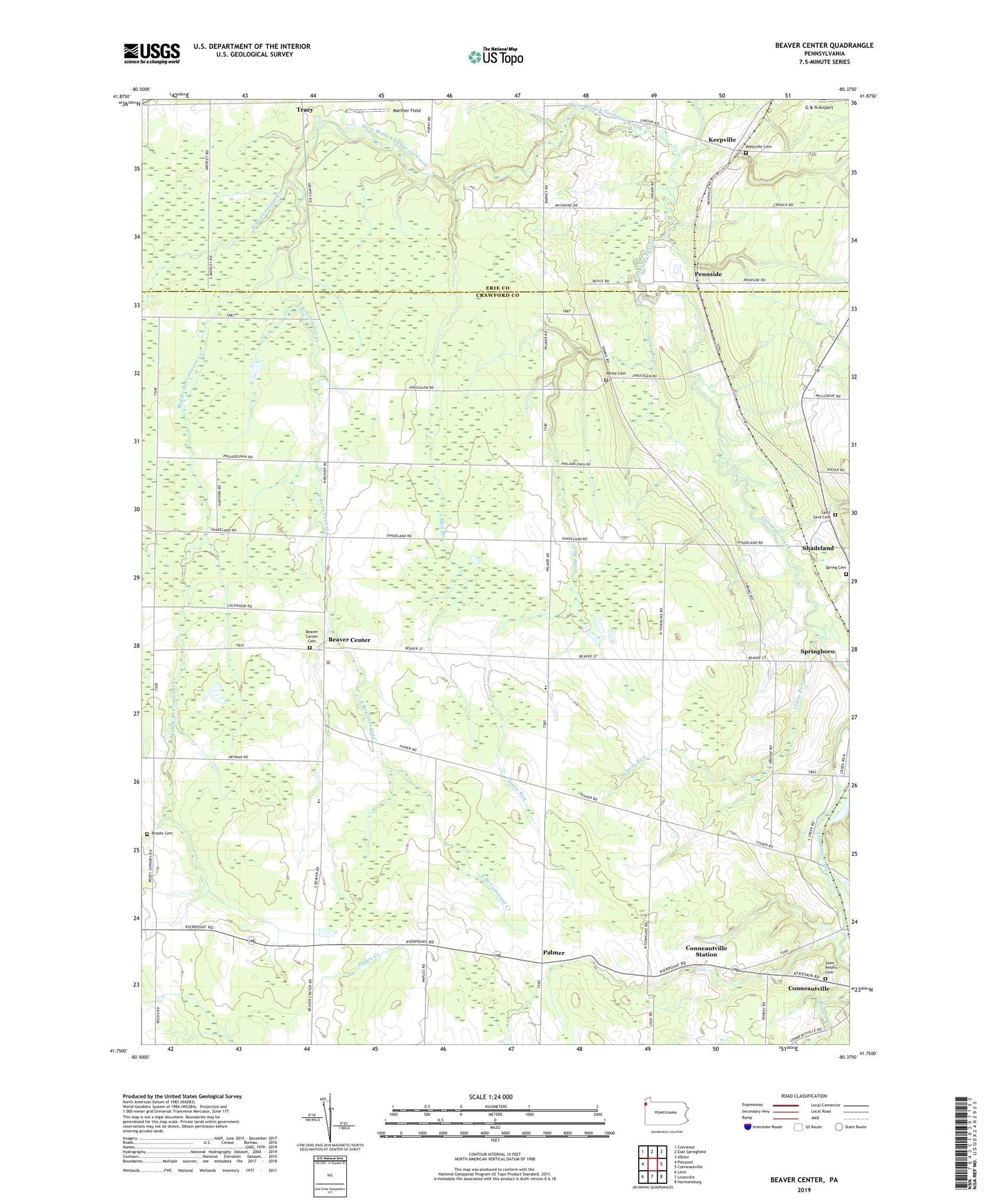
2023 topographic map quadrangle Beaver Center in the state of Pennsylvania. Scale: 1:24000. Based on the newly updated USGS 7.5' US Topo map series, this map is in the following counties: Crawford, Erie. The map contains contour data, water features, and other items you are used to seeing on USGS maps, but also has updated roads and other features. This is the next generation of topographic maps. Printed on high-quality waterproof paper with UV fade-resistant inks.
Quads adjacent to this one:
West: Pierpont
Northwest: Conneaut
North: East Springfield
Northeast: Albion
East: Conneautville
Southeast: Harmonsburg
South: Linesville
Southwest: Leon
This map covers the same area as the classic USGS quad with code o41080g4.
Contains the following named places: Beaver Center, Beaver Center Cemetery, Brooks Cemetery, Conneautville Station, Crazy Run, East Branch Conneaut Creek, Keepville, Keepville Cemetery, Keepville Wesleyan Methodist Church, Marther Field, Middle Branch Conneaut Creek, Misty Hollow Farm, Mud Run, Palmer, Pennside, Pontius Airport, Rausch Farm, Saint Peters Cemetery, Saint Sava Cemetery, Seldom Home Farm, Shadeland, Shadeland Station, Spring Cemetery, Springboro Station, State Game Lands Number 101, Stone Run, Township of Beaver, Tracy, West Branch Conneaut Creek, White Cemetery, Wing, ZIP Code: 16435