MyTopo
Lyons Ohio US Topo Map
Couldn't load pickup availability
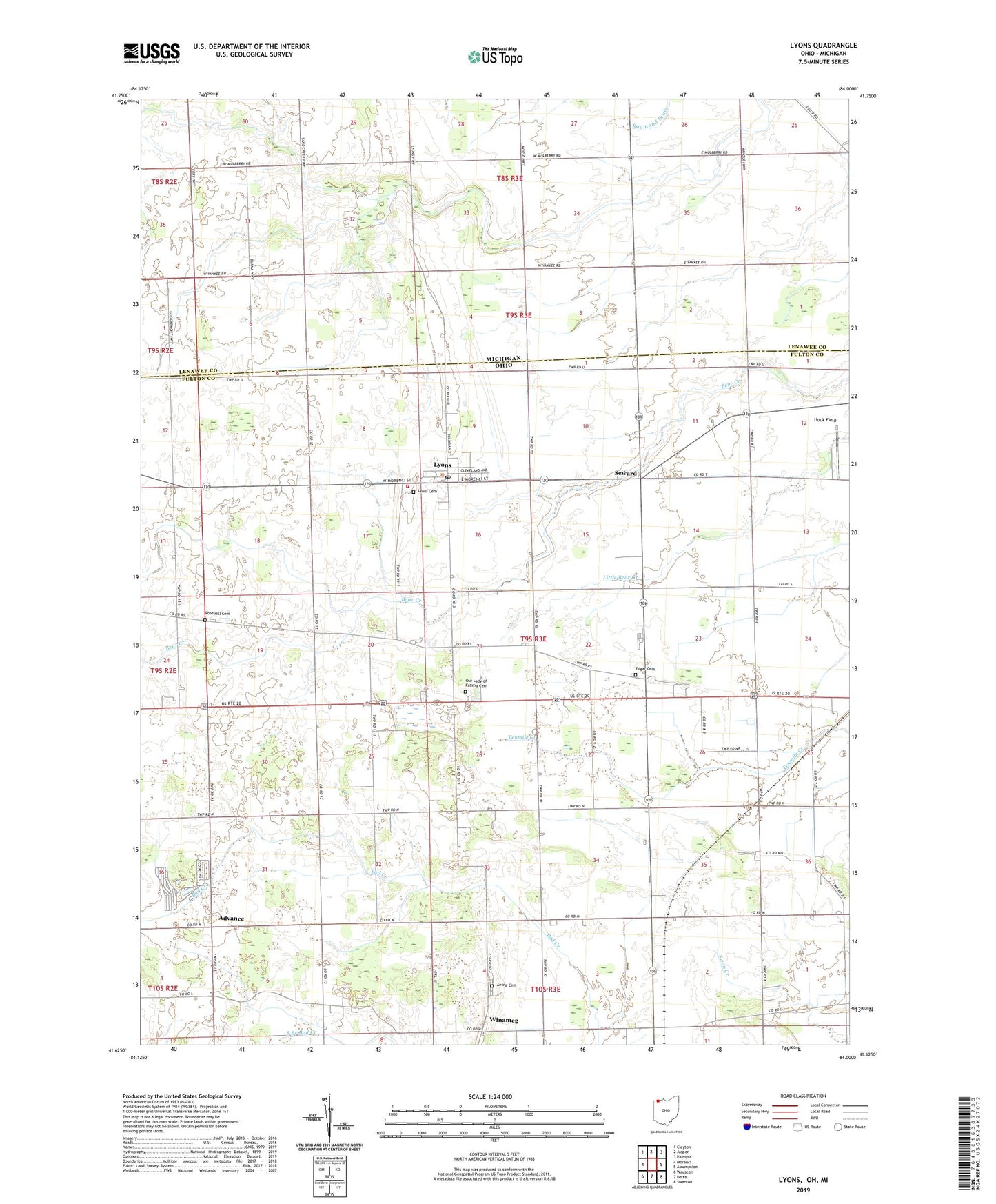
2019 topographic map quadrangle Lyons in the states of Ohio, Michigan. Scale: 1:24000. Based on the newly updated USGS 7.5' US Topo map series, this map is in the following counties: Fulton, Lenawee. The map contains contour data, water features, and other items you are used to seeing on USGS maps, but also has updated roads and other features. This is the next generation of topographic maps. Printed on high-quality waterproof paper with UV fade-resistant inks.
Quads adjacent to this one:
West: Morenci
Northwest: Clayton
North: Jasper
Northeast: Palmyra
East: Assumption
Southeast: Swanton
South: Delta
Southwest: Wauseon
Contains the following named places: Advance, Advance Post Office, Aetna Cemetery, Beulah United Methodist Church, Edgar Cemetery, First Unitarian Universalist Church, Houk Field, Ireland School, Jordan Shcool, Lasalle School, Lemles Greenhouse, Liberty Missionary Baptist Church, Lyons, Lyons Cemetery, Lyons Christian Church, Lyons Elementary School, Lyons Post Office, Lyons Royalton Volunteer Fire Department, Mount Pleasant United Brethren Church, Nile Ditch, Our Lady of Fatima Cemetery, Our Lady of Fatima Church, Pratt School, Robinson School, Rose Hill Cemetery, Ross School, Scott School, Seward, Seward Post Office, Seward School, Swamp Angel School, Township of Royalton, Tubbs School, Village of Lyons, Whitcomb School, Winameg, Winameg Christian Church, Winameg Post Office, ZIP Code: 43533