MyTopo
Palmyra Michigan US Topo Map
Couldn't load pickup availability
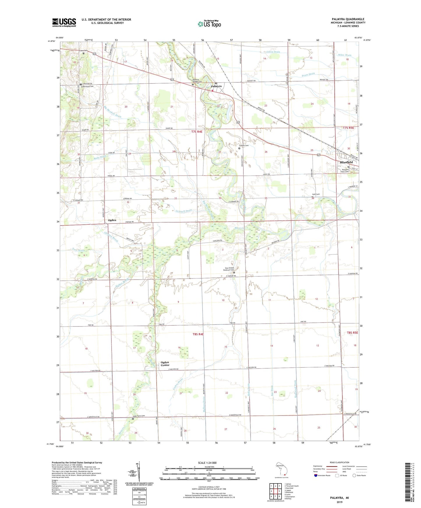
2023 topographic map quadrangle Palmyra in the state of Michigan. Scale: 1:24000. Based on the newly updated USGS 7.5' US Topo map series, this map is in the following counties: Lenawee. The map contains contour data, water features, and other items you are used to seeing on USGS maps, but also has updated roads and other features. This is the next generation of topographic maps. Printed on high-quality waterproof paper with UV fade-resistant inks.
Quads adjacent to this one:
West: Jasper
Northwest: Adrian
North: Tecumseh South
Northeast: Deerfield
East: Blissfield
Southeast: Berkey
South: Assumption
Southwest: Lyons
This map covers the same area as the classic USGS quad with code o41083g8.
Contains the following named places: Bay Drain, Bear Creek, Bell Drain, Big Meadow Drain, Bixby Drain, Black Creek, Blessed Savior Lutheran Church, Blissfield Health Center, Clement Drain, Coach Light Estates Mobile Home Park, Colvin Drain, Corbin Drain, Cornerstone Baptist Church, Crane Cemetery, Foot Drain, Gleason Brook, Goff Cemetery, Goodrich Drain, Grinnell Drain, Grosvenor Post Office, Hahn Drain, Luke Farm Cemetery, Malburg Drain, Mulberry Station, Ogden, Ogden Center, Ogden Center Church, Ogden Center Post Office, Ogden Post Office, Ogden Station, Ogden Town Hall, Palmyra, Palmyra Community Church, Palmyra Post Office, Palmyra Presbyterian Church Historical Marker, Palmyra School, Palmyra Station, Palmyra Township Fire Department, Palmyra Village Cemetery, Pleasant View Cemetery, Rockwood Drain, Scovell Cemetery, Township of Ogden, Township of Palmyra, Underwood Cemetery, Victorsville Post Office, Walker Brook, West Ogden Post Office, Zion Church, Zion United Brethren Cemetery, Zion United Brethren Church, ZIP Codes: 49228, 49268