MyTopo
Martinsburg Ohio US Topo Map
Couldn't load pickup availability
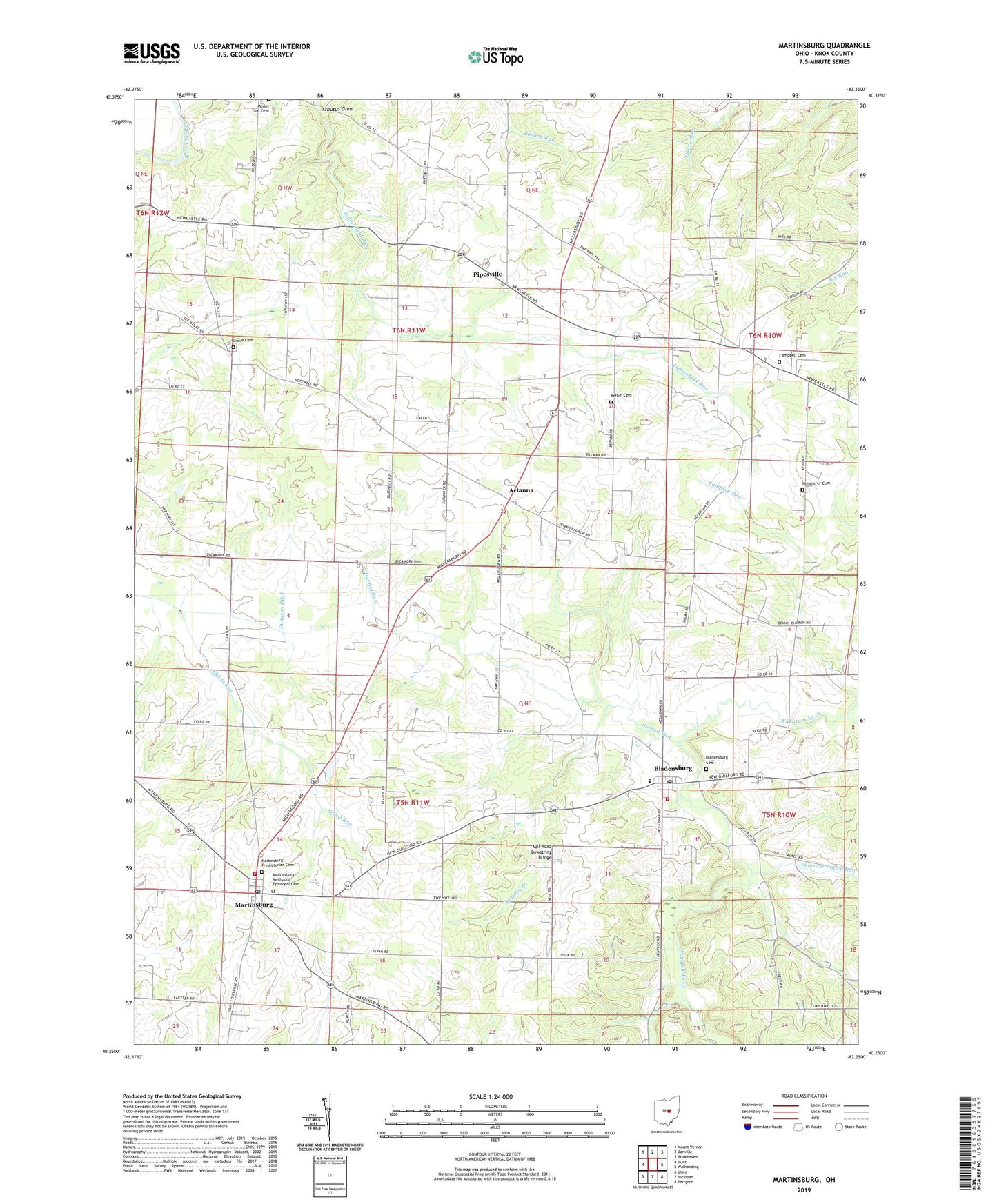
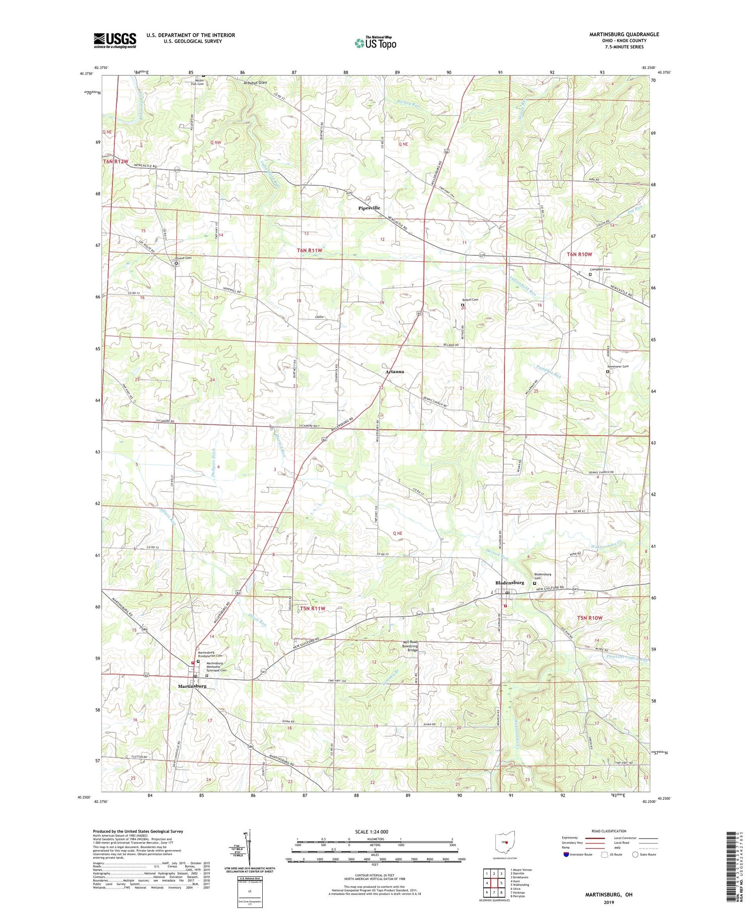
2019 topographic map quadrangle Martinsburg in the state of Ohio. Scale: 1:24000. Based on the newly updated USGS 7.5' US Topo map series, this map is in the following counties: Knox. The map contains contour data, water features, and other items you are used to seeing on USGS maps, but also has updated roads and other features. This is the next generation of topographic maps. Printed on high-quality waterproof paper with UV fade-resistant inks.
Quads adjacent to this one:
West: Hunt
Northwest: Mount Vernon
North: Danville
Northeast: Brinkhaven
East: Walhonding
Southeast: Perryton
South: Hickman
Southwest: Utica
Contains the following named places: Arbutus Glen, Artanna, Baird School, Bell School, Bethel Cemetery, Bladensburg, Bladensburg Cemetery, Bladensburg Census Designated Place, Bladensburg Elementary School, Bladensburg Post Office, Bladensburg Volunteer Fire Department Station 1, Bladensburg Volunteer Fire Department Station 2, Borror Farm, Burtnit School, Campbell Cemetery, Clutter Farms, Dudgeon Ditch, Dugan Stock Farm, Earlywine Airport, Elliott Run, Ferembaugh School, Flack School, Front Royal, Front Royal School, Grove Cemetery, Grove Church, Hamilton Farm, Harrod Run, Hazel Dell School, Horn School, Kemmerer Cemetery, Lepley Farms, Martinsburg, Martinsburg Methodist Episcopal Cemetery, Martinsburg Post Office, Martinsburg Presbyterian Cemetery, Mill Road Bowstring Bridge, Mount Zion School, Pipesville, Pipesville Post Office, Pleasant Valley Run, Pumpkin Run, Ray School, Ross School, School Number 3, School Number 6, Serendipity Farm and Stable, Spring Creek Dairy, Summit Level Farm, Tomaky Branch, Township of Clay, Township of Harrison, Veatch Farms, Village of Martinsburg, Wild Side Farms, ZIP Codes: 43005, 43022, 43037