MyTopo
Midway Ohio US Topo Map
Couldn't load pickup availability
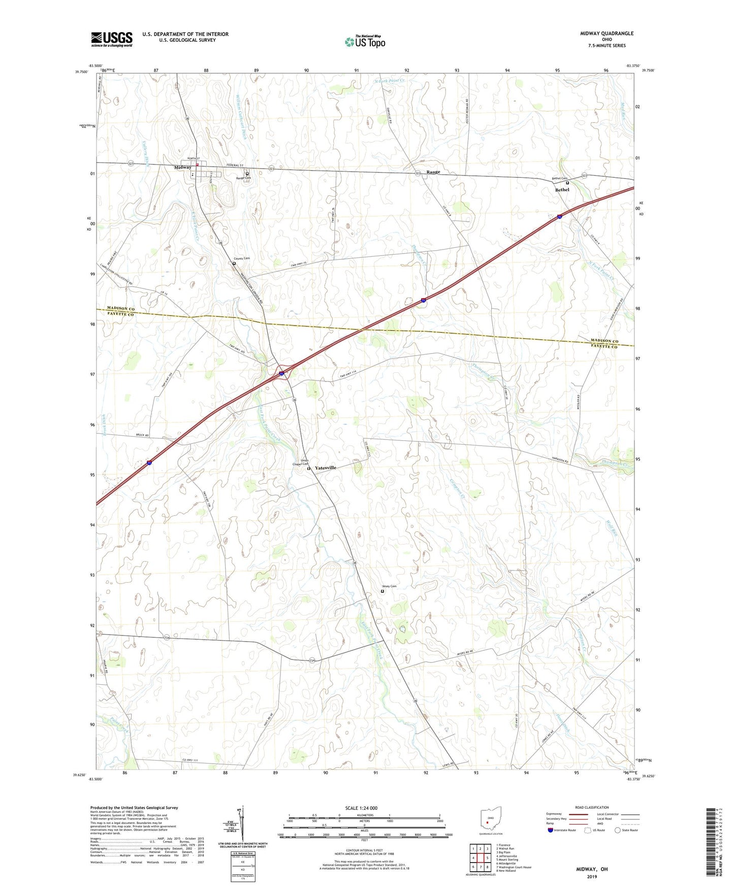
2019 topographic map quadrangle Midway in the state of Ohio. Scale: 1:24000. Based on the newly updated USGS 7.5' US Topo map series, this map is in the following counties: Fayette, Madison. The map contains contour data, water features, and other items you are used to seeing on USGS maps, but also has updated roads and other features. This is the next generation of topographic maps. Printed on high-quality waterproof paper with UV fade-resistant inks.
Quads adjacent to this one:
West: Jeffersonville
Northwest: Florence
North: Walnut Run
Northeast: Big Plain
East: Mount Sterling
Southeast: New Holland
South: Washington Court House
Southwest: Milledgeville
Contains the following named places: Bethel, Bethel Cemetery, Bethel Methodist Episcopal Church, Bock Farms, Brock Ditch, Counts Cemetery, Dews Ditch, Midway, Midway Elementary School, Range, Range Cemetery, Range Post Office, Range Township Fire Department, Sedalia Post Office, Stardust Dairy, Township of Paint, Township of Range, Union Chapel Cemetery, Union Chapel Methodist Church, Vallery Ditch, Vesey Cemetery, Village of Midway, William Cathcart Ditch, Yatesville, Yatesville Post Office, ZIP Codes: 43106, 43151