MyTopo
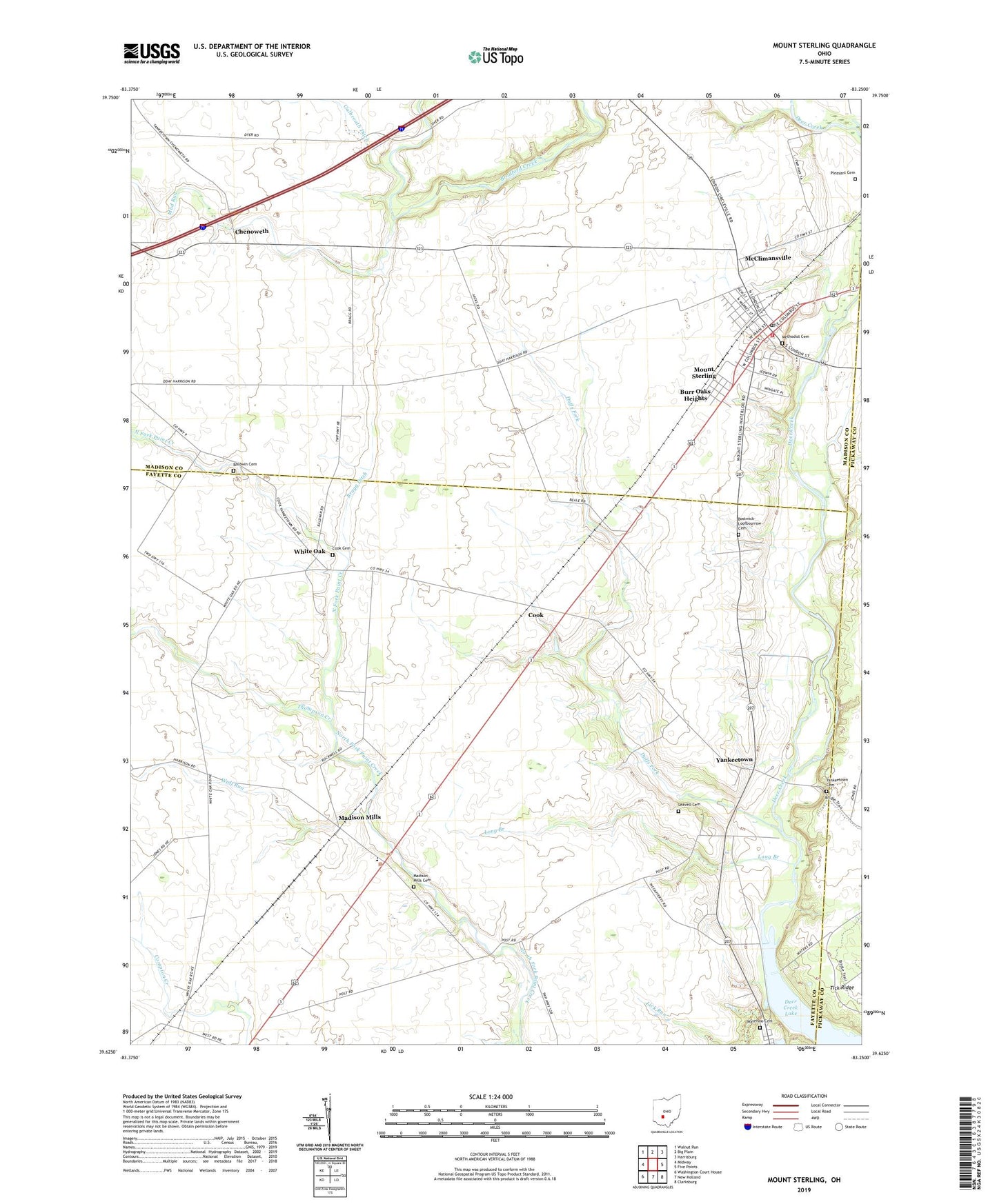
Mount Sterling Ohio US Topo Map
Couldn't load pickup availability
2023 topographic map quadrangle Mount Sterling in the state of Ohio. Scale: 1:24000. Based on the newly updated USGS 7.5' US Topo map series, this map is in the following counties: Fayette, Madison, Pickaway. The map contains contour data, water features, and other items you are used to seeing on USGS maps, but also has updated roads and other features. This is the next generation of topographic maps. Printed on high-quality waterproof paper with UV fade-resistant inks.
Quads adjacent to this one:
West: Midway
Northwest: Walnut Run
North: Big Plain
Northeast: Harrisburg
East: Five Points
Southeast: Clarksburg
South: New Holland
Southwest: Washington Court House
This map covers the same area as the classic USGS quad with code o39083f3.
Contains the following named places: Baldwin Cemetery, Bostwick-Loofbourrow Cemetery, Bradford Creek, Bragg Ditch, Burr Oaks Heights, Chenoweth, Chenoweth Post Office, Cook, Cook Cemetery, Cook Post Office, Duffs Fork, Galbreath Ditch, Leavell Cemetery, Lick Run, Long Branch, Madison Mills, Madison Mills Cemetery, Madison Mills Elementary School, Madison Mills Post Office, Madison Mills United Methodist Church, McClimansville, Methodist Cemetery, Mount Sterling, Mount Sterling Elementary School, Mount Sterling Historic District, Mount Sterling Post Office, Mount Sterling United Methodist Church, Mud Run, Pleasant Cemetery, Plumwood Mobile Home Park, Sterling Joint Ambulance District, Thompson Creek, Township of Madison, Township of Pleasant, Tri - County Joint Fire District Station 491, Village of Mount Sterling, Waterloo Cemetery, White Oak, White Oak Post Office, Wolf Run, Yankeetown, Yankeetown Cemetery, ZIP Code: 43143